- Havasu Falls
- Phantom Ranch
- Las Vegas NV
- Flagstaff AZ
- Williams AZ
- Lake Powell
- Bryce Canyon
- Antelope Canyon
- Monument Valley
- Handcrafted Self-Drive Tours
- Tailor-Made Private Tours
- Small Group Adventures
- Itinerary Ideas
- Travel Blog
- Transportation
- Restaurants
- Hiking Tours
- Rafting Tours
- Train Rides
- Scenic Flights
- South Rim Hotels
- North Rim Hotels
- West Rim Hotels
- East Rim Hotels
- Private Tours
- Self-Drive Tours
- Vacation Packages
- Adventure Tours
- National Park Tours
- Explore the Map
- Customize your Trip
- Calculate Trip Cost
- Get the Guidebook

Grand Circle 5-Day Road Trip Itinerary
Beyond hoodos 5-day road trip.
Grand Canyon, Bryce Canyon, Zion, Lake Powell, Antelope Canyon and Sedona Itinerary - Beyond Hoodoos is the best way to see the top Grand Circle destinations as well as Bryce Canyon. You’ll start your road trip at Grand Canyon National Park’s South Rim where you can drive, take the free shuttle buses, or hike to take in the spectacular views before heading to Kanab, UT for the night. After breakfast in Kanab, you’ll spend the day in Zion National Park enjoying the unparalleled scenery of Southern Utah and the Virgin River. Day three of your southwest itinerary includes a day exploring the incredibly colorful Hoodoos of Bryce Canyon National Park. Day four will bring you from Kanab to beautiful Lake Powell to enjoy the wonders of canyon country with a Jeep ride to Antelope Canyon, one of the world's most famous slot canyons. After exploring Antelope Canyon with your Navajo guide, set out on short self-guided hike to Horseshoe Bend to get a selfie with the Colorado River. You’ll end the night in historic Flagstaff, AZ. Day five will include one last day of adventure while you explore the red rocks of Sedona, AZ before heading home. This itinerary is best started from Tusayan, AZ or Grand Canyon Village and includes Grand Canyon National Park South Rim, Zion National Park, Bryce Canyon National Park, Lake Powell, Antelope Canyon, Horseshoe Bend, and Sedona. Read the full five day itinerary below to learn more.
Grand Canyon Guru is reader-supported. When you buy through links on our site, we may earn an affiliate commission. Thanks.
Self-Guided Road Trip Details
Day 1 grand canyon south rim and lake powell:.
The best locations to begin this road trip from are Flagstaff, Williams, Tusayan or Grand Canyon Village ( South Rim ). Once you're on the road and ready to explore head out to the South Rim, either on your own or select to take one of many exciting guided Grand Canyon tours . No matter how you choose to travel, awesome vistas, ancient ruins, and a time for a picnic lunch are all a part of a trip to Grand Canyon.
- Begin your South Rim exploration at the Grand Canyon Visitor Center and enjoy a short walk to the first breathtaking view of the canyon at Mather Point.
- From there you can decide to take a leisurely walk along the rim to take in even more views along the way, or you can return to the Visitor Center and hop on the park’s free Kaibab/Orange shuttle bus route that will take you to more scenic views over the course of about two hours.
- You’ll continue along Hwy 64E and can make short stops at the ancient Tusayan Ruins and at the beautiful Desert View Watchtower that overlooks Grand Canyon.
- Once you exit the park, you’ll be on the land of the Navajo Nation and you should make sure to check out the Cameron Trading Post, a great place to check out authentic native art or grab a delicious Navajo taco. From there, a few hours’ scenic drive will take you to Kanab, UT for a good night’s rest.
Day 2 Zion National Park:
Waking up in beautiful Southern Utah means it’s only a short drive to Zion National Park . Spend the day exploring Zion in all its splendor by using the park’s free shuttle buses.
- Make sure you stop at the intriguing Weeping Wall and the Temple of Sinawava where you can wade into the waters of the Virgin River and take in a view of the “Narrows.”
- If you want a short hike, get off the shuttle at the Grotto and hike to Upper Emerald Pool which takes about an hour and rewards you with the beautiful contrast of water flowing through the red rocks.
- After a busy day exploring, you’ll head back to your lodging in Kanab, UT.
Guru Tip: Zion is an extremely beautiful and very busy destination. Zion National Park operates a shuttle system that runs most of the year (March-November, plus busy weekends) and limits where and when you can drive your personal vehicle. Parking lots for the shuttle fill up early when it’s busy and lines to get into the park get backed up, so it’s important to do some planning and get to Zion early in the day to enjoy your visit. Camping, backpacking and other activities may also require advanced reservations if you want to make sure to include them in your trip. For more tips and up to date information on the shuttle, traffic and traveling to Zion you can check out the parks travel page .
Day 3 Bryce Canyon National Park:
Day three takes you even higher up the Paunsaugunt Plateau through the cliffs of the Grand Staircase and the beauty of Red Canyon until you reach Bryce Canyon National Park .
- One of Utah's most sought after destinations, you'll marvel at the hoodoo- filled amphitheaters at places like Inspiration Point.
- If you’re looking for a mellow day, take an easy hike along the canyon’s rim but if you’re up for more adventure, a hike that descends into Bryce Canyon will reward you with incredible views.
- If time allows, enjoy a beautiful sunset at the park before heading back to your hotel for a peaceful night’s rest.
Day 4 Antelope Canyon:
Your Southwest trip continues with more wonders of Canyon Country. The day begins with a drive to Page, AZ where you will hop on a Jeep Tour to explore the world-famous slot canyon at Antelope Canyon .
- After some off-road fun, you’ll arrive at Antelope Canyon where a Navajo guide will lead you on a tour along the gentle floor of this colorful sandstone canyon for some once in a lifetime photos.
- After exploring Antelope Canyon, you’ll return to Page and then drive to the Horseshoe Bend Overlook of Glen Canyon. A short and easy hike will reward you with one of the most iconic views of the Colorado River.
- From there, you’ll continue across the Navajo Indian Reservation en route to the historic town of Flagstaff, AZ . Explore Flagstaff’s charming downtown on foot and stop to enjoy a beer at one of its many excellent breweries.
Day 5 Sedona Arizona:
From Flagstaff you'll drive through scenic Oak Creek Canyon to Sedona, AZ for breathtaking red rock views.
- It is easy to take self-guided trips to two of Sedona's most popular parks : Slide Rock and Red Rock State Parks. Slide Rock offers incredible swimming opportunities, especially refreshing on a hot summer day, or you can enjoy a tour of the historic orchards or hike on one of the park’s trails. Red Rock State Park has a beautiful trail system that allows you to get more sweeping views of Sedona’s scenic wonders.
- As you head out of Sedona, no matter where your final destination may be, you’ll enjoy some final views of the spectacular Arizona desert along the way.

Bespoke Self-Drive Tours

Private Southwest Tours
Recommended vacation packages and travel guides.

Grand Canyon and Antelope Canyon Small Group Overnight Tour
Duration: 2 days Rating: 5 out of 5 from $319 on Viator

3-Day Tour - Zion, Bryce, South Rim, Antelope Canyon, Monument Valley
Duration: 3 days Rating: 4.8 out of 5 from $695 on Get your guide

Guide to Popular Grand Canyon Area Hotels and Lodging
Location: Grand Canyon Rating: 4.8 out of 5 from $80 a night
Find Hotels

Travel and Road Trip Guide to Parks near the Grand Canyon
Location: Grand Canyon Area Rating: 5 out of 5 fees vary by park
Get Grand Canyon ready

Have the Grand Canyon Guru find the perfect small group tour for your Grand Canyon adventure.

Self-Drive Tour Design
Work with our Professional Trip Designers to create a custom Self-Drive Grand Canyon vacation.

DIY Adventure Planning
Grand Canyon Guru’s self-guided itineraries will help you plan the ultimate DIY road trip.

Custom Private Tour Design
Have our Destination Experts design a hand-crafted private tour for a fully guided Grand Canyon experience.
adventure awaits
Download our free guide to the best of the Grand Canyon
Get the guide
Join the Adventure: Start Your National Park Bucket List
National Park Bucket List
How to Plan a Grand Circle Road Trip to Utah and Arizona National Parks
This Grand Circle road trip features the best national parks and outdoorsy adventures in Utah and Arizona.

The longest arch in the U.S., miles of slot canyons, winding river gorges, and otherworldly rock formations — it’s all a part of this Southwest national parks road trip. The Arizona and Utah border shares a landscape of desert plateaus, deep canyons, sandy dunes, and red rocks. Some of the best parts are preserved in over a dozen national and state parks.
This Grand Circle road trip wraps six national parks into one epic Utah and Arizona itinerary, with tons of other recreation areas, scenic byways, and hiking trails along the way. This guide will help you map out the best route to see as much of it as possible, whether you’re planning a 7-day Southwest road trip or an extended vacation.
The included Grand Circle road trip itinerary has options for 7 to 14 days in Utah and Arizona. Plus, we’ve included a detailed bucket list of destinations you’ll want to target. After spending several weeks in the Southwest over the years, I’ve still barely scratched the surface of this breathtaking region. I know you’ll fall in love with it, too!
Southwest Grand Circle Map
This Grand Circle Map has tags for all the locations on the Southwest road trip below. Click to open a Google Map and save the destinations.
Grand Circle Road Trip Itinerary Options
These Grand Circle itineraries all start and end in Las Vegas since the city has an international airport close to the region. For more airport options, scroll down to the tips section at the end.
1 Week Grand Circle Road Trip Itinerary
Day 1: Las Vegas to Zion National Park Day 2: Zion to Bryce Canyon National Park Day 3: Bryce Canyon to Moab Day 4: Arches and Canyonlands National Parks Day 5: Moab to Monument Valley to Page Day 6: Page to Grand Canyon North or South Rim Day 7: Grand Canyon to Las Vegas
10 Day Grand Circle Itinerary
Day 1: Las Vegas to Zion National Park Day 2: Zion to Bryce Canyon National Park Day 3: Bryce Canyon to Capitol Reef National Park via Byway 12 Day 4: Capitol Reef National Park to Moab Day 5: Canyonlands National Park and Dead Horse State Park Day 6: Arches National Park Day 7: Moab to Monument Valley to Page Day 8: Page to Grand Canyon National Park Day 9: Grand Canyon South Rim or North Rim Day 10: Grand Canyon to Las Vegas
2 Week Grand Circle Road Trip Itinerary
Day 1: Las Vegas to Valley of Fire to Zion National Park Day 2: Zion National Park Day 3: Zion National Park or Grand Canyon North Rim Day 4: Bryce Canyon National Park Day 5: Kodachrome Basin to Capitol Reef National Park via Byway 12 Day 6: Capitol Reef National Park Day 7: Capitol Reef to Goblin Valley to Moab via Upper Colorado Scenic Byway Day 8: Canyonlands National Park and Dead Horse State Park Day 9: Arches National Park Day 10: Moab to Natural Bridges National Monument to Goosenecks State Park Day 11: Valley of the Gods or Monument Valley to Page Day 12: Page to Grand Canyon South Rim or North Rim Day 13: Grand Canyon National Park Day 14: Grand Canyon to Las Vegas via Historic Route 66
The Grand Circle Road Trip Stops
These Grand Circle national parks, state parks, and scenic drives should be on your radar. While you’ll need 2 weeks to fit them all in, you can skip some on a shorter Southwest national parks road trip.

Valley of Fire State Park
Valley of Fire State Park is a must-see on the drive from Las Vegas to Zion National Park. It’s located about an hour outside the big city in Nevada.
On a short visit, drive Mouse’s Tank Road , where the pavement cuts through a red rock landscape before opening up to sweeping desert views. With a little more time, you can add on a few of the park’s short hikes. The Fire Wave Trail (1.5 miles, easy) has a huge sandstone formation with swirling stripes of red, pink, and white. The White Domes Loop (1 mile, easy) passes through a slot canyon and alongside domes and ridges splattered with colors.
Recommended time : Half to full day

Zion National Park
Zion is many people’s favorite Utah national park. It’s also the most visited one on this itinerary (yes, even more than the Grand Canyon). When you’re wading through a river staring up at soaring red and pink canyon walls, or climbing a narrow ridge that steeply drops a thousand feet to the valley below, it’s easy to see why.
Zion National Park isn’t only for adrenaline seekers, though. The scenic Zion-Mount Carmel Highway weaves through checkerboard hills and a historic tunnel before dropping to the canyon floor. And family-friendly walks along the river (try the Pa’rus Trail or Riverside Walk ) show off the landscape to mild adventurers.
If you’re able, though, don’t miss some of the bucket list hikes here. Two of the most popular are The Narrows trail (up to 10 miles, strenuous) in the Virgin River and the West Rim trail to Angel’s Landing (5.4 miles, permit required , strenuous). The Canyon Overlook Trail (1 mile, moderate) offers a view of Pine Creek Canyon. And the Emerald Pools trails (up to 3 miles, easy to moderate) lead to lower and upper waterfall basins. Most hikes are along the Floor of the Valley Road, which is closed to private vehicles from April through November. Allow extra time to park and ride the shuttle from the visitor center in Springdale.
With more than a couple of days here, don’t bypass the Kolob Canyon section of Zion. It’s 40 miles north of the Springdale entrance and less busy. Drive to the end of Kolob Canyon Road for the 1-mile Timber Creek Overlook Trail to a sweeping canyon view.
Recommended time : One to three days
Coral Pink Sand Dunes State Park
Located near Kanab, Utah, Coral Pink Sand Dunes State Park makes a great stop between Zion and Bryce Canyon. The 1,200-acre park allows dune buggies and ATVs on the hills. You can also just hike and play in the soft sand.
Recommended time : One to three hours

Bryce Canyon National Park
Bryce Canyon National Park is known for its hoodoo rock spires that sometimes vaguely resemble people or objects. The sides of the main Bryce Canyon amphitheater are full of these orange stone figurines, with a forest of green to contrast the scene on the basin floor.
On a short visit, aim to catch the sunrise or sunset from a handful of lookouts along the rim. Sunset Point, Sunrise Point, Bryce Point, and Inspiration Point are the must-sees. With a half-day, you can add in a hike to the canyon floor. The Navajo Loop Trail (1.3 miles, moderate) winds down the Wall Street switchbacks and passes a hoodoo named Thor’s Hammer. The Queen’s Garden and Navajo Loop (2.9 miles, moderate) crosses through the canyon and by the regal Queen Victoria hoodoo.
For a full day of adventures in the park, start with a challenging morning hike of the Figure 8 Combination (6.4 miles, strenuous) which included the Queen’s Garden, Navajo Loop and Peekaboo Loop. Then, head down the 17-mile Bryce Canyon Scenic Drive to some lesser-visited lookouts like Rainbow Point and Bryce Natural Bridge.
Kodachrome Basin State Park
Neighboring Bryce Canyon, Kodachrome Basin State Park is known for its 67 sedimentary pipes, towering stone spires that rise from a rusty-tinted landscape. A couple of the trails here are open to hikers, bikers and horseback riders . Try the Grand Parade Trail (1.5 miles, easy) on the floor of the basin to see a pair of box canyons or the Panorama Trail (3 to 6 miles, easy to moderate) for the best overview of the park’s geological features. For an elevated view of the surroundings, hike the Angel’s Palace Trail (1.5 miles, easy to moderate) up 150 feet. Or, climb the Eagle’s View Trail (0.25 miles, strenuous) to a 500-foot-high panoramic vista.
Recommended time : Half a day

Scenic Drive: Highway 12
The dramatic landscape of Utah’s Scenic Byway 12 takes you from verdant valleys to sweeping canyons and along ridges at the tops of plateaus, covering an elevation range of 4,000 to 9,000 feet. Designated an All American Road by the U.S. Department of Transportation, the route runs for 124 miles between U.S. 89 near Panguitch and Bryce Canyon and State Road 24 in Torrey, Utah, near Capitol Reef National Park.
Along the way are enough recreational, archaeological and scenic stops to keep you occupied for days. From here, you can access Bryce Canyon National Park, Capitol Reef National Park, Glen Canyon National Recreation Area , Grand Staircase-Escalante National Monument , Kodachrome Basin State Park, and Anasazi State Park .
If you stretch this drive into a full day or two, some of the best destinations (besides the national parks) are Hole in the Rock Road outside Escalante for slot canyon hikes, Burr Trail Road to Singing Canyon, and the hike to Lower Calf Creek Falls (6 miles, moderate). Be sure to make a pit stop in Boulder for a burger and homemade pie at the Burr Trail Grill.
Recommended time : Half a day to two days

Capitol Reef National Park
Capitol Reef National Park’s diverse features make it the perfect overview of the southern Utah landscape. Called a “wrinkle on the earth,” it’s on the Waterpocket Fold, where rock layers lift 7,000 feet to one side. The geologic features in the park include monoliths, domes, slot canyons, arches, bridges and gorges. Since the Freemont River runs through here, there’s also a contrasting verdant variety of orchards.
A day in the park is enough time for the 7-mile Capitol Reef Scenic Drive , with stops for a couple of hikes. The Capitol Gorge trail (1 to 2 miles, easy) leads to historic rock carvings. The Grand Wash trail (up to 4.4 miles, easy) winds through a narrow canyon. The Cassidy Arch trail (3.4 miles, strenuous) climbs up to a rock span. And the Cohab Canyon trail (3.4 miles, moderate) ends in a view over the orchards of Fruita. Hickman Bridge (1.8 miles, moderate) is another popular trek nearby off State Route 24.
You also don’t want to miss the historic town of Fruita , where you can see an old wooden schoolhouse dwarfed by towering canyon walls overhead, take photos of the old barn at the Gifford Homestead , taste homemade pie at the Gifford House, and seasonally pick heirloom fruit like cherries, peaches and apples from the orchards. Easy-to-reach lookouts like Sunset Point, Goosenecks Overlook and Panorama Point are the perfect spot to end the day.
With more time in the park, spend a full day driving the remote Cathedral Valley to see towering monolithic rocks. It takes about 6 to 8 hours for the full loop on an unpaved, rugged road.
Recommended time : One to two days
Goblin Valley State Park
The combination of an otherworldly landscape and remote location make Goblin Valley State Park seem like another planet. Some of the sandstone rock formations called “goblins” resemble mushrooms and others are taller hoodoos and spires.
The main feature, the Valley of Goblins , packs thousands of rocks into 3 square miles that you can explore freely. Unless you want to hike one of the four established park trails, you can spend less than a half-day here.
But, consider staying overnight in the campground to experience the light-pollution-free Milky Way views at the certified Dark Sky Park. There are also a couple of yurts available to rent!
Recommended time : Half a day

Scenic Drive: Upper Colorado River Scenic Byway
Spanning about 45 miles between Moab and Cisco, Utah, the Upper Colorado River Scenic Byway (State Route 128) follows the winding waterway through soaring canyons. While it’s slightly out of the way if you’re driving from Capitol Reef to Moab for Arches and Canyonlands national parks, the stunning route is worth a couple of extra hours of sightseeing.
If you have time to make stops, pause in Cisco for a ghost town, the Fishers Tower Trail (4.2 miles, moderate) for massive rock formations, JJ’s Mercantile for snacks and souvenirs, and the Moab Museum of Film and Western Heritage to see film memorabilia and backdrops. There are also spots to stop and picnic.

Arches National Park
With over 2,000 stone arches, plus pinnacles, balanced rocks, spires and other intriguing geologic features, Arches National Park outside of Moab is a must-see on a Grand Circle road trip. A timed reservation is required to visit between April and early October. Tickets open three to four months in advance.
Plan for at least a full day in the park if you like to hike. Most trailheads are along the 17-mile Arches Scenic Drive . You can pull over at lookouts like the Courthouse Towers, Balanced Rock, Panorama Point and the Fiery Furnace Overlook.
With a full day in the park, start at the end of the road for the Devil’s Garden area hikes to Landscape Arch (1.9 miles, easy), the longest one in North America at 306 feet, or Double O Arch (4.1 miles, strenuous). You can make a few quick stops during the middle of the day to spots like Skyline Arch (0.4 miles, easy), Broken Arch (1.2 miles, easy), Sand Dune Arch (0.3 miles, easy), Double Arch (0.5 miles, easy), and the North and South Windows and Turret Arch loop (1 mile, easy). The Windows and Double Arch are in the same area and quick to see if you’re short on time.
You don’t want to leave the park without seeing the 46-foot-high Delicate Arch , freestanding on a sloping red-rock face. The accessible Lower Viewpoint and the Upper Viewpoint (0.5-mile hike, moderate) are the easiest ways to see it from afar. But, adventurous travelers should plan to hike the Delicate Arch Trail (3 miles, strenuous) to the base of the formation. This makes the perfect sunset viewing spot to end the day. Recommended time : One to two days

Canyonlands National Park
The least visited of Utah’s national parks, Canyonlands has four separate districts formed by the Colorado River and Green River. Most visitors head for the Island in the Sky district 30 miles from Moab, or the Needles , 75 miles away. The others are a bit more remote.
On a Grand Circle road trip that only allows a day for Canyonlands, stick to Island in the Sky area. Here, you can drive Grand View Point Road on the mesa top to viewpoints 1,000 feet above the river canyon. Pull over for the Shafer Canyon Overlook, Buck Canyon Overlook, Green River Overlook, and Grand View Point.
With a full day, there’s time to hit some of the park’s shorter trails to spots like the popular Mesa Arch (0.5 miles, easy), which sits on a cliff’s edge, Upheaval Dome (1 to 2 miles, moderate) to peek inside a crater, Whale Rock (1 mile, moderate), a sandstone dome, and Grand View Point (2 miles, easy), along the canyon rim.
In a four-wheel-drive vehicle, you can take the unpaved and winding Shafer Canyon Road 1,500 feet down a cliff. At the bottom, take Potash Road past a gooseneck of the Colorado River below Dead Horse Point State Park and Thelma and Louise Point (where the famous movie ending was filmed) back toward Moab. The drive takes a least a couple of hours. Recommended time : One to two days
Dead Horse Point State Park
A gooseneck wrap of the Colorado River forms the dramatic view at Dead Horse Point State Park. Located outside Moab, it’s down a side road on the way to Canyonlands and pairs well with the park.
Plan to visit around sunset to take in the view from the Dead Horse Point Overlook . Or, allow a couple of hours for trails along the rim.
Recommended time : Two to three hours

Natural Bridges National Monument
Though it’s only a couple of hours south of Arches, Natural Bridges National Monument gets less than 5% of the annual visitors that the national park does. This means far fewer crowds to see the sandstone spans at this park in southern Utah.
The main feature here is the trio of bridges named for the ancestral Puebloans who once lived in the area. Sipapu, Kachina, and Owachomo are all visible from easy-to-reach viewpoints along a 9-mile scenic drive. If you have a few hours to spend here, consider hiking to the base of a couple of them.
The path to Owachomo , the thinnest and likely oldest in the park, is only about half a mile. It’s about 1.5 miles roundtrip to 268-foot-long Sipapu and 1.4 miles on a strenuous trail to the thick Kachina . A 12-mile primitive and challenging route over mesas and through canyons connects all three. Recommended time : Half to full day
Scenic Drive: Moki Dugway
Highway 261 is both the quickest route from Natural Bridges down to Monument Valley on the Arizona border and a bucket-list drive. The Moki Dugway, a 3-mile dirt-road section carved into a cliff, narrowly twists down switchbacks at a 10% grade.
While it sounds dangerous, the drive is doable for most smaller vehicles, but not RVs. It has a great pullout spot that overlooks the Valley of the Gods below and Monument Valley in the distance.
The road is part of the Trail of the Ancients National Scenic Byway in the Four Corners regions of southeastern Utah and southwestern Colorado.
Recommended time : Less than an hour

Goosenecks State Park
Just outside the town of Mexican Hat, Utah, Goosenecks State Park is named for a pair of U-shaped bends of the San Juan River. Standing high above the rust-tinted water on the cliff rim, you can see it twisting around the layered canyon below.
It’s a quick stop just to take in the view, but the park also has primitive campsites along the rim.
Recommended time : One to two hours
Valley of the Gods
A quieter alternative with a similar landscape to Monument Valley, Valley of the Gods is 35 miles north in Utah. The 17-mile drive here is on unpaved roads with no services. Along the way, you can witness large sandstone formations named for their shapes, like Castle Butte, Battleship Rock, and the Seven Sailors.
The monoliths and pinnacles here are a little less dramatic than the ones in Monument Valley, but there are far fewer visitors and the experience feels more wild and remote. There are a few places for primitive car camping along the way.
The drive is located within the Bear Ears National Monument , under the cooperative management of five local Tribes, the USDA Forest Service, and the Bureau of Land Management.
Recommended time : Two to four hours
Monument Valley Navajo Tribal Park
Red stone monoliths, buttes, mesas and pinnacles poke up hundreds of feet from the desert floor in Monument Valley . Hugging the border of Arizona and Utah, the park has been extensively featured in film and on social media, drawing crowds to a 17-mile driving loop on the Navajo Nation.
Vehicles can enter on a first-come, first-served basis, or you can book a tour to go further off the beaten path.
Recommended time : Two hours to half a day

Page and Glen Canyon National Recreation Area
You could spend a whole week in Page, Arizona, hiking through slot canyons, boating on Lake Powell, and exploring the remote reaches of Glen Canyon National Recreation Area.
Aside from the lake and Glen Canyon Dam, the town is best known for Horseshoe Bend , where a short hike leads to a view of the Colorado River wrapped in a U-shape around a canyon, and Antelope Canyon , where narrow slot canyons weave through copper-colored sandstone walls. The canyons are only accessible with a guided tour, so schedule a visit in advance to Upper Antelope Canyon, Lower Antelope Canyon, or the less-crowded Antelope Canyon X.
The 1.25 million-acre Glen Canyon National Recreation Area sweeps through this area and across the border into Utah with endless options for water activities and remote recreation in the backcountry. Rainbow Bridge National Monument , one of the more popular destinations, is about a 50-mile boat ride from Page.
Recommended time : Half a day to two days or more
Grand Canyon National Park
The Grand Circle road trip can include the northern or southern rim of the Grand Canyon (or both) to finish up a loop of Utah and Arizona national parks. The two destinations in Grand Canyon National Park are about 21 miles apart via the footpaths into the canyon, but driving from one to the next is a 220-mile trip. For this reason, most people opt for the popular South Rim, while the North Rim receives just 10% of the annual park visitors.
Grand Canyon North Rim
If you want a less crowded experience at the highest overlooks in the park, the Grand Canyon North Rim is the way to go. Start near the visitor center at Bright Angel Point , where a short but steep path leads to an overlook. You can continue from there on the Transept Trail (up to 4 miles, moderate) for more vantage points along the rim. Next, drive Point Imperial Road and Cape Royal Road to several lookouts, including the highest overlook in the park at 8,803-foot Point Imperial and a view of the Colorado River and Angel’s Window rock formation at Cape Royal (0.8 miles, easy). Other stops on the way include Roosevelt Point, the ancestral Puebloan ruins at the Walhalla Overlook, and Vista Encantada, a great picnic spot.
If you want to hike into the canyon from this rim, the North Kaibab Trail is the only path down. You should start early in the morning to avoid crowds and maximize your time. It’s 14.2 miles each way, but for a day hike you can just walk a couple of miles down or turn around at the Supai Tunnel rest stop (3.4-miles, moderate). Going back up generally takes twice as long as walking down, so plan accordingly and don’t overextend yourself.
The road to the North Rim is only open with full services between May 15 and October 15.
Recommended time : One day

Grand Canyon South Rim
With miles of trails and overlooks along the rim, and a pair of paths stretching all the way to the canyon floor, the Grand Canyon National Park South Rim is full of things to do.
There are three primary zones in this park, the Grand Canyon Village and visitor center area near the entrance, Hermit Road to the west, and Desert View Drive to the east. For a short and low-adventure visit, you can check out the view near the visitor center from Mather Point and Yavapai Point and walk some of the Trail of Time (2.8 miles, easy), a rim route with geological exhibits.
With at least a half or full day, you can check out the other two areas. The 7-mile Hermit Road has nine official overlooks and is closed to private vehicles for most of the year. Ride the free hop-on, hop-off shuttle and stop as many times as you want on the ride out to Hermits Rest, which has restrooms and a snack shop at the final lookout. Hopi Point and Mohave Point on this route are popular for sunset, and the final three lookouts between Monument Creek and Hermits Rest) are connected on a 2.8-mile (each way) paved trail for walking or biking.
Desert View Drive spans nearly 25 miles between Grand Canyon Village and the East Entrance of the park. If you drive in this way from northern Arizona, you can stop at the Desert View area for a 1932 stone tower and observation deck plus amenities like a market, ice cream shop and gas station. Elsewhere along the road are about 10 designated overlooks, many with views of the Colorado River below. The shuttle does not go down this road, so it’s less crowded than other sections of the park.
Hikers should plan to spend at least two days in the park to try out parts of the Rim Trail (13 miles one way), which incorporates the trail of time and Hermit Road vistas, or to hike into the canyon on the South Kaibab Trail (6.8 miles one way) or Bright Angel Trail (9.3 miles one way). You should not attempt to make it to the floor and back in one day unless you’ve trained for it. Instead, aim for turn-around spots like Ceder Ridge (3 miles roundtrip, moderate) on the South Kaibab or Indian Garden (9 miles roundtrip, strenuous) on the Bright Angel.
Scenic Drive: Old Route 66
If you visit the Grand Canyon South Rim on this Southwest road trip, take old Route 66 back towards Las Vegas. The road diverts from Interstate 40 between Kingman and Ash Fork in Arizona and takes a couple of hours to drive. Along the historic route, you’ll pass abandoned gas stations, a couple of retro diners and saloons, and colorful roadside attractions like a giant green head sculpture.
Planning Tips for the Grand Circle National Parks

Where do you fly into for a Grand Circle road trip in Arizona and Utah?
The Grand Circle road trip loop above starts and ends from the airport in Las Vegas , Nevada, which is about 3 hours from Zion National Park and less than 5 from Grand Canyon National Park. The full 2-week southwest road trip itinerary would be approximately 23 hours of driving, not counting the scenic drives within the national parks.
Another option is to fly into Salt Lake City , Utah, and make a Grand Circle national parks loop starting in Bryce Canyon and doing the rest of the trip in order but ending in Zion for about a 26-hour Southwest road trip.
There is also an international airport in Phoenix , which would allow you to add Sedona onto the Southwest road trip loop on the way to the Grand Canyon. That drive would be 25-plus hours.
How many days do you need for a Southwest national parks road trip?
I recommend at least a 2-week Grand Circle road trip itinerary to hit all the destinations mentioned above. Even that amount of time will only give you a day in some parks. If you can only swing a week or 10 days, you’ll either have to cut out stops, briefly sightsee at some of the parks, or stick to shorter hikes. The Grand Circle itinerary options at the top of this post will give you an idea of what you can fit into different amounts of time.
How much does the Southwest Grand Circle road trip cost?
How much you spend on a Utah and Arizona road trip will vary widely depending on factors like flying and renting a car versus driving in your own vehicle or staying in hotels versus camping.
Grand Circle Road Trip Budget Tips
• Purchase an America the Beautiful pass for a year of admission to all the national parks. • Avoid booking hotels in the more expensive and popular areas like Springdale near Zion National Park and Moab near Arches National Park. • Rent a campervan to combine the costs of a rental car and hotel. • Book hotels and campsites a few months in advance for the cheapest options. • Look for hostels and cabins in RV parks to save on hotels. • Grocery shop instead of eating out for every meal (it’s more practical to have picnic lunches most days, anyway).
What is the best time of year for a Grand Circle road trip?
April through October is the busy tourist season for most national parks road trips in the Southwest, with peaks in summer. Summer is also very hot at the lower desert elevations and late summer is monsoon season, a dangerous time for hiking in slot canyons.
Fall and spring are ideal for a Grand Circle road trip, with temperate conditions for hiking. To avoid the crowds, aim for March , April, October, and November and skip school holiday times like Spring Break and Memorial Day, and Labor Day weekends.
Winter can be a great time to visit for lower prices on hotels, but some roads and trails may be icy or closed. These are 10 of the best national parks in January !
Similar Posts

12 of the Best National Parks to Visit in February in the USA

10 of the Best National Parks to Visit in April in the USA

10 of the Best National Parks to Visit in January in the USA

10 of the Best National Parks to Visit in March in the USA

The Best 2 Days in Zion National Park Itinerary for Your First Time

The Best Zion Bryce Grand Canyon Itinerary for 4 to 7 Days
Leave a reply cancel reply.
Your email address will not be published. Required fields are marked *
Save my name, email, and website in this browser for the next time I comment.

Grand Circle Road Trip Itinerary
This post may contain a few affiliate links, meaning if you make a purchase through them I may earn a small commission at no extra cost to you! As an Amazon Associate I earn from qualifying purchases.
Want to see the amazing National Parks of Arizona and Utah, and a few extras in two weeks? This road trip itinerary takes you through The Grand Circle, which is a region in the southwest United States including Utah’s big 5 National Parks of Arches, Canyonlands, Capitol Reef, Bryce, and Zion, plus the Grand Canyon, Monument Valley, Mesa Verde National Park, and Valley of Fire state park in Nevada!

2 Week Grand Circle Itinerary Summary:
- Day 1: Las Vegas to Williams AZ
- Days 2 & 3: Grand Canyon South Rim
- Day 4: Monument Valley
- Days 5 & 6: Four Corners and Mesa Verde
- Days 7 & 8: Arches & Canyonlands
- Day 9: Capitol Reef
- Day 10: Bryce Canyon
- Days 11 & 12: Zion
- Day 13: Valley of Fire
- Day 14: Las Vegas, travel home
If you don’t have two weeks, this itinerary can be modified easily to ten days by taking out the days to Monument Valley, Mesa Verde, and Valley of Fire. You could also drive straight from Las Vegas to the Grand Canyon in one day if you want.
10 Day Grand Circle Itinerary:
- Day 1: Las Vegas to Grand Canyon South Rim
- Day 2: Grand Canyon South Rim
- Days 3 & 4: Arches & Canyonlands
- Day 5: Capitol Reef
- Days 7: Bryce Canyon
- Day 8 & 9: Zion
- Day 10: Las Vegas, travel home
Now time to come along for an adventure tour of the amazing southwestern United States! 🙂

Las Vegas to Williams AZ
Las Vegas is a great starting point for a trip of the Grand Circle because it’s easy to get flights to and rent a car , which is what we did.
Staying in Boulder City instead of Las Vegas was a quieter overnight option , and waking up in the morning and seeing beautiful Lake Mead was so nice! You can get breakfast or stock up on groceries in town, and see some sights before hitting the road.
Sites to check out in Boulder City include:
- Hemenway Park – a pretty little local park, nice place for a picnic and to see big horn sheep!
- Lake Mead National Recreation Area – You do need to buy a pass to get into Lake Mead if you want to visit, but since you’ll be visiting many National Parks on this trip, I highly recommend picking up the National Park’s Annual pass here if you don’t already have one! There shouldn’t be much of a line to get it like there can be at the Grand Canyon.
- Hoover Dam – (we took a walk on the Hoover Dam bridge for free , getting a beautiful view of the dam, instead of taking the tour which would have taken much longer)
The drive from the Hoover Dam to Williams was easy highway driving totally approximately 3 hours and 20 minutes. We made a lunch stop in Kingman, and when we finally got to our destination for the night we had a fun time walking around and exploring a little of the town of Williams on Route 66 !
You can read more details of the full drive to the Grand Canyon here .

Grand Canyon South Rim
Days Two and Three.
The drive from Williams to the south rim of the Grand Canyon is only an hour long. After that, you’ve got the rest of the day and all of the next to explore one of the wonders of the natural world! The Grand Canyon is breath taking!
We had almost 2 full days at the south rim. I would have preferred a third, but if you’re not into hiking then 2 days should be enough. You’ll be able to see all the viewpoints and stops, museums, gift shops, etc. with 2 days for sure. Even one full day is good for an overview if that’s all the time you have.
Things to check out at the south rim include:
- Mather Point – Make this your first stop! It’s right next to the main visitor’s center(which should probably be your second stop 😉
- Desert View Watchtower
- Take the shuttle bus out to Hermit’s Rest and other viewpoints
- Tusayan Ruins Museum and historic site
- Go on a day hike down Bright Angel Trail
- Take an easy walk along the South rim where there are art galleries, restaurants, and views galore!

Monument Valley
The drive to Monument Valley from the Grand Canyon was an easy 3 hours through dry desert landscapes. Monument Valley is located on Navajo lands, and is not an actual National Park. But it’s an impressive sight nonetheless, with towering “monuments” of red desert sandstone jutting out through the arid, flat lands.
The Navajo here have their own visitor’s center, museum, and even guided tours on jeep or horseback, or you can take your own car and drive the gravel road through the monuments. They do charge a fee to get into the main area.
I would say one day here is good enough for a visit. There’s enough things to do filling up a whole day , with time to sit and relax a little. Also if you’re up for camping-or glamping, I highly recommend it! We had one of the most beautiful nights of our trip sitting under the stars at a camp fire, playing music, and then watching the sun rise over the monuments the next morning!

Four Corners & Mesa Verde National Park
Days Five and Six.
Being in this part of the country, and with the Four Corners Monument so close by, I knew we had to stop and visit it. It’s really out in the middle of nowhere, so if standing in four states all at once thrills you, go there!
Getting there from Monument Valley was about an hour and a half, and you only need an hour or two max to visit. You get your photo taken at the four corners, and there’s a lot of Native American vendors to shop at around the perimeter.
Continuing on to Cortez, Colorado , the town just outside of Mesa Verde, took another hour drive. All said, with driving times and the stop at the Four Corners, took up half a day.

We split our time at Mesa Verde National Park from the afternoon on the first day, and morning on the second. We were able to see all the sites on Chapin Mesa , one of the two major sections of the park, and also take a tour of Balcony House.
Going on a tour of one of the cliff dwellings is a must at Mesa Verde!
There was still Wetherill mesa, and other cliff dwelling houses we could have toured, but we just didn’t have the time. I would recommend 2 full days for Mesa Verde. But one day was fine if you just want to get an overview of the place like we did.
After our tour of Balcony house the morning of day six, we continued on and drove on towards Moab for the rest of our day.

Arches & Canyonlands National Parks
Days Seven and Eight.
Both Arches and Canyonlands National Parks are right outside of the town of Moab, Utah. Moab is THE place you want to stay at when visiting these parks. It’s full of adventure seekers and there are even state parks around like Dead Horse Point adjacent to Canyonlands that you may want to check out if you have more time.
We gave ourselves 2 full days here, one for each park.
At Arches, we saw almost all the major sites , and hiked to the iconic landmark of Delicate Arch , as well as Landscape Arch .

The section of Canyonlands we visited was Isle in the Sky district (the park is made up of 3, with this one being the main part and most popular). We had so much fun at this park! It’s not as crowded or famous as Arches, but it’s absolutely beautiful, don’t miss it!
We drove and stopped at all the viewpoints, hiked the short trail to Mesa Arch , and then went to Grand View point to see the sunset.
So one day at each park was enough for a good taste of what these beautiful places are like.

Capitol Reef National Park
One of the lesser known National Parks, Capitol Reef was quite stunning, and I have to wonder why it’s so overlooked! It’s smaller than the others, and with one main road makes it easy to see the sites in one day.
Getting there from Moab was a 2.5 hour drive, not too long, so driving didn’t take up much of the day, and we had the rest of it to see the park.
With one day spent at Capitol Reef , we were able to view the petroglyphs and historic sites, have a picnic lunch near the river and apple orchards, stop in the gift shop and buy some delicious mini pies! You must get some of those deserts! Drive all the way down Capitol Gorge dirt road, and then even hike the Tanks Trail. It was a fun filled day!
We spent the night at an Airbnb in the town of Torrey which is the closest town outside of the park. There are of course some hotels there as well.

Bryce Canyon National Park
If I had another day on this trip, I would dedicate it to Bryce. Hands down. But, that’s because I like to go on hikes, to really explore places as much as I can. If you’re not into hiking, one day at Bryce is enough to see all the views and go on a short hike.
Driving to Bryce From Torrey was incredibly beautiful! We took the famous Utah Scenic route 12 , and I can’t recommend it enough!
We had an incredible day visiting Bryce Canyon , getting to all the scenic viewpoints along the drive, and hiking half of the Fairyland loop trail. It was so beautiful, and I don’t regret it, but this is where I do wish I did some more research beforehand (or simply had more time). If I knew better I think I would have chosen the Queen’s Garden and Navajo Loop trails. Simply because from the pictures I saw throughout the years afterwards, I SO want to go back and do that trail!
In a way though, it’s nice having reasons to go back to all of these places 🙂

Zion National Park
Days Eleven & Twelve.
Day eleven was taken up driving to Zion from Bryce , which was another beautiful scenic drive, especially on getting to Zion because you drive through part of the park, and there are tunnels and views galore!
We were staying overnight in the town of Hurricane, which was farther away from the park than what I would have liked, but only 30 mins so not too bad. Word of advice, book early if you want to stay in the towns close by !
The next day we got up, but not as early as I would have liked. Another word of advice: get to Zion early if you want a parking space x.x We spent about another half hour or more driving around looking for one. Finally we found a spot near the campground parking lot, and we walked a part of the Pa’rus trail, and got on the park shuttle to see the rest.
There’s many things to see and hikes to do at Zion . With one full day we did that small hike on the Pa’rus, visited every shuttle stop, hiked the lower and upper Emerald Pools Trail, and continued on to the Kayenta trail, hiked up to see the Weeping Wall, and also did the 1 mile River walk to the start of the Narrows.
We didn’t have time for any of the major hikes like Angel’s Landing, the Narrows, or Observation Point, but we got a great overview of the park! Of course if one of those hikes is important to you, you can simply spend the day doing that instead.
But for us…another time hopefully! 🙂

Valley of Fire State Park
I had no idea this place existed before planning this trip. When making plans, I look for places inbetween the major stops, to give ourselves a break driving and find other things of interest.
Valley of Fire is a gem , and just outside of Las Vegas!
We had such a fun day there, just as much fun as any of the National Parks!
We drove from Zion to Valley of Fire on our last day, and spent the whole day in the park. Doing as we usually do; stopping at the visitor’s center(you do have to pay a fee to get in), getting a map, driving the roads and stopping at all the landmarks if possible. As well as hike a few small trails.
You can easily fill up your whole day here with plenty of stuff to see. Just be sure to pack a lunch with you and plenty of water! There are no food stands in the park.

We dropped off our rental car, which we conveniently got right at the Las Vegas Airport , and flew home.
Ok, so you may have to count an extra day or two for travel in this itinerary. For our trip it was 13 days with 2 days travel, but that also depends on the flights you get, and how long it takes you to get to Las Vegas. If you’re from the East coast and you catch an early flight, you can definitely do the drive from Las Vegas to Williams on day one.
All said and done, this was a great trip, and I’d do it again any time! I hope these details can help you out planning your own trip 🙂
Let me know in the comments below if you have any alternate Grand Circle Trip itineraries, or special places along the way that are worth checking out!
Save this article on Pinterest!

Share this article!
Related Topics
15 thoughts on “grand circle road trip itinerary”.
Thank you for sharing. I’m planning a similar itinerary but renting an RV. Do you think it is doable in february? I’m worried about snowing driving conditions. Thank you in advance for any comment on that subject.
Hi, I’d definitely be wary if you go in February. There can be a lot of snow and road closures around the Grand Canyon and elsewhere. The park itself could close. If you have decent weather with little snow fall though it could be very beautiful, and no crowds! So only plan then if you have flexibility to cancel or go elsewhere.
Hi, your site has been very helpful in planning our future trip. I was wondering if you could provide any feedback/suggestion on the below draft itinerary. Thanks
Day 1 (Tues.): Fly into Las Vegas, drive to Grand Canyon South Rim
Day 2 &3 (Wed. & Thurs.): Explore GCNP: (3 nights – Bright Angel Lodge)
Day 4 (Fri.): Drive to Lake Powell/Antelope Canyon (2 nights – Home2 Suites) • Antelope Canyon Boat Tour
Day 5 (Sat.): Lake Powell/Antelope Canyon • AM – Upper Antelope Canyon Tour — PM – Lower Antelope Canyon Tour
Day 6 (Sun.): Drive to Arches NP (2 nights – Moab Springs Ranch or Red Cliff) • Drive the park, Devil’s Garden Trail
Day 7 (Mon.) • Ranger guide hike: Fiery Furnace, Off-Road Hell’s Revenge Tour
Day 8 (Tues.): Drive to Capitol Reef National Park (1 night- Broken Spur Inn?) • Drive Capitol Gorge
Day 9 &10 (Wed. & Thurs.): Drive to Grand Staircase-Escalante National Monument (2 nights -Escalante Yurts) • Hike the Lower Calf Creek Falls, Devil’s Garden, Willis Creek Slot Canyon, Escalante Natural Bridge, Hell’s Back Bone & Peekaboo Tour
Day 11 (Fri.): Drive to Bryce NP (1 night – Bryce Lodge) • shuttle to Inspiration Point, walk Rim Trail to Bryce Point/Mossy Cave Trail
Day 12 (Sat): Drive to Zion NP (2 nights – Zion Lodge) • Explore Park
Day 13 (Sun.): Zion: Narrows Bottom Up/Emerald Pool Hike:
Day 14 (Mon.): Drive to Las Vegas – return rental car (1 night)
Day 15 (Tues.): Fly back to MD
Hi, glad you could find it useful! Your itinerary looks great! It does a few things differently than I did but there’s nothing wrong with that. Going to Lake Powell/Antelope canyon is a great alternative to Mesa Verde, and I did consider going there instead on our trip, but will have to wait for next time! The only things I’d consider maybe differently is if you’d rather go to Canyonlands instead of having 2 days in Arches(Canyonlands is equally as beautiful), and also at Bryce you might want to do a short hike down into the canyon to see what it’s like https://cameraandacanvas.com/bryce-canyon-one-day/ But if you’re only looking at doing easy hikes it is best to stay above. I hope you have a good trip!
Thanks so much…just what I was looking for! Hope to do something similar in 2024.
Is there a way to contact anyone about these trips. Can’t find email or phone number.
Hi, these are just trip itineraries I went on personally and wrote about to help others. I don’t take personal phone calls or offer more advise than small questions, like others have asked here in the comments.
Hi. Love the itinerary. We are planning for a road trip but would like to include Page, AZ for Antelope Canyon and Horseshoe bend. What would you advise. We will be travelling with 2 kids ages 11 &7. Thank you!
Those would also be great places to visit! It really depends on how much time you have for your trip. If you have an extra 1 or 2 days or more you could definitely include Page/Antelope in this itinerary before you drive onto Monument Valley. Or you can substitute the trip to Page instead of Mesa Verde. Antelope Canyon also requires reservations so check their website when you’re planning.
I love the idea of this tour of Parks, We have a 29 foot travel trailer, would we be able to find spots to overnight at these parks or close to them? Not sure how that works, not knowing if there are RV parks in the area. Thanks for your suggestions. Laurie
Hi, yes I’m certain you could find spots in or near the parks with a trailer as many people bring their RV’s. You’ll have to be careful on certain roads however, such as on the way from Bryce to Zion, you’ll want to follow a certain road which I mention in my article here: https://cameraandacanvas.com/driving-bryce-canyon-to-zion-national-park/ Before you make your trip just look up campground around each national park you want to visit to find good spots for RV’s, they will be there!
This itinerary is exactly what I have been looking for! Thank you for sharing! Could you recommend any places to stay along the way? And what time of year did you make this trip?
Hi, I’m so glad it could help you! I made the trip at the beginning of October, the weather was beautiful then and it wasn’t too crowded! As for places to stay, as you scroll through this article, I do make recommendations on the different locations to stay at(and in more detail in the links about each place).
Such great information, thanks for sharing. It looks like you had a great time! It sounds like I need a month to explore over there because I love to hike too!
Yes a month would be a great amount of time! The 2 weeks that we had was enough to get a good feel for each place, but if you really want to explore and do more hikes and see other parts of the park, you’d at least need a month 🙂
Leave a Comment Cancel reply
This site uses Akismet to reduce spam. Learn how your comment data is processed .

- Destinations
An Epic 7-Day Grand Circle Road Trip Itinerary

If you’re looking for otherworldly views and dramatic landscapes, there’s no place like the southwest USA. A road trip itinerary through the “grand circle” (aka a loop between Las Vegas, Utah’s five national parks, and the Grand Canyon) is an epic way to see these landscapes firsthand.
I took this road trip with my best friends and it’s still one of my favorite trips to date. The beauty of this area is unparalleled! I guarantee you’ll love it too.

Views from the road through Capitol Reef National Park. Are you ready for epic landscapes like this?!
Before we dive into the details of this grand circle road trip itinerary, let’s chat logistics.
I’ll be upfront: this itinerary packs a lot into one week (six national parks, to be exact!). Obviously, you could spend a week at almost every one of these stops. There’s so much to see in this part of the country! However, I’ve designed this road trip itinerary to give you a taste of all the grand circle highlights so you can pack as much into your week vacation as possible! You can always come back and explore your favorite areas on a later trip.
As with all national park trips , I recommend getting the Annual Parks Pass to save on your park entrance fees! It’s also fun to get a national parks passport that you can get stamped at all the park visitors centers.
This part of the country gets very hot in the summers (and also packed with tourists), so I recommend visiting in the shoulder season, like early spring or late fall. I visited in October and it was perfect. Mornings were a bit chilly, but the sunny afternoons quickly warmed things up.
Finally, many parts of this itinerary are in remote areas, so cell phone reception may not be the best. Consider a GPS phone, and at the very least make sure to have your itinerary and directions available offline.
Food, gas, and rest stops may be few and far between, so always make sure you have enough gas to get to the next major city. And, as my grandma always said, never skip a bathroom!
Bags packed and ready to go? Here’s my itinerary for an epic week-long grand circle road trip.
Read more: The Ultimate U.S. National Parks Guide
Grand Circle Road Trip Itinerary: Day 1
Arrive in las vegas.

4x4s make driving through the off-road section of Capitol Reef National Park a breeze.
The easiest way to start your grand circle road trip is from Las Vegas. There are plenty of flights to this airport (including many budget airlines like Southwest). Make sure to arrive in the morning so you can take full advantage of day one.
It’ll be easy to rent a car directly at the airport. Opt for something with at least all wheel drive (or even four wheel drive), as some parts of this itinerary involve bumpy back roads.
Finally, I recommend packing snacks or stopping at a grocery store on your way out of town. Parts of this itinerary are fairly remote, so you’ll want to have plenty of food and water with you. I packed a reusable water bottle that I filled up at the airport and bought some non perishable snacks (like granola bars, clif bars, jerky, bagels and peanut butter, and canned sparking water) at a Wal-mart not too far outside of Las Vegas.
Visit Zion National Park

Our first park of the trip! Iconic Zion views.
After grabbing groceries and a quick lunch in Vegas, drive 2.75 hours northeast to your first stop: Zion National Park ! (Keep in mind that you’ll also lose an hour when you cross into Utah’s mountain time zone.)
Make your first stop at the Zion National Park visitors center. Here you can grab a park map, get your park passport stamped, use the restroom, and fill up on water. The parking lot is fairly small, and this park is very popular, so you may need to circle a few times to find a spot. One thing to keep in mind is that many of the roads in the park are closed during the summer and require you to take park shuttles to trailheads, so make sure to check the park’s website before setting out.
Next, stop at the photogenic Canyon Junction Bridge for some pictures. This spot is about ten minutes from the visitors center and will sneak up on you, so be aware! There are a few nearby pull offs that you can park in while you pop out for your pics. This stop will only take a few minutes but it’s worth it for the scenery.
You’ve got time for one hike in Zion, so pick wisely! We skipped the ever-popular Angel’s Landing and the Narrows (we’ll come back another time for those!) and opted for a slightly less intense hike at Canyon Overlook that still packs in amazing views.

The first of many beautiful sunsets on this trip!
The trailhead is about 15 minutes from the bridge. This is another one that sneaks up on you! This parking lot is VERY small. We had to park along the road shoulder and walk back to the trailhead.
The Canyon Overlook Trail is a one mile out-and-back trail with about 160 feet of elevation gain. While short, consider that you are hiking at elevation which may take longer. Parts of the trail were slippery with sandy rock – don’t skip your hiking boots here!
The end of this trail is a spectacular viewpoint looking over Zion Canyon. You can see little cars winding up the road you just drove. Take a few minutes and enjoy the view, maybe while enjoying one of the snacks you packed! If you time it right, you’ll be getting here around sunset and can watch the sky light up beautifully.
End the first day of your grand circle road trip by staying somewhere between Zion and Bryce Canyon. We opted for a rental property in Hatch, which is another hour north of Zion, and grabbed dinner at a local saloon.
Grand Circle Road Trip Itinerary: Day 2
Sunrise at bryce canyon national park.

And the first of many sunrises!
Day two starts with an early wake up call – we left Hatch a little over an hour before sunrise. If you go in October like I did, it will be quite cold. It was even flurrying during our drive! Make sure to make yourself a hot coffee or tea before you leave and pack a warm, lightweight coat.
The drive from Hatch to the Bryce Canyon National Park entrance is about 35 minutes. Once you arrive, park near Sunset Point. There should be plenty of spots. (While there is also a Sunrise Point, I liked Sunset Point as you can see more of the sun on the rocks.)
After parking, take a short walk to the canyon rim and find a quiet spot where you can watch the sunrise peacefully. The views here are all amazing and you don’t need to be packed in at the overlook with the other sunrise photographers. Even before sunset, the views will be breathtaking – the canyon is filled with unique spiraling rocks called hoodoos and is unlike any other place I’ve seen.
As the sun comes up, you’ll be rewarded for the early wake up call with a spectacular show! The sun will peek over the canyon and slowly warm up the hoodoos with golden light. This was one of the best sunrises I’ve ever seen, and I won’t soon forget it.

Bryce Canyon is an absolute dream.
Once the sun is up, time for a hike! I recommend hiking the Navajo Loop Trail paired with the Queens Garden Trail for a 2.9 mile hike with 600 feet of elevation. This trail takes you down into the canyon, past plenty of hoodoos, through a forest, and back up some through some weaving hoodoos. Start at Sunset Point, then connect to Navajo, then Queens Garden, then Sunrise Point, then the Rim trail.
Plan for 2-3 hours for this hike, as there are plenty of beautiful spots along the way to stop and take photos. Plus, this is the highest elevation of the trip, so if you’re like me, you may be a little breathless!
Once you’re done, stop at the visitors center for the usual items. Then, grab lunch near the entrance to the park (there are a few general stores), and head on your way to your next destination!
Off Road at Capitol Reef National Park

Dancing by the Temple of the Sun and Moon. One of the more remote places I’ve been!
Drive the 2.25 hours to the Capitol Reef National Park visitors center. Here, make sure you fill up on gas and water, because this afternoon is going to be remote!
Drive a little past the visitors center until you see a turnoff on your left; this will take you to the Temple of the Sun and Moon, two large rock formations in the remote part of this park. The drive is quite rough and will take almost two hours. Take your time and enjoy the epic views – you’ll likely be the only person for miles!
If you have a four wheel drive car and the river is low, you could also ford the river and drive to the epic Bentonite Hills. You’ve probably seen these on Instagram – these striped hills look like they’re the surface of mars, and at sunset turn amazing shades of blue and red. Unfortunately, the river was too high for us to safely cross (this is something to ask about at the visitors center!), but luckily there were a few similar hills on the way to the Temples of the Sun and Moon.

Bentonite Hills or Mars?
After you’ve seen the Temples, turn around and drive out the way you came. I would try not to do this past sunset, as it will be incredibly dark on the remote road.
Have dinner at one of the restaurants near the park (Pioneer Kitchen, Rim Rock, or Hunt and Gather). Then, rest up at the Capitol Reef Resort for the night.
Grand Circle Road Trip Itinerary: Day 3
Explore more at capitol reef national park.
This morning is all about exploring the “on-road” part of Capitol Reef National Park. There is a main road that winds through this part of the park, so I recommend stopping at the various turnouts and hiking around. Some great spots to stop at include Panorama Point, Sunset Point, and Goosenecks Overlook. These all have their own parking lots and short trails you can wander through.

More epic views of Capitol Reef – don’t sleep on this park!
Then, head to the trailhead for the Fremont River Trail for the main hike of the morning. This hike is 2.0 miles roundtrip and 440 feet of elevation gain. You will start with a quiet walk along the river before steeply ascending during the second half of the hike. However, the views from the top are breathtaking! If you keep going past the official trail “end” (you’ll see an unofficial path from others), you’ll get a great view of the canyon below.
Reward yourself for all the hard work with one of the famous homemade pies at the Gifford Homestead. This historic home from the early 1900s serves up some delicious treats. Consider having a picnic lunch here with some of the snacks you bought on day one. Don’t forget to pet the horses!

Motivation for hiking steep trails.
On your way out of Capitol Reef, stop at Petroglyph Panel to see a series of historic drawings from the Native Americans who lived in this area, the Fremont Culture, between 600-1300 AD. There’s a convenient parking lot at the turnoff and a few boardwalks to explore.
In my opinion, this is one of the most underrated parks in the US. Hopefully now that you’ve explored it for yourself, you’ll understand why!
Pit Stop at Goblin Valley State Park

The ~unique~ rocks in Goblin Valley.
Next, drive east for about 1.25 hours until you reach Goblin Valley State Park. This unique area is worth a pit stop (and the entrance fee). The white rock formations are completely different from the red hoodoos in Bryce Canyon. Many of them may resemble a melting *eggplant emoji*, if you catch my drift.
You can free-roam through this canyon, so spend some time stretching your legs before the next leg of the itinerary, which is to drive another 1.75 hours to Moab.
Moab is by far the biggest town so far in this road trip, so there will be plenty of options for accommodation, including hotels and funky vacation rentals!
Grab dinner and drinks at a local restaurant. There’s plenty of good food in Moab! We ate Vietnamese at 98 Center Moab and loved it.
Grand Circle Road Trip Itinerary: Day 4
Sunrise at canyonlands national park.

Sunrise at Canyonlands – sadly cloudy for us, but still beautiful!
Today’s grand circle itinerary involves another early wake up call (but I promise it’ll be worth it). Wake up at least two hours before sunrise and drive the hour into Canyonlands National Park . Head to the famous Mesa Arch trailhead and hike the easy 0.7 miles to the arch. Consider headlamps so you can see where you’re going in the dark!
There’s plenty of parking at the trailhead, but expect crowds at this famous sunrise spot. Getting there early will ensure you get a good spot to watch (or photograph) the sunrise over the Canyon and reflect off this giant arch.
After sunrise, continue driving along the park’s main road and pull off at some of the turn-offs for more beautiful views. I recommend Buck Canyon Overlook and Green River Overlook.

These landscapes are just unreal.
If you have the time (and energy), hike the White Rim Overlook trail. This 1.8 mile roundtrip hike includes only 159 feet of elevation gain and will get you even closer to some of the canyon overlooks.
Explore Moab
Moab is the largest town we’ve visited so far on this grand circle road trip itinerary, so after a busy morning in nature, spend a little time in the city. There are lots of cute shops selling local artisanal goods. There are also plenty of coffee shops, bars, and restaurants to explore! Don’t miss Love Muffin, our favorite little coffee and breakfast spot.
Sunset at Dead Horse Point State Park

Dead Horse Point State Park – sad name, good views.
There’s so much to do in this area that Dead Horse Point State Park is often overlooked by visitors. Don’t make that mistake! This is an incredible park that is certainly worth a visit. The landscape is similar to the famous Horseshoe Bend, but twice the bends!
There are a few trails you can hike, but we just wandered around the main one along the canyon’s edge. The views are breathtaking, especially at sunset!
This state park is about 45 minutes drive outside of Moab and requires a $10 entrance fee.
Grand Circle Road Trip Itinerary: Day 5
Sunrise at arches national park .

Delicate Arch is even bigger in person than we imagined!
Another day, another sunrise. Arriving early to the popular (and crowded) Arches National Park will give you plenty of time to explore its unique landscape.
You’ll start your day with a hike up to the famous Delicate Arch. Leave about two hours before sunrise to allow for the 45 minute drive into the park and the beginning of the hike. Again, I suggest bringing a headlamp so you can watch your step on the trail.
This 3.4 mile, 480 foot elevation gain hike is very popular, but also rather challenging. There are parts that are quite steep, as well as close to large drop-offs (including the end of the trail near the arch itself). If you’re afraid of heights, keep this in mind. Seeing this huge, mind-blowing arch in person will be worth the effort, though!

Nature is neat.
Once you’re finished with the Delicate Arch hike, there are a few other arches you can see from fairly near the parking lots. These include Windows Arch, Turret Arch, Double Arch, and Balancing Rock.
Before you leave, head out on one more (less strenuous) hike to Landscape Arch. This arch is long and thin and appears to almost defy physics. This hike is 1.8 miles and only 40 feet of elevation gain, so will be fairly easy compared to the first hike of the day!
Once you’ve finished, it’s time to pack up, fill up on gas and water, and head south for the next part of your epic grand circle road trip itinerary!
Detour Through Monument Valley
Run, Forest, run!
Take a slightly longer route to Page, AZ by driving through Monument Valley. You’ve seen this in countless photos and films (including Forrest Gump), and trust me, the extra driving time is worth it to see this beautiful area! The way the rocks rise up so high from the flat ground is amazing.
Make sure to stop at the aptly named Forrest Gump point along Highway 163 for the famous view of the road with the iconic monument valley rock formations in the background. There’s a pull off on the right side of the road where you can park and snap a photo. The drive from Moab to here will take you about 2.25 hours.
From here, drive another 2.25 hours to Page, AZ, where you’ll spend the night. We treated ourselves to Under Canvas Glamping and are so glad we did – it was such a unique stay. We got the stargazer room so we could see the stars from our bed. Just be warned that it gets a little cold at night so be prepared to stock your fire!
Note that if you do this, Under Canvas Lake Powell is in Utah, a separate time zone from Arizona. This part of Arizona is also a separate time zone from the part you just drove through (due to being on Navajo lands). It can all be a bit confusing so I recommend manually setting your phone to Page time so you don’t miss any tours or events!
Grand Circle Road Trip Itinerary: Day 6
Squeeze through a slot canyon.

You could almost feel how mystical these slot canyons are.
Sleep in this morning (you deserve it!) before heading to a slot canyon tour. The most famous slot canyon is Antelope Canyon (specifically lower Antelope Canyon), which is on Navajo land. The canyon is sacred to the Navajo people and they are the only ones who can provide tours of the canyon. You can’t visit on your own, you must book one of these tours.
It can get a bit crowded in Antelope Canyon, but there’s nothing like it so I think it’s worth a visit. The crowds are better in recent years now that they made the canyon one-way walking only. The best time of day to visit is midday so you can see the famous light beams! Sadly in October the sun doesn’t get high enough in the sky for this, but it was beautiful nonetheless.

Abe Lincoln’s chin…can you see it?
Several tour companies offer package tours so you can see other slot canyons. Definitely do this so you get a contrast to Antelope Canyon, both in terms of style and crowds! Being alone in a quiet slot canyon is definitely a majestic moment.
I was worried about the slot canyons being too narrow and getting claustrophobic, but they weren’t too bad. Looking up and seeing the sky really helped!
Relax at Lake Powell
Grab lunch in Page on your way back and spend the afternoon relaxing at Lake Powell. You can rent a boat or kayak and enjoy some time on the water and in the sun!
Sunset at Horseshoe Bend

Famous, but for good reason.
Horseshoe Bend is probably one of the most famous viewpoints in the world, but honestly, it’s for good reason. This spot is just gorgeous!
The viewpoint is a short, 10-minute walk from the parking lot. While there will be large crowds, the bend is quite large and there are plenty of large rocks for you to find a spot that’s a little less busy. Get here early, bring a picnic, and enjoy a beautiful sunset as it reflects off the canyon walls and Colorado river below.
Grand Circle Road Trip Itinerary: Day 7
Explore grand canyon national park.

The grandest canyon of them all.
It’s time for one more national park on your last day of the grand circle road trip itinerary! Drive the 2.5 hours south to the south rim of Grand Canyon National Park for epic views of this incredible landscape. This is one of those places where pictures just can’t do it justice!
There’s no real itinerary for this section – just stop at various pull offs along the southern rim and enjoy the views!
Witness History at the Hoover Dam

Hoover Dam!
After leaving the Grand Canyon, drive 3.75 hours west towards Las Vegas. The Hoover Dam is famous for being a depression-era feat of engineering. Conveniently, it’s also right off the highway on your way back, so it’s well worth it to stop! Depending on how much time you have, you can vary how long you spend here. We just parked and took a quick walk across the bridge, but you can definitely stay longer and learn more about the history and engineering of this massive dam.
Return to Las Vegas and Head Home
Unfortunately, it’s finally time to drive the final hour back to Las Vegas, return the rental car, and head home. It’s been an amazing trip!
LGBTQ Considerations

My wife and I went on this trip with another lesbian couple, and we all had an amazing time! While I’m always a little cautious in small towns, generally national parks attract a diverse crowd, which enabled us to relax, explore, and be ourselves.
Read more: Top Safety Tips for Queer Travelers
I hope you’ve enjoyed this grand circle road trip itinerary as much as I did! This is one of the most beautiful parts of the USA and being able to pack so much into one trip is just incredible.
Tell me, what was your favorite part of the grand circle road trip?
Read more: United States Travel Guide
Share This Story, Choose Your Platform!
Related posts.

The Ultimate 10 Day Costa Rica Itinerary

The Queer Traveler’s Guide to Costa Rica

The Best Things to Do at Indiana Dunes National Park

Hello, I’m planning a Grand Circle road trip and like the itinerary you posted. We will have 7 nights and was wondering where you would spend an extra night?

Great question! I would pick which park sounds most interesting to you and stay there! That being said, this itinerary probably spends the least amount of time in Zion – that park has so much more to offer, so if it were me, I would stay there!
Leave A Comment Cancel reply

Jaw-dropping Grand Circle road trip
- Post last modified: March 21, 2024

Hit the asphalt for the bucket list Grand Circle road trip, taking you to dramatic canyons and unearthly rock formations. It’s a loaded journey that combines the best sights in Arizona and Utah’s mighty national parks. Are you ready for a jaw-dropping drive through the American Southwest?
Disclosure: All listings are independently selected. If you buy something through our links, we may earn an affiliate commission. Learn more ›
Grand Circle route
- Start: Las Vegas
- Grand Canyon
- Antelope & Horseshoe
- Monument Valley
- Canyonlands & Arches
- Capitol Reef
- Bryce Canyon
- Finish: Las Vegas
Head southeast from Las Vegas towards the one-and-only Grand Canyon, breaking off the drive with a stop at the Hoover Dam. After visiting Horseshoe Bend and Antelope Canyon, venture into Utah via the bordering Monument Valley.
While you can take your Grand Circle road trip in either direction, this itinerary runs counterclockwise. It begins with the longest drive (Las Vegas to Grand Canyon), saving the shorter legs and the red national parks in Utah for the end.

- Total distance: 1,177 mi / 1,894 km
- Total driving time: 20.5 h
1. Las Vegas, NV
Yes, the Grand Circle road trip is mostly about the unique nature of the American Southwest. But if you’re down for it, the flashing Las Vegas is always ready to entertain.
Las Vegas Boulevard South is a melting pot of extravagance. Also known as the Strip, it’s a stark contrast to the rest of the Grand Circle itinerary.
On the Strip, one casino after another towers up. Caesars Palace, the Venetian and Bellagio are just a few of the many institutions where activity flows day and night.
If you feel lucky, there’s no better spot.
But you don’t have to gamble to have fun on the Strip in Las Vegas. A prime example is Bellagio’s popular musical fountain show, which caters to roadtrippers of all ages.

Extra stop: The Hoover Dam , an awe-inspiring National Historic Landmark, is located on the way from Las Vegas to Grand Canyon South Rim. It’s just too good of an opportunity to miss.
Route info: There are two Grand Canyon rims: North Rim and South Rim. This itinerary takes you to the South Rim. It’s the most renowned Grand Canyon rim, and it’s open year round.
2. Grand Canyon, AZ
Driving distance: 279 mi / 449 km Driving time: 4.5 h
Grand Canyon is so long, wide and deep that it’s hard to grasp. Luckily, this Golden Circle road trip takes you right to the start of the Grand Canyon adventure, where you can see the magic for yourself.
Grand Canyon National Park is one of the most visited national parks in the USA . It’s an Arizona wonder talked about around the entire globe.
Such celebrated views must be hard to access, right?
Actually, the opposite is true at Grand Canyon South Rim. You can drive your car more or less to the very edge of the over one mile (1,847 m) deep canyon — wow.
The Rim Trail beautifully stretches out along the canyon’s edge. By the easily accessible trail, there are more spectacular overlooks than you can count.

3. Antelope Canyon & Horseshoe Bend, AZ
Driving distance: 132 mi / 212 km Driving time: 2.5 h
The town of Page, Arizona, is spoiled with natural beauty. At its eastern end, you find Antelope Canyon ; across the city, Horseshoe Bend awaits.
Capture the otherworldly Antelope Canyon
Antelope Canyon, boasting wavy canyon walls, is on every photographer’s bucket list. Split into two distinctive parts, both Upper Antelope Canyon and Lower Antelope Canyon offer surreal shapes.
If you take the Grand Circle road trip during the year’s warmer months, you in Upper Antelope Canyon also have the chance to see the so-called light beams. These natural sunlight shows occur at midday between late March and mid-October.
Just pay attention to that you need a guide to venture down into Antelope Canyon. In particular during peak season, from June to August, Antelope Canyon tours book up long in advance.
Fall in love at Horseshoe Bend
It’s just over 5 miles (8 km) from Horseshoe Bend to the beginning of Grand Canyon National Park. Because of the proximity, Horseshoe Bend is often referred to as Grand Canyon East.
But the truth is that Horseshoe Bend offers something unique even for the mighty Grand Canyon.
At the Horseshoe Bend viewpoint, you can enjoy unrivaled views of the Colorado River, the tireless creator of the Grand Canyon. Especially if you visit early or late in the day, it’s one of the most romantic spots on the Grand Circle itinerary.

4. Monument Valley, AZ/UT
Driving distance: 121 mi / 195 km Driving time: 2 h
Monument Valley, on the Arizona-Utah border, may be the coolest road trip destination of them all. It’s a valley in the middle of nowhere where the landscape feels like a different planet.
If you know your movie history, this is nothing new. Monument Valley is where Forrest Gump, in the namesake movie, finally stopped his cross-country running.
The exact spot, the Forrest Gump Point, is as epic as easy to tick off.
For much more scenery, the nearby Monument Valley Tribal Park brims with huge stone structures. As you drive by, it’s certainly a must to enter.

Extra stop: Want to include even more sights on your Grand Circle road trip? If so, on the way from Monument Valley, make a detour to Colorado’s Mesa Verde National Park, home to stunning cliff dwellings. However, it adds 151 miles (243 km) and about 3 hours to the itinerary.
5. Canyonlands & Arches, UT
Driving distance: 148 mi / 238 km Driving time: 2.5 h
The Grand Circle road trip welcomes you to Utah. A hub for adventurers, Moab is the gateway town to both Canyonlands National Park and Arches National Park.
Discover Canyonlands
Canyonlands National Park, southwest of Moab, is the first of Utah’s five mighty national parks on the itinerary. It protects three distinct areas: Island in the Sky, The Needles and The Maze.
Island in the Sky is the park district closest to Moab. Here, jaw-dropping pullouts — showcasing the surrounding desert landscape — and the front-cover Mesa Arch await.
Further south, The Needles stands out for its many rock spires, or needles. It’s a hiking paradise.
The final district, The Maze, requires a warning. It’s a remote four-wheel drive area, which demands both a lot of time and careful planning.
Balance through Arches
North of Moab, a collection of more than 2,000 natural arches has given name to Arches National Park.
Its most famous photographed arch is the Delicate Arch. You can see it from a roadside viewpoint, or for more intimate views, a 3-mile (4.8 km) round-trip hike takes you all the way there.
Beyond the arches, there are many other peculiar rock formations in Arches National Park. Towers, pinnacles and balanced rocks are other park features to enjoy.
The fascinating Balanced Rock continues to defy gravity. One day, its balancing boulder will come down. However, let’s hope it will keep its balance for many years to come.

6. Capitol Reef, UT
Driving distance: 146 mi / 235 km Driving time: 2.5 h
Capitol Reef is a national park for travelers who appreciate the road less traveled. Say hi to the least visited of all the national parks on the itinerary.
Sure, you won’t find the most dramatic canyons or rock formations in Capitol Reef National Park. Yet, it may just be the best stop on the itinerary for history buffs.
Fruita Historic District, Capitol Reef’s heart, is a small national treasure.
From the late 1800s into the 1960s, pioneers planted and harvested fruit trees in the fertile valley. Over the years, to put food on their tables and money in their pockets, families planted loads of trees.
Still to this day, orchards of apples, pears, peaches, apricots and more thrive in Fruita. If you take the Grand Circle road trip during harvest season, be sure to include picking fruit in Fruita on the itinerary.
But the orchards are not the only traces of the historic community. Preserved structures, such as the Gifford Homestead and one-room schoolhouse, tell more stories about past life in Fruita.

7. Bryce Canyon, UT
Driving distance: 118 mi / 190 km Driving time: 2.5 h
Bryce Canyon National Park, home to the world’s largest concentration of rock hoodoos, makes jaws drop daily. It’s a must to include this peculiar gem on your Grand Circle itinerary.
But what are hoodoos? Think sandstone pillars typically topped by higher density, less easily eroded rock. These formations, also known as tent rocks and fairy chimneys, come in thousands in Bryce Canyon.
In particular, the Bryce Amphitheater, the park’s main stage, is dotted with them. Bryce Point, Inspiration Point, Sunset Point and Sunrise Point are some of the best viewpoints easily reached by car.
For more adventure, Bryce’s famous overlooks also function as trailheads. When descending into the depths of the park, you get up close to the tall but friendly Bryce Canyon locals.

8. Zion, UT
Driving distance: 73 mi / 117 km Driving time: 1.5 h
Zion National Park is last but certainly not least on your Grand Circle itinerary. Discover some of America’s most awe-inspiring hikes, lined by red sandstone cliffs and evergreen plants.
Angels Landing is the most storied of them all. This 5-mile (8 km) adventure features thrilling climbs with huge drops. Its demanding elevation change of 1,488 feet (453 m) is as hair-raising as unique.
Keep in mind that, due to its popularity, an Angels Landing permit is required.
Other strenuous, eye-popping hikes in Zion are the Narrows and Observation Point. The latter has an elevation change of 2,148 feet (655 m) but without the tight climbs of Angels Landing.
A less pulsating option, and family favorite, is the round trip 2.2-mile (3.5 km) Riverside Walk. It follows the Virgin River until the canyon gets so narrow that only the river can fit.

Extra stop: Valley of Fire State Park makes your jaw drop one more time. The Nevada state park, between Zion and Vegas, is full of fascinating rock formations.
9. Las Vegas, NV
Driving distance: 160 mi / 257 km Driving time: 2.5 h
The final 160 miles (257 km) complete your ultimate Grand Circle road trip loop. As you arrive in Las Vegas with new memories that last for a lifetime, the road trip adventure is over for this time.

Where to stay along the Grand Circle route
There’s no shortage of exceptional places to stay along the Grand Circle route. We think these two options stand out a little extra, though.
A gateway to Arches and Canyonlands, Red Cliffs Lodge makes eyes pop. Be wowed by the rippling Colorado River, towering rock faces and dusty horse corral (it’s no surprise that Hollywood has taken advantage of the setting).
When visiting Zion, treat yourself to a stay at Cable Mountain Lodge . Picture luxury surrounded by red cliffs, with the national park accessible right across the soothing Virgin River.
Best time to do the Grand Circle road trip
Driving the Grand Circle road trip appeals around the year. However, your timing will heavily influence your experience.
Take off in spring or fall to enjoy moderate temperatures, perfect for tackling tough trails, and uncrowded national parks.
Summer is the year’s busiest period for the itinerary’s national parks. Anticipate hot temperatures (bring plentiful water) and highly trafficked trails.
Go during winter to find a much quieter landscape. Freezing temperatures are likely, especially at high altitudes, but snow-dusted rock formations make up for it.
Grand Circle road trip FAQ
This ultimate Grand Circle road trip is 1,177 miles (1,894 km) long, taking 20.5 hours excluding the time you need for the stops along the way.
The main stops on the Grand Circle drive are Las Vegas, Grand Canyon, Antelope Canyon, Horseshoe Bend, Monument Valley, Canyonlands, Arches, Capitol Reef, Bryce Canyon and Zion. Additional destinations include the Hoover Dam, Mesa Verde and Valley of Fire.
The six national parks on the Grand Circle road trip itinerary are Grand Canyon, Canyonlands, Arches, Capitol Reef, Bryce Canyon and Zion. If you go for the additional Colorado stretch, between Monument Valley and Canyonlands, you add Mesa Verde National Park as a seventh national park.
Some spots on the itinerary, such as Antelope Canyon and Horseshoe Bend, can quickly be explored. Others, including Grand Canyon and Zion, require more time to be fully appreciated. For a relaxing experience, with casual driving, hiking and stargazing, we recommend allowing two weeks or more.
You might also like
- Where to stay near Bryce
- Most scenic places in Utah
- Your USA national parks guide
Sign up for our newsletter to get monthly updates.
Share this story Share this content
- Opens in a new window
Leave a Reply Cancel reply
The Grand Circle is the ultimate US Southwest road trip
Sep 14, 2020 • 6 min read

White Pocket at Vermilion Cliffs National Monument in Arizona © Getty Images
Driving the Grand Circle can take up to three weeks, but a spectacular eight-to-10 day portion centers around the Grand Canyon and features bold colors, fascinating geological shapes and textures and living history of our indigenous culture at every turn. Amidst views, hikes and grandeur, it includes stops in town for local art, cuisine and culture and where to sleep at night. Here’s how to hit the road for the best of the Southwest.
The Grand Circle consists of five Southwestern states – Arizona , New Mexico , Colorado , Utah and Nevada – and has America’s largest concentration of national parks and monuments. It’s perfect for a majestic road trip of scenic byways, sheer cliffs, and purple, orange and indigo mesas.

Parowan & Cedar City, Utah
Parowan is home to the first pioneer settlement in Utah, heritage museums, as well as famous landmarks such as the geometric petroglyphs at Parowan Gap. These ancient symbols were carved into cliff faces along the same path that local people have used for centuries.
Take a 23 minute drive “downtown” to Cedar City, Utah, and relax after hiking with a wine tasting at IG Winery & Tasting Room , featuring world-class signature blends. Be sure to try one of the famous cinnamon rolls in Parowan Cafe , which are made fresh every morning and can sell out by lunch.
Kanab, Utah
Both Parowan and Kanab, Utah, are ideal basecamps for the Grand Circle’s natural wonders.
One of them, Peekaboo Slot Canyon is a 10-minute drive from Kanab and needs an arranged tour. It is less crowded than the more well-known slot canyon at Upper Antelope (your next stop), but requires some rock scrambling, including about a 12ft hike to enter. The narrow, swirled arches are carved out of sandstone created by centuries of water rushing and are every shade of orange, depending on the sunlight.
Head to “downtown” Kanab for dinner at Rocking V , an eclectic art gallery/cafe for creative dishes. Sleep at Red Canyon cabin, which is set in a quiet area on the edge of town, but close enough to walk to the visitor center.
If you can afford it, splurge on a flightseeing trip in the morning to get to your next destination for an incredible air tour of Lake Powell and Horseshoe Bend and endless views of erosion-sculpted deep gorges weaving in and out of the shimmering blue lake.

Upper Antelope Canyon: Page, AZ
Page is located directly on Lake Powell. Just four miles out of town is the most photographed slot canyon in the world, Upper Antelope Canyon ( currently closed ). Reservations are required here with a licensed guide , and tours are limited. The soft polished red sandstone has swirls of red, white, tan and pink and the walls glow as the dust particles drift in the shafts of sunlight. It’s highly Instagrammable and simply stunning.
Grab dinner at Lake Powell Resort and Marina’s waterfront spot, Driftwood for views, high-end burgers, and sustainable seafood. Book a lakefront room for lodging, a small Native American inspired room loaded with upscale amenities and chairs on the patio to enjoy the lake’s breathtaking sunset views.

Grand Canyon, AZ
At last, your centerpiece. The Grand Canyon is 277 miles long and over a mile deep from the river to the rim in some spots – the largest canyon in the world. If you like, you can bicycle around the edge, or simply hike the many trails.
Highlights on the Southern Rim include Desert View Point and Watchtower, Moran, Lipan and Grandview Point. As you gaze at the scenery, make sure to take a look around at the viewpoint buildings too, such as the 70ft tall Desert View Watchtower ( currently closed ), designed by architect Mary Colter . Arrive before 11am for cooler temperatures, less traffic and fewer lines.
Drive downtown to Grand Canyon Village and dine at the internationally recognized 117-year-old El Tovar located in the historic hotel. Many a president and celebrity has dined here. Sleep at Yavapai Lodge in the national park, which lets you walk or bus about a mile to the South Rim.

Flagstaff, AZ
Drive 30 miles on historic Route 66 to get to the Wupatki National Monument , an old Indian cliff dwelling between the Painted Desert and Ponderosa highlands, outcropped on red rock across miles of prairie.
Only a mile out of town is where dwarf planet Pluto was discovered, the 125-year-old Lowell Observatory ( open only to private groups ). This is the world’s first International Dark Sky City. Gaze at the sea of stars, moon and planets for night or day tours.
Just off Route 66, grab dinner at Tourist Home All Day Cafe , a renovated 1926 house, for an upscale Hash Bowl and drive less than a mile to sleep at Hotel Monte Vista another 20’s era landmark replete with live music, all day happy hour, two swanky lounges, lots of ghost stories and a room as charming as the historic lobby.

Sedona is a well-known crystal and art lover’s New Age healing paradise, but it’s also an outdoor haven surrounded by 1.8 million acres of national forest. Amidst red-rock buttes, steep canyon walls and pine forests are numerous trailheads in the city to access Sedona’s stunning red rocks.
Drive seven miles south of uptown Sedona and start at Bell Rock for its bell-shaped striped earth-toned mesas. There is a vortex, said to be a zone of spiritual healing energy, near the breathtaking Chapel of the Holy Cross built by owner and rancher Marguerite Brunswig Staude which sits high atop the red rocks.
Sleep at Sky Ranch Lodge for the best views of the city and walk to Mesa Grill for southwestern inspired cuisine and stellar skyline views. Don’t leave without crystals and jewelry from the outdoor mall, Tlaquepaque.

Driving into this small town you will see some of the most spectacular views in Arizona. Then, downtown is art gallery hopping, or a juicy ghost tour as Jerome was once the “wickedest town in the West” with brothels, opium dens and saloon gun fights replete with potential paranormal phenomenon.
Founded in 1876 and once a copper mining boom town of 15,000 it turned into virtual ghost town (population: 50 people) after the mines closed in 1953. Artists moved in and now the winding switchback streets are now filled with painters, writers, musicians and historians.
Eat at the Haunted Hamburger , for local draft beers, cocktails and supposedly hammer-yielding ghosts. Stay at the perhaps spirit-filled former hospital Jerome Grand Hotel with gorgeous views, gilded artwork, burgundy walls, fine dining and captivating views. Get up in the morning for your last stop.

Prescott, AZ
This mile-high city lies in the middle of pinon pine-covered Prescott National Forest, and has more than 15 distinctive hiking and biking trails where you can stretch your legs. Definitely hike Thumb Butte which is only a three and a half mile drive from downtown, but can get crowded. Parts are steep, but there are panoramic views of the city and neighboring mountains.
For a waterfront oasis, you can fish and boat at Watson Lake , which is only a four miles from downtown. Head back downtown for art, performances and dining – we recommend Murphy’s Prescott for elegant but moderately priced seafood. Sleep at the historic Grand Highland Hotel as it sits on Whiskey Row, which is just as famous as the town.
You might also like:
Now's the time to plan a fall road trip to these national parks The Grand Canyon: how to get the most from a short trip National Parks: Top 10 US travel experiences
This article was first published January 2020 and updated September 2020
Explore related stories

Wildlife & Nature
Jun 18, 2022 • 10 min read
From Old West neighborhoods to inspiring museums to stunning natural attractions, Colorado Springs has something to cater to every traveler.

Jun 14, 2022 • 8 min read

Mar 17, 2022 • 8 min read

Mar 16, 2022 • 5 min read

Dec 1, 2021 • 8 min read

Nov 4, 2021 • 7 min read

Nov 25, 2020 • 5 min read

Nov 17, 2020 • 10 min read

Sep 18, 2020 • 4 min read

Jul 22, 2020 • 7 min read
- Search Please fill out this field.
- Manage Your Subscription
- Give a Gift Subscription
- Sweepstakes
- Destinations
See 9 National Parks on This Picturesque Road Trip Through the American West — Including the Grand Canyon, Arches, and Zion
Plus, you'll drive through the Navajo Nation Reservation and visit the Four Corners.
Evie Carrick is a writer and editor who’s lived in five countries and visited well over 50. She now splits her time between Colorado and Paris, ensuring she doesn't have to live without skiing or L'As du Fallafel.
:max_bytes(150000):strip_icc():format(webp)/evie-carrick-df91be43396540c492c4141c56a71a9e.jpg "grand circle road trip 5 days")
Don Elm/Travel + Leisure
With so much to do and see in the world , there’s something wonderfully efficient about a road trip that takes you through five states and nine national parks in one go. The Grand Circle road trip, best visualized here , starts in Nevada and passes through Utah, Colorado, New Mexico, and Arizona before returning where it started. The giant loop provides a great introduction to the Southwest as it takes travelers to nine national parks, a national monument, and a handful of towns worthy of a lengthy stopover .
For a route that seems to have it all, there is very little information on it. Some versions of the route pass only through Utah and Arizona — a truncated version that still includes six national parks. But if you have the time, we recommend the Grand Grand Circle road trip, which also passes through Colorado and New Mexico and includes a visit to Four Corners National Monument where four states meet.
According to our calculations, the full loop covers well over 1,500 miles and will take a full 15 days (if not more) to complete. The route starts and ends in Las Vegas , a major flight hub that is less than three hours from Zion National Park — the first stop on the road trip. (You can also fly in and out of Albuquerque. Though, for simplicity's sake, we built the trip around arrival and departure from Las Vegas.) Here we go!
Day 1 and 2: Las Vegas to Zion National Park
After picking up a car in Las Vegas and making the three-hour journey to Zion National Park in Utah, the fun begins. The first park on the Grand Circle is also Utah’s first national park, and it’s become iconic for its red sandstone cliff walls and narrow slot canyons. Spend a full day exploring Zion’s not-to-miss adventures like Zion Narrows , a watery gorge hike with 1,000-foot-tall walls, and the Emerald Pools , which have waterfalls and a hanging garden.
Day 3 and 4: Bryce Canyon National Park and Capitol Reef National Park
Tessa Desjardins/Travel + Leisure
It takes less than two hours to drive to Bryce Canyon National Park from Zion, so you should be able to get in a full day of exploration. Like Zion, Bryce Canyon has lots of stunning red rock, which is extra vibrant in photos taken at sunrise and sunset. But while Zion is known for its sky-high canyon walls, Bryce is famous for the crimson-colored hoodoos (spire-shaped rock formations) and the Bryce Amphitheater . Your best bet is to hike the Rim Trail, which provides views over the amphitheater.
After a full day at Bryce Canyon, make the two-hour drive to the next park on the Grand Circle: Capitol Reef National Park .
Day 5 and 6: Capitol Reef National Park and Moab
Brad McGinley Photography/Getty Images
You’ll want to spend at least one full day at Capitol Reef National Park, which is known for the bizarre rock formations that surround the long “wrinkle” in Utah’s south-central desert known as the Waterpocket Fold . Highlights inside this national park include the Chimney Rock pillar, the Hickman Bridge arch, and a series of white sandstone domes. To the north, you can walk among the towering monoliths of Cathedral Valley.
After exploring the park, make the two-hour drive to Moab — an adventure town with mountain biking, rafting, and Jeeping that’s easily worth a full day of exploration (if not more). You’ll pass the next two national parks on your drive in, but both are within 30 minutes of Moab and an easy backtrack once you’ve had a day back in “civilization.”
Day 7 and 8: Arches National Park and Canyonlands National Park
Suphanat Wongsanuphat/Getty Images
Arches National Park is less than 10 minutes from downtown Moab, so if you want to sleep in, this is the day to do it. Arches is small compared to most other Utah parks , but it packs a punch. Within the 120-square-mile park are over 2,000 towering sandstone arches, including the massive Delicate Arch and the unbelievably long and thin Landscape Arch.
From Arches, it’s just a 30-minute drive to Canyonlands National Park , which you passed on your way into Moab. Canyonlands has everything from Native rock paintings to the towering rock pinnacles found in the Needles area . For views over the desert, make your way to the Island in the Sky — a giant, flat-topped mesa with overlooks galore.
Day 9 and 10: Black Canyon of the Gunnison National Park and Telluride
Mark C Stevens/Getty Images
After a day in Canyonlands, hop back in your trusty vehicle and make the road trip’s longest segment yet — a three-hour drive out of Utah and into Colorado. Once you’ve crossed the state line, it’s around two hours to your next destination: Black Canyon of the Gunnison National Park .
The red rock landscapes of Utah are long gone, replaced by dark Precambrian rock. But, like many of the parks in Utah, Black Canyon is built around a deep, steep-walled gorge. You can travel all the way down to the bottom of the gorge via the winding East Portal Road, or explore the South Rim Road and enjoy the 12 overlooks and mini hiking trails that wind off the route. (Pro-tip: don’t miss a stop at the striped Painted Wall cliff face !)
After a day in the Black Canyon, make the scenic, 1.5-hour drive to the mountain town of Telluride , which is wildly picturesque and offers plenty to do on your “down day” — including hikes to waterfalls and a free gondola up the mountain.
Day 11 and 12: Mesa Verde National Park and Four Corners National Monument
Jorge Villalba/Getty Images
The landscape goes from mountainous to high desert on the 1.5-hour drive between Telluride and Mesa Verde National Park . This Colorado park is particularly special because it protects several well-preserved ancestral Puebloan cliff dwellings, including the huge Cliff Palace. These homes, which are built into the rock, can be explored on foot, or you can drive the Mesa Top Loop Road past the park’s many archaeological sites and overlooks.
Not long after leaving Mesa Verde, you’ll pass through the Ute Mountain Reservation and then into the Navajo Nation Reservation. In the latter, you can swing through the Navajo Nation’s Four Corners National Monument , where you can stand at the point where all four states — Utah, Colorado, New Mexico, and Arizona — meet. The Four Corners National Monument is less than an hour from Mesa Verde, but the next park on the list — Petrified Forest National Park in Arizona — is still another three hours away.
Day 13 and 14: Petrified Forest National Park and Grand Canyon National Park
Lauren Breedlove/Travel + Leisure
Petrified Forest National Park is the first stop in Arizona, the final and fifth state in the Grand Circle Road Trip. This lesser-known park doesn’t see anywhere near the number of visitors as your next stop, Grand Canyon National Park, so soak up the solitude and enjoy the quiet trails that pass through the park’s colorful, petrified forest. For a dose of local history, check out the petroglyphs of Newspaper Rock and the ruined village of Puerco Pueblo.
After a day in Petrified Forest National Park, make the three-hour drive northwest to the South Rim of Grand Canyon National Park , the final stop on the Grand Circle. The immense, mile-deep Grand Canyon has many viewpoints, including Mather Point and the Yavapai Observation Station. If you need to stretch your legs, the Bright Angel Trail is a popular and easy-to-access hike.
Day 15: Return to Las Vegas and Fly Home
The drive from the South Rim of the Grand Canyon to Harry Reid International Airport (LAS) in Las Vegas takes around 4.5 hours, so make sure to budget plenty of time.
- South Africa
- Afghanistan
- North Korea
- Adventure + Outdoors
- Amusement Parks
- Backpacking Trips
- Boating + Cruises
- Budget Travel
- Bus + Train Travel
- Coasts + Islands
- Country Trips
- Fall Vacations
- Family Vacations
- Green Travel
- Heritage + History
- Honeymoons + Romance
- Inspiration + Guide
- Landmarks + Attractions
- LGBT Travel
- Markets + Bazaars
- National Parks + Reserves
- Nature + Wildlife
- Parks + Gardens
- Pets + Animals
- Photography
- Airlines + Airports
- Budgeting + Currency
- Business Travel
- Celebrity Travel
- Customs + Immigration
- Deals + Rewards
- Family Travel
- Hotels + Resorts
- Luggage + Packing Tips
- Offbeat News
- Photography Tips
- Responsible Travel
- Solo Travel
- Tech + Gear
- Travel Etiquette
- Travel Warnings
- Bars + Clubs
- Celebrity Chefs
- Restaurants + Cafés
- Wine + Vineyards
- Beach Hotels
- Boutique Hotels
- Hotel Openings
- Hotel Reviews
- Luxury Hotels
- Mountain + Ski Resorts
- Spa Resorts
- Vacation Rentals
- Asia Cruises
- European Cruises
- Festivals + Events
- Museums + Galleries
- Style + Design
- Travel’s Best
- Hotel with Agoda.com
- Hotel with Booking.com
Guide to Shenzhen nightlife — Top 5 things & what to…

Ladakh trip cost per person from Delhi — How much does…

India travel tips — 25+ what & things to know before…

Must eat in Hong Kong — 7+ must eat & must…

Coron itinerary 5 days — What to do & how to…

India trip tips — 9+ things to know before going to…

All about tips in Nepal — How much to tip in…

Cambodia travel tips — 15+ what to know & things to…

When is the best time to visit Kyoto? — The best,…

Must eat in Georgetown — 10+ famous, must-eat & best street…

Must eat in Melaka — 10+ famous Malacca street food &…

Hong Kong Soya sauce Chicken Rice and Noodles — The first…

Top hotels in Siem Reap — 8+ best places to stay…

Top hotels in shanghai — 15+ best hotels in Shanghai

Top hotels in Malacca — 10+ good & best hotels in…

Top places to stay in Bali — Top 10 best areas…

10 must-know things for your best first time European river cruise

Top 3 best luxury cruises in Halong Bay, Vietnam

Cherry blossom festival Korea 2024 — Top 5 cherry blossom festivals…

Ghibli museum blog — The fullest Ghibli museum guide for first-timers

Kyoto festival — Top 10 best events & most famous festivals…

National Palace Museum Taipei blog — What to see in National…

Japanese waterfall — Top 10 most beautiful waterfalls in Japan in…

19+ most beautiful towns in Europe every tourist need to visit…

Georgia travel photos — 20+ captivating photos show Georgia is heaven…

Explore Damnoen Floating Market — The oldest floating market of Thailand

Visiting Fenghuang Ancient Town — One of the most charming ancient…

Mekong Delta travel blog — Beyond rivers of Southwestern Vietnam

14 reasons why you should travel when you are young

Shigaraki Tanuki – An animal symbol of good luck in Japan

Living in the charms of cave houses in Andalucia, Southern Spain

20+ jaw-dropping tiny homes around the world
Grand circle usa blog — the guide & suggested perfect grand circle road trip itinerary for 3 weeks.

Wow, I had a wonderful road trip to explore the US Southwest, passing through breathtaking routes, spectacular national parks, magical canyons with surreal landscapes. In this article I want to share with you my great experiences I got on this memorial road trip to explore the enchanting land of Grand Circle USA for those who are planning a Grand Circle road trip itinerary to discover the legendary land.
- Antelope Canyon travel blog — Upper Antelope vs Lower Antelope & photography tips and best camera settings for Antelope Canyon
- Bryce Canyon itinerary — How to visit Bryce Canyon in one day?
- Yellowstone travel blog — My trip to Yellowstone, the first national park in the world
- Turkey top national parks — 10 must-visit & best national parks in Turkey
- What to buy in New York City? — 13+ must have souvenirs, gifts & best things to buy in NYC
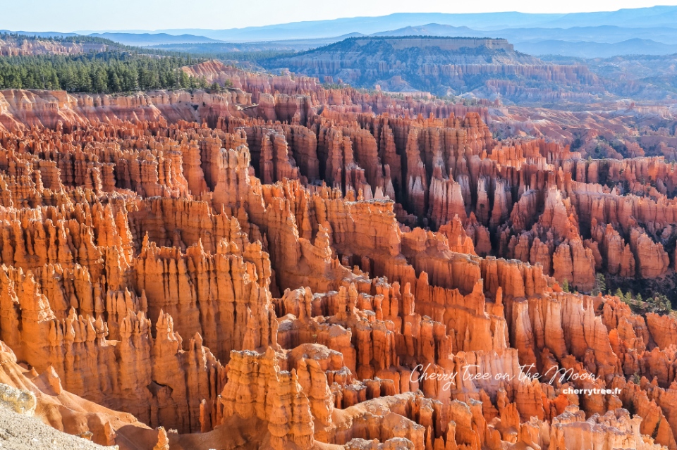
Once upon a time, in my early twenties, I never dreamed the American dream. Because at that time in my head I pictured a country full of boring high-rise buildings, crowded roads and weird people. But on a beautiful day, fate and work pushed me to come here. Everything in America came rushing in front of me, telling me to stop imposing prejudices on a land I had never been to. Indeed, America was not the same as I had imagined. The imaginary narrow streets were replaced by wide avenues, straight highways. American culture is also a bit different from Europe, but most of the people I meet are kind, generous. And the urban skyscrapers are not so suffocating. And if compared with the surrounding spacious nature, it is just like a small island in a vast ocean.
At first sight, the green patches of high mountains, deep forests, rolling plains, interwoven with multicolored deserts have awakened in me an adventurous passion. I thought to myself, if there’s a place in the world that’s perfect for endless travel, it’s probably this country. At that moment, I knew I would return in one day.
And I’m really back. Almost right after. And I chose Grand Circle in the American Southwest for a 3-week road trip (Grand Circle road trip itinerary 3 weeks). Before those days, I never went far, just wandering between a few bustling cities and quiet villages. So that roadtrip was the starting point, paved the way for me on the journeys to come.
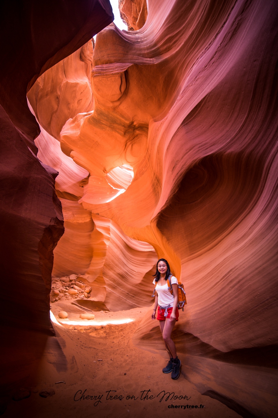
The American West is not the easiest destination one can choose for their first long-distance trip. Honestly, up until now, this is still the most desolate place I’ve ever been to. I still remember the times when the car sped through the night, I opened the window, tried to open my eyes to find a light, but only saw darkness. In my heart agitated knowing that the surrounding wilderness, a radius of a hundred kilometers around it, was not a single person. Having trouble sleeping the first night due to the difference in time zone, I listened nervously to the wolves of Death Valley howling, echoing over the cliffs near and far. Or in the other day, my campsite was alerted to rattlesnakes. So that night, my heart “stopped” a few times, listening the rustling under the bed and praying to God that no snake would come out and lick my cheek.
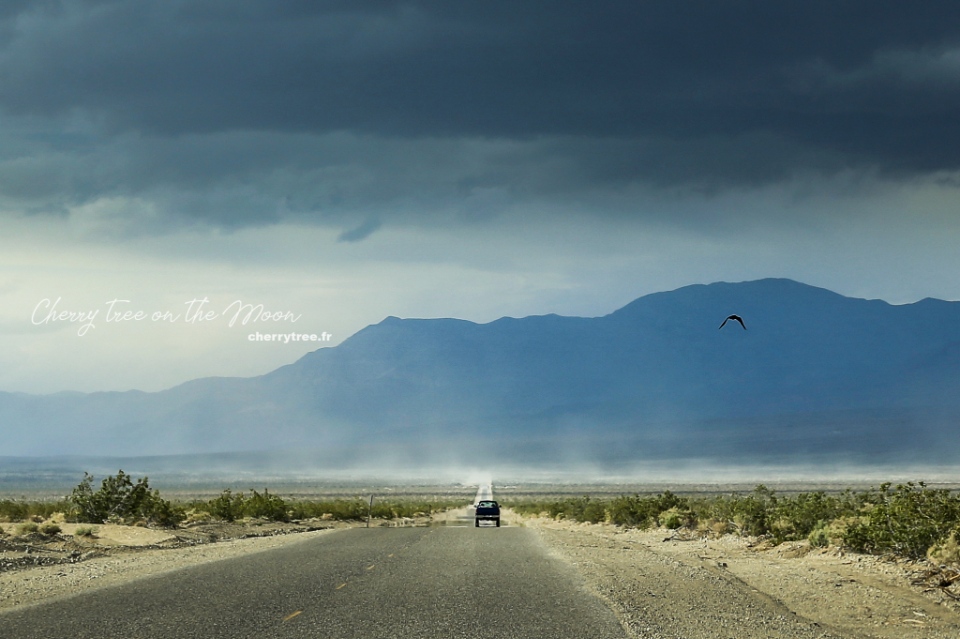
In return, those nerve stimuli are the source of adrenaline that makes us addicted. Gradually, I was no longer afraid like the first days. In the desert, I feel as small as a grain of sand. Nature surrounds me, embraces me. And on the high mountainside, I watched in awe as the sun scattered glittering bands of light down the majestic Colorado river. From dawn to dusk, day by day, in front of the ever-changing majestic landscapes, I happily waved in the open space, happily enjoying the glorious moments that belonged to me. The West poured me every sip of the golden sunshine drenched in the “scent” of freedom and before I knew it, I was already drunk.
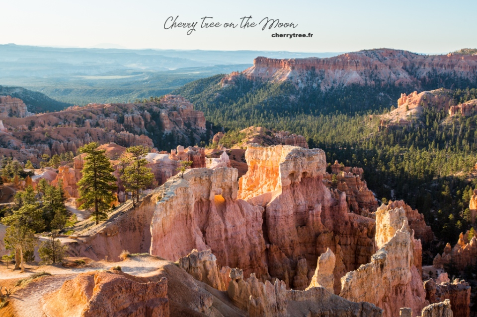
The 3 weeks road trip is too long to wrap up in one article. However, 3 weeks is very short to explore all the way of the Grand Circle, each national park I can only stay for 1 to 3 days, consider it the first “survey” to find the most favorite place, to return in other journeys later.
This note I will dedicate to summarize the past Grand Circle road trip itinerary. In addition, the majestic and enchanting scenery of the Grand Circle USA is a paradise for those who like landscape photos. Alternating in the itinerary, I will include beautiful photo spots that I know. The Grand Circle region is mainly desert, red sandstone mountains, so sunset and dawn are the two most beautiful times to admire and take pictures here. Every day, I have a few reminders for you to go to photogenic spots at the best time of the day.
Now, let’s go together!
Grand Circle USA blog — Detailed Grand Circle road trip itinerary 3 weeks

Day 1: Los Angeles
Arrive in Los Angeles, get a car at the airport, visit the city, go to the supermarket to buy food and water for long distances. Overnight in Los Angeles.
Day 2: Antelope Valley
- Driving: Los Angeles – Antelope Valley (1h30, 85 miles). Antelope Valley is a reserve of yellow poppy flowers, a desert area in the state of California. You should go to Antelope Valley after 10 am because the flowers have not yet bloomed in the early morning. Flowers only bloom in late April, early May. If you come here in another season, skip this area.
- Drive: Antelope Valley – Death Valley (2h45, 148 miles) on Trona Wildrose Road instead of Road 190. Trona Wildrose Road has more scenic views.
- Overnight in Panamint Spring, Death Valley
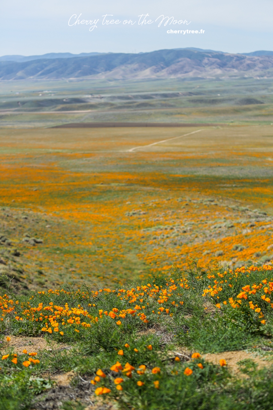
Day 3: Death Valley National Park (Np)
Death Valley , a nearly 8,000 km² national park located in eastern California, is one of the hottest regions in the world. This place is wild and has extremely diverse terrain, from desert to salt lake, high snow-capped mountains, volcanoes… Death Valley is one of the places that impressed me the most on this trip, I was always surprise with “eyes in O shape, and mouth in A shape”.
- Welcome sunrise at the sand dunes of Mesquite Flat.
- Travel along Racetrack Road to Racetrack Playa, the dry lake area is so flat that the rocks here slide across the lake surface when wind blows, creating a long trail behind. Note: The distance is 27 miles of trails, do not go in bad weather.
- Sunset at Zabriskie Point, watching the magical light is unforgettable.
- Overnight in Furnace Creek in the middle of Death Valley.
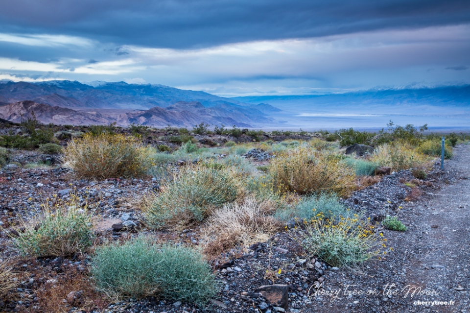
Day 4: Death Valley Np, Las Vegas
- Dawn is the best time to visit Badwater Basin, the lowest point in North America (86m below sea level). You should go far into the middle of the Basin to see the salt areas that gather into beautiful ridges.
- Drive along Artists Pallette near Badwater, see colorful sandstone.
- Driving: Death Valley – Las Vegas (2h, 118 miles).
- Overnight in Las Vegas, in a hotel in the middle of The Strip area for convenient visiting Las Vegas by night.
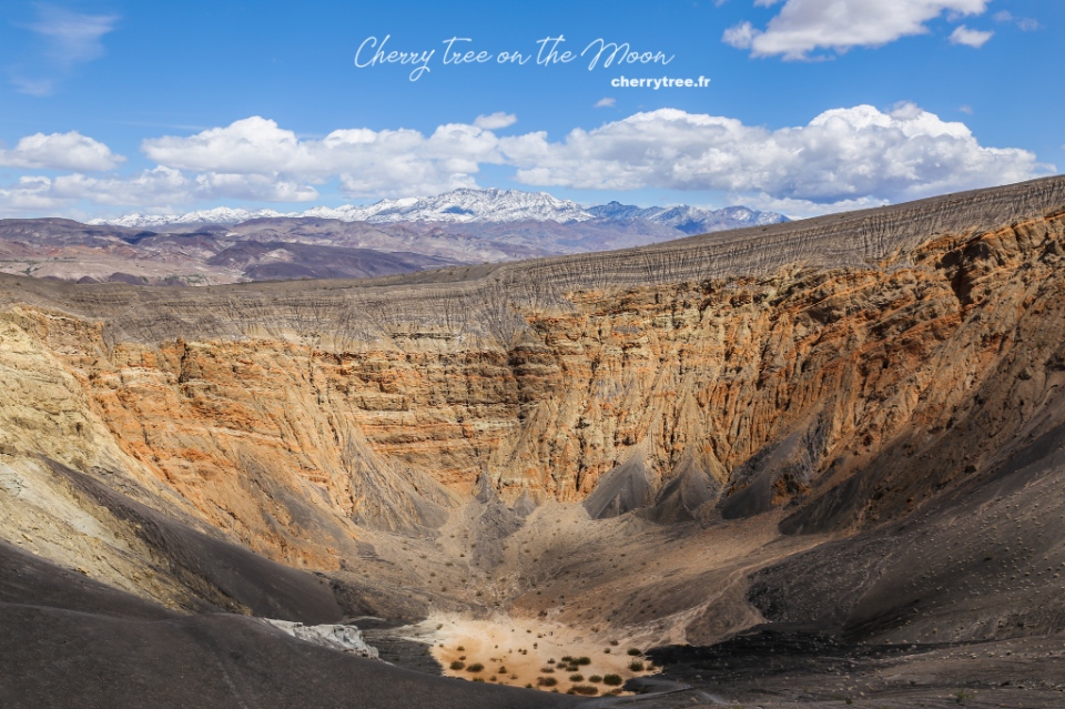
Day 5: Valley Of Fire State Park (Sp)
- Driving: Las Vegas – Valley of Fire (1h, 56 miles) on the road NV167 to get to Valley of Fire Park from the east. Valley of Fire is a Nevada state park, although not very large, but very beautiful, diverse terrain and photogenic with special sandstone structures. You should stop by here for at least a day, exploring the short trails in the area.
- Atlatl rock, Arch rock is frontlighting in the morning, perfect for take pictures, the most beautiful time is about 30 minutes after sunrise.
- Arrival in Jumble rock, Elephant rock in the mid-afternoon.
- White dome, Rainbow vista, Fire wave are most beautiful from late afternoon until sunset. These are the three most beautiful short trails of the Valley of Fire, especially at dusk. I chose Fire wave, and absolutely love the red sandstone color in the sunset.
- Overnight near the Valley of Fire.
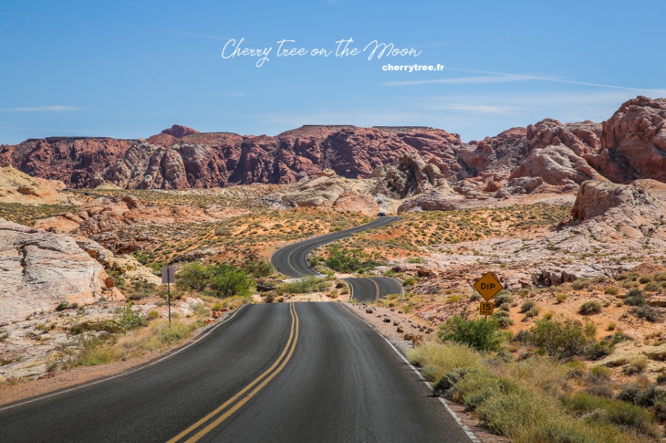
Day 6: Zion Np
- Driving: Valley of Fire – Zion NP (2h30, 140 miles). Zion is the most green national park in the region. The steep cliffs covered with pine trees are reminiscent of European mountains and forests. From spring to fall, private vehicles are not free to enter Zion Canyon. Instead, the park’s free bus takes visitors from the Zion Canyon Visitor Center all the way to the Temple of Sinawava.
- Trekking Angel’s landing (3-4 hours), Zion’s most famous trek thanks to the beautiful scenery at the end of the road and also the steepness. There are sections only 40, 50 cm wide and 400m vertical cliff on both sides. You should go early in the morning to avoid the heat because the first section is not difficult but very steep. Pay attention to consider whether to trek this route on rainy and windy days. I climbed 2/3 then had to go down because the wind was too strong to stand. In the afternoon, when hiking at Observation Point, I saw a helicopter hovering over Angel’s landing because someone fell into canyon from the cliff.
- It is said that Angel’s landing trail takes a few lives every year.
- Afternoon: Hiking Observation Point (4 hours from Weeping Rock car park).
- Driving: Zion NP – Bryce Canyon (2h, 100 miles)
- Overnight near Bryce Canyon.
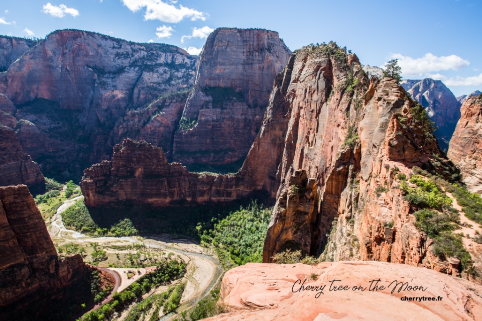
Day 7: Bryce Canyon Np
Bryce Canyon is one of the most beautiful national parks in the United States, with a strange landscape, large orange hoodoos rocks (spectacular rock formations formed over thousands of years which protrude from the bottom of an arid drainage basin or badland.) standing close together, unmistakable. Bryce Canyon in the state of Wyoming, covering an area of 145 km². Coming here, you cannot miss the sunrise at the view points. The moment the sun rose, the rays of light threaded between the fiery red stone pillars, it was truly amazing.
- Dawn: Sunrise point
- From Sunrise point, go down hiking Queen Garden trail and Navajo loop trail
- Sunset: Sunset point
- Overnight near Bryce Canyon
Day 8: Bryce Canyon Np
- Morning: Welcome dawn at Sunset Point and Inspiration Point.
- Driving: Bryce Canyon – Moab (5h, 270 miles) via Scenic byway 12.SB12 is one of the most beautiful roads in America, passing through majestic and very wild landscapes, especially the part between Escalante and Boulder. If you want, you can spend another day day on this road, visiting Escalante National Monument or Capitol Reef National Park.
- Fisher tower sunset near Moab.
- Overnight in Moab.
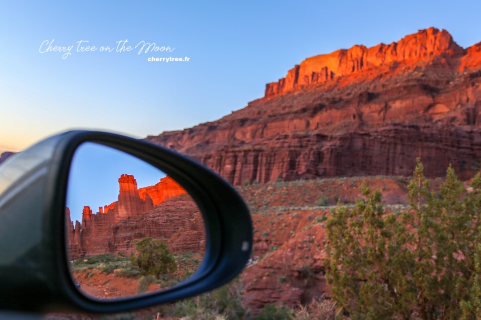
Day 9: Dead Horse Point Sp, Arches Np
- Driving: Moab – Arches NP (9 minutes, 6 miles)
- Dawn at Dead horse point SP . Dead horse point SP is a typical image of a canyon in the American West. From the parking lot, walk a few hundred meters for a better view of the Colorado River and Manti-La Sal mountain.
- Drive from Dead horse point SP to Arches NP. Arches NP is a national park with more than 2000 natural stone arches. Red sandstone terrain, eroded by wind and rain into weird and interesting shapes.
- Hiking Devil garden trail (4.2 miles, 6.8 km), should go in the morning to cool down.
- Visit Windows section, stop by Double arch (0.8 mile, 1.2 km).
- Late afternoon hiking Delicate arch trail (3.0 miles, 4.8 km). The Delicate arch is the symbol of the state of Utah. You should go late afternoon because Delicate arch is more beautiful at sunset. If you go in the morning, it will be backlit. This trek is very hot because there is no shade, remember to bring at least 1 liter of water per person.
Day 10 : Canyonlands Np
- Driving: Moab – Canyonlands NP (45 minutes, 33 miles). Canyonlands is a national park located next to Arches NP. Canyonlands is true to the name “the land of canyons”, is a collection of countless canyons formed by the erosion of two rivers Colorado and Green. Canyonlands is extremely large, including 3 separate areas with 3 different entrances, hundreds of miles apart: Island in the Sky, Needles and The Maze. Because I was so fascinated with the image of Mesa arch, I chose to go to Island in the Sky.
- Dawn at Mesa arch, one of the most beautiful stone arches in America. You should come here before dawn to find a place to find a good spot for your camera in the middle of the forest of professional photographers waiting. From the parking lot to the arch, you have to walk for about 15-20 minutes.
- Drop by Murphy point, White rim overlook, Grand viewpoint, Green River overlook, Shafer Canyon overlook.
- Hiking False Kiva trail (2 miles, 3 km).
- Catch the sunset at the Grand viewpoint or at the Green River Overlook, admiring the scenery of one of the most remote and wild lands in the West.
- Canyonlands – Monticello (1h40, 86 miles)
- Overnight in Monticello.
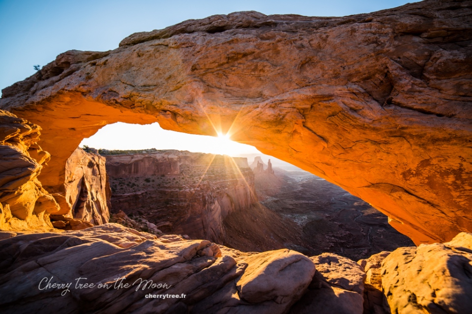
Day 11: Valley Of The Gods, Goosenecks Sp, Monument Valley Navajo Tribal Park (Ntp)
- Driving: Monticello – Monument Valley (1h50, 96 miles), on the way stop by Valley of the Gods https://utah.com/monument-valley/valley-of-the-gods . On the Route 163, turn onto Valley of the Gods road.
- Stop by Goosenecks SP at the intersection of roads 163 and 261 before continue going to Monument Valley . Monument Valley, or Tse’ Bii’ Ndzisgaii in the Navajo language, is a symbol of the Southwest. This place has been used as a backdrop for hundreds of movies, music clips, magazine covers… Monument Valley is owned by the Navajo Nation, so it has its own “rules”, different from state parks or national parks.
- Hiking Wildcat trail (4 miles, 6 km), one of the most beautiful trails in Monument Valley.
- Take a tour around Monument Valley via Scenic Drive in the late afternoon.
- Sunset at the viewpoint right in front of Monument Valley’s Visiter Center.
- Overnight in Monument Valley.
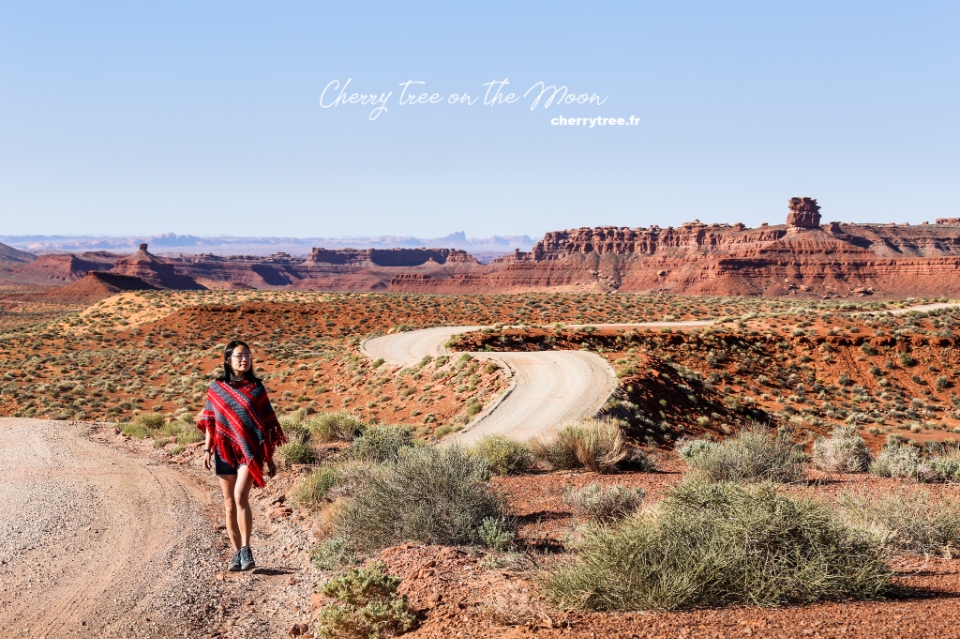
Day 12: Page
- Driving: Monument Valley – Page (2h, 126 miles)
- Strolling Thousand Pockets (2 miles, 3 km)
- Visit Stud Horse Point.
- Overnight in Page.
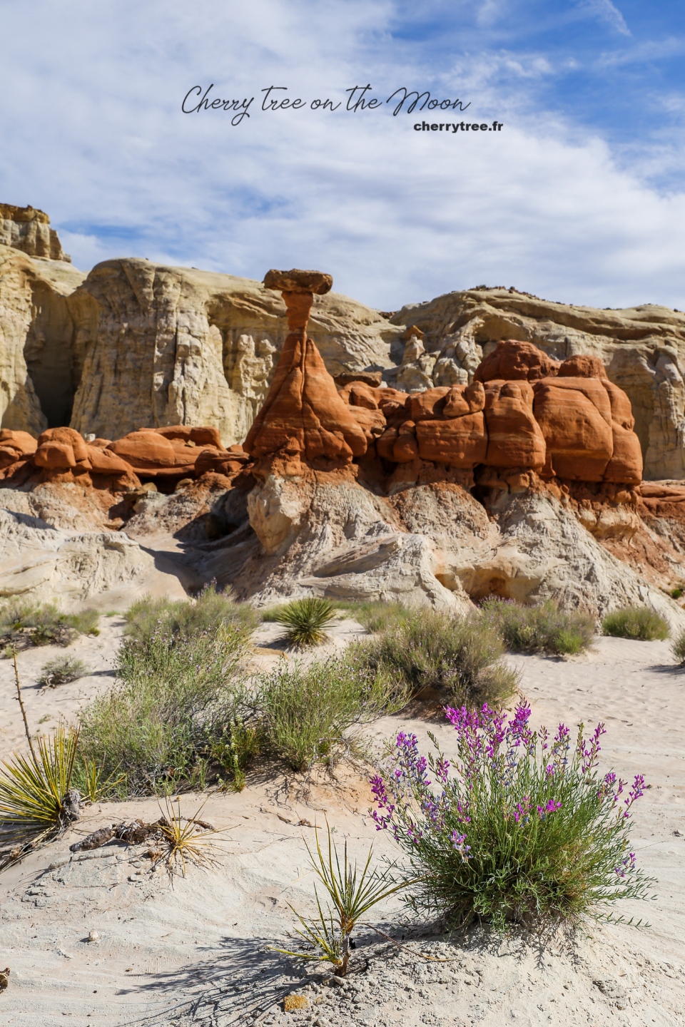
Grand Circle road trip itinerary: Day 13: Antelope Canyon Ntp
Antelope Canyon are two beautiful narrow canyons formed by the process of wind and water abrasion. Antelope Canyon is also managed by the Navajo Nation. Since about 10 years ago, AC has become more and more famous, so the price of admission is very expensive (42-98 USD, 2022 price).
- Visit Lower Antelope Canyon (Hasdeztwazi). Buy a photo pass to travel freely in the canyon). Update 2022: from 2018 there is no longer photo tour for Lower AC.
- Visit Upper Antelope Canyon (Tse Bighanilini’), visiting hours: 11am-1pm to get beautiful light. Update 2022: you need to book several months in advance if you want to enter Upper AC at a nice time frame.
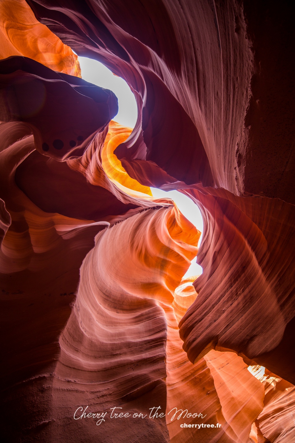
Day 14: Lake Powell, Horseshoe Bend
- Book a tour to explore Lake Powell by boat.
- Catch the sunset at Horseshoe Bend.
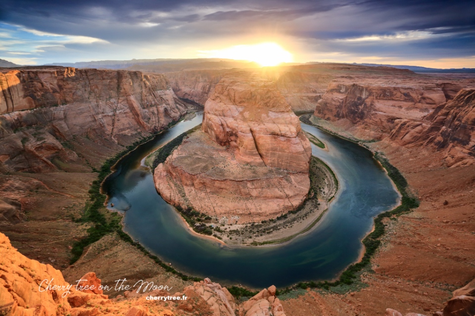
Day 15: Grand Canyon Np
- Driving: Page – Grand Canyon South Rim (2.5 h, 133 miles)
- Drop by Lee’s Ferry.
- Hiking Cathedral Wash (2.5 miles, 3.75 km).
- Stop at Desert View 22 miles from GC, nice light in the afternoon.
- Overnight in Grand Canyon Village. Grand Canyon is created by the erosion of the Colorado River into the rocky mountain bed, is the largest canyon in the United States. No len can capture the magnificence and overwhelming immensity of the landscape here.
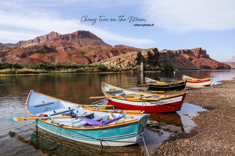
Day 16: Grand Canyon Np
- Dawn at Mather Point.
- Hiking Bright Angel trail to 3-miles Resthouse and back (6 miles, 9.6 km).
- Sunset at Hoppi Point.
- Overnight in Grand Canyon Village.
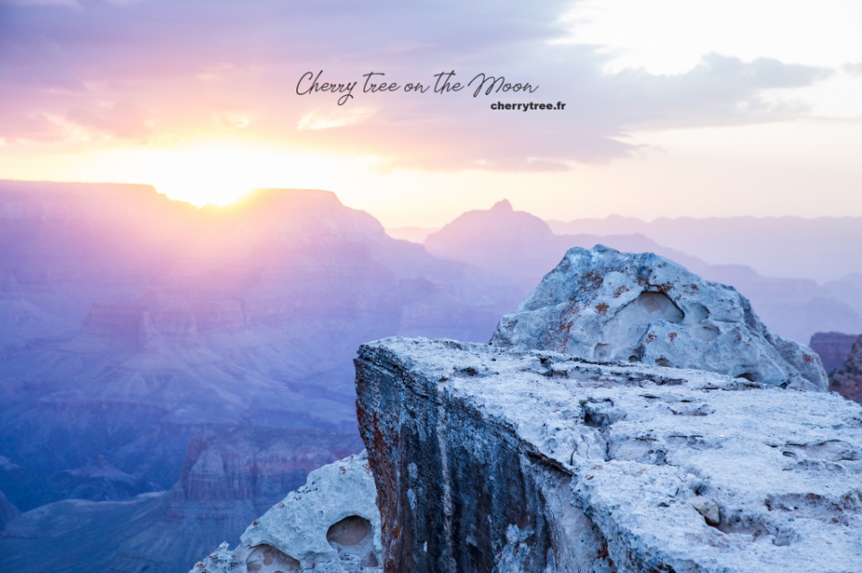
Day 17: Grand Canyon Np
- Dawn at Yaki Point.
- Hiking South Kaibab trail to Cedar Ridge and back (3 miles, 4.8 km).
- Take the trail of Time from Verkamp’s Visitor Center to Yavapai Point (1.9 miles, 3 km).
- Sunset at Yavapai Point.
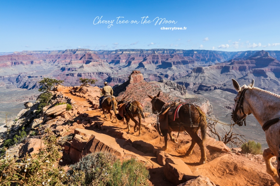
Day 18: Route 66
- Driving: Grand Canyon – Williams – Twentynine Palms (8h, 480 miles).
- Drive along the legendary Road 66 (Route 66): Seligman, Hackberry, Kingman, Oatman, Essex, Newberry Springs.
- Overnight in Twentynine Palms.
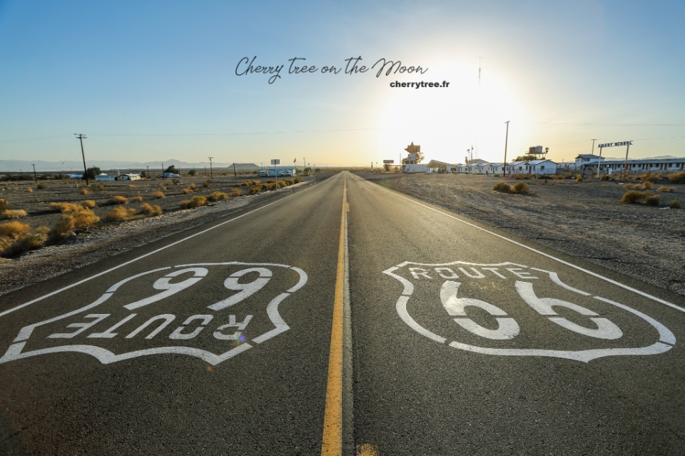
Day 19: Joshua Tree Np
- Driving: Twentynine Palms – Joshua Tree National Park .
- Strolling around Hidden Valley, Cholla Cactus Garden.
- Driving: Joshua tree park – Santa Ana (2h, 140 miles).
- Purple Santa Ana in May, on the Myrtle Street side, Morrison Park.
- Santa Ana – Los Angeles (1h, 40 miles).
- Overnight in Los Angeles.
Day 20: Los Angeles
- Sightseeing in Los Angeles.
Day 21: Los Angeles
- Return car.
Grand Circle road trip itinerary: When to come?
Grand Circle has mountainous and desert terrain, the weather is quite harsh. Take a roadtrip in spring (March to May) and autumn (September to November) are the two most beautiful seasons. The summer months (June, July, August) are very hot, especially in the Death Valley, the daytime temperature can be reach up to 40, 50 degrees Celsius. And winter is cold and snowy, dangerous if you are not used to driving on wet and icy roads.
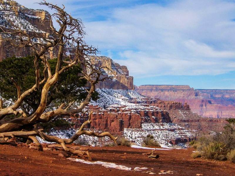
National Parks and Reserves
National parks and reserves all have a certain entrance fee, from 5 to 10 USD. This fare can be charged on a per capita basis or calculated for everyone in the car. If your itinerary goes through about 5, 7 parks, reserves, national works, you should buy an American The Beautiful Pass.
American The Beautiful Pass:
- Price 80 USD.
- Valid within 1 year from date of purchase.
- The pass takes effect as soon as you pay.
- Usable throughout the United States in all government areas (not counting single states or of Indians).
- Buy at the tourist information center (Tourist office) of the first NP you will come to.
- The pass cover for 1 car and 7 people.
- List of areas where the pass can be used and more information here .
State Parks and Reserves
American The Beautiful pass cannot be used in these areas, additional payment is required. Price from 5 to 10 USD / 1 car. Tickets purchased on the spot.
Navajo Nation Parks
These areas are not administered by the state, but by the Navajo people. Ticket prices are therefore also quite expensive and increasing exponentially. In my itinerary above, there are 2 places in the Navajo Nation, which are Monument Valley and Antelope Canyon.
Tickets to Monument Valley cost 20 USD / 1 car for 4 people, from the 5th person add 6 USD / 1 person.
Accommodation
I usually book hotels on famous websites like booking , agoda or expedia. In which Booking is the page with the room in the hierarchy that suits my budget.
The accommodation of NPs
All NPs have lodges with a variety of rooms for tourists, located right in the NP. These lodges are usually a bit more expensive than hotels outside but are in good locations, making it very convenient for visiting the park for several days. You need to go directly to each park’s website to see prices and make reservations.
Camping in NPs
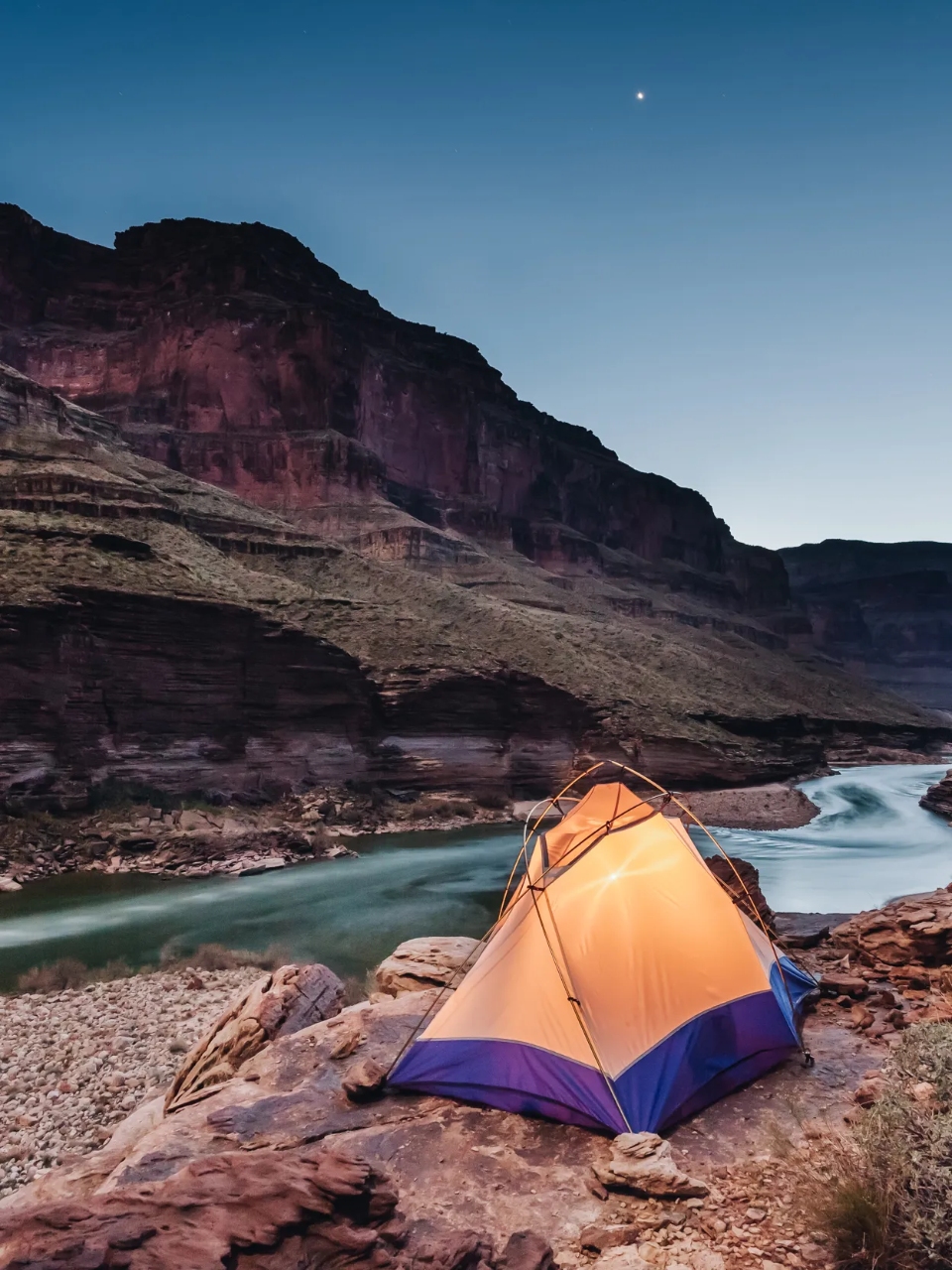
For guests with a more modest budget, NPs also have one or more camping sites. Camping site of NP is very good, with electricity and water, clean bathrooms and toilets. Great for those who love backpacking travel. You only need to bring camping gear (tents, mattresses, cooking utensils…), pay attention to the temperature in the desert at night, it is a bit cold, need to prepare a warm sleeping bag.
Renting a car in the US
I often rent a car on Rentalcars site. This firm has a pretty good service, listing many car companies for you to choose from. I will write a detailed article about renting and driving in the US later.
Reference costs
- Round-trip airfare from Europe: 800 – 1000 USD.
- Hotel: 50 – 100 USD.
- Meal: 10 – 20 USD / 1 person / 1 meal.
- Self-drive car rental 40 – 50 USD / 1 car / 1 day.
Total cost about 5,600 USD / 3 weeks for 2 adults.
Reference books and websites
This is my first roadtrip, so I prepared very carefully, read a lot of websites and reference books. Among them, which I find most useful for photography enthusiasts like myself, is the 3-book “Photographing the Southwest” series by Laurent Marthès.
For those of you who know French, you can refer to the website RoadTrippin , an “encyclopedia” of roadtrips in the US. I found a lot of good information there.
I have a lot of maps of NPs that I have passed, if you need them, please message me to scan.
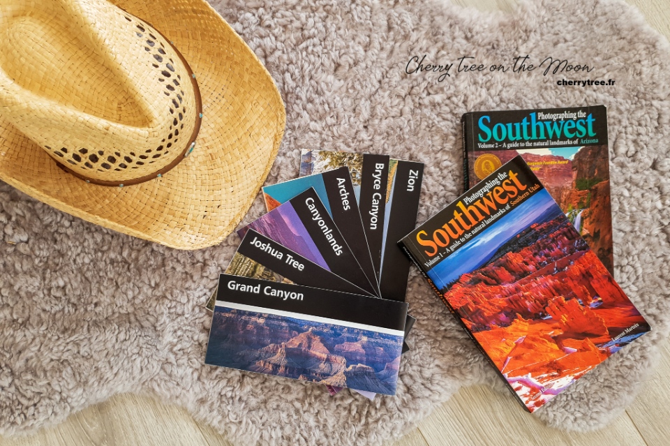
Read more US guide here .
Related articles

RELATED ARTICLES MORE FROM AUTHOR
Guide to shenzhen nightlife — top 5 things & what to do in shenzhen at night, ladakh trip cost per person from delhi — how much does ladakh trip by bike cost, india travel tips — 25+ what & things to know before traveling to india, coron itinerary 5 days — what to do & how to spend 5 days in coron.

Arashiyama travel blog — The fullest Arashiyama travel guide with top things to do in Arashiyama

Explore Fenqihu old street — What to do in Fenqihu in a day trip?

Where to go in Kunming? — 15+ top Kunming attractions & best places to visit in Kunming
Must eat in melaka — 10+ famous malacca street food & must try food in melaka.

What to do in Alishan? — 5 top attractions & best things to do in Alishan, Taiwan
Editor picks.

Guide to Shenzhen nightlife — Top 5 things & what to...

Ladakh trip cost per person from Delhi — How much does...

India travel tips — 25+ what & things to know before...
Popular posts.

What to buy in USA? — 17+ must buy in USA...

Must buy souvenir in Taiwan — Top 17+ most famous, cheap...
")
Must buy in Korea — Top 23 cheap, famous & best...
Popular category.
- Inspiration + Guide 1459
- Trip Inspiration 468
- Thailand 209
- Food + Drink 208
- Coasts + Islands 193
- South Korea 168
- Vietnam 166
- Travel Photos 144
- Work for Us
- Terms & Conditions
- Privacy Policy
- Trending To display trending posts, please ensure the Jetpack plugin is installed and that the Stats module of Jetpack is active. Refer to the theme documentation for help.
Our Ultimate 2 Week Grand Circle Road Trip Itinerary

Utah boasts 5 national parks, commonly referred to as “The Mighty 5” when done as a single road trip. But why stop there? In addition to all 5 Utah national parks, you can easily add Grand Canyon, Mesa Verde, Monument Valley, and Lake Powell (Glen Canyon Recreation Area) to your itinerary. All together this makes up the Grand Circle road trip.
How To Use This Itinerary
We’ve tried to make this itinerary as customizable as possible. As it stands, it can be done in a busy 2 weeks. We would love it if everyone could spend 3 weeks on a Grand Circle road trip, but totally get that for most people that isn’t possible. Whenever possible, we’ve indicated places that are good to add time (if you have it!) or cut if you’re super short on time.
This itinerary starts from Salt Lake City, Utah. You could pick it up from somewhere else. Las Vegas, Nevada is another common starting point. If you start in Las Vegas, go to Zion or Grand Canyon first.
We’ve listed approximate drive times and distances. That’s only “in the car” time. Your travel time will vary depending on breaks and sightseeing.

2 Week Grand Circle Itinerary
Day 1: salt lake city to moab, utah.
Driving Time: 5 hours
Today is the first day of your Grand Circle road trip. I know you’re excited, but today is largely a travel day. Settle in with a good audiobook and start your engines.
Make use of any evening time you have left with a visit to Arches National Park.
If you arrive in time, Delicate Arch is postcard-perfect at sunset. It’s also a massive crowd scene. If anyone in your group is afraid of heights, Delicate Arch may not be the hike for you.
Day 2: Arches National Park

Today is your chance to enjoy all that Arches National Park has to offer. You really can’t go wrong with what you decide to see. The only mistake you can make is arriving too late. By 8:00 am the entrance line will be huge.
Today we recommend you:
- Enter the park early.
- Hike Delicate Arch first, if you missed it at sunset on Day 1.
- Pick up a Junior Ranger book at the Visitor Center
- Drive through the park hitting several of the short, gorgeous hikes. You should be able to fit in several. Great choices include Park Avenue, Windows, Double O Arch, Balanced Rock, and Tower Rock (AWD required).
- Finish off your day outsid the park on a heart pumping sunset jeep tour with Dan Mick’s Jeep Tours .
One longer hike worth the time and advanced planning is Fiery Furnace . This is our favorite hike in all the national parks we’ve visited. A permit is required so make sure to read our detailed trail guide .
Day 3: Canyonlands National Park & Dead Horse State Park

Driving Time: 2 hours
Today you are headed to the Island in the Sky region of Canyonlands National Park. Like Arches, Canyonlands offers lots of shorter hikes that are great for families and multi-generational trips.
Canyonlands is divided into 4 parts and roads do not connect the different areas. The area closest to Moab is Island in the Sky.
Today we recommend:
- Start your day with the short hike to Mesa Arch (0.5 miles). You’ll probably just catch the sunrise photographers finishing up.
- Clamber up the dome of Whale Rock (1 mile, but steep)
- Stop at the Green River Overlook
- Hike to Grand View Overlook (2 miles)
- Complete your Canyonlands NP Junior Ranger badge at the Visitor Center.
- Spend late afternoon in Dead Horse State Park. At minimum, do the short, paved walk to Dead Horse Point Overlook Trail and complete the Utah State Park Junior Ranger badge.
Extra time? We recommend river rafting and more time in Arches.
Day 4: Canyonlands National Park Needles Area
Driving Time: 2.5 hours
Short on time? Head straight to Mesa Verde National Park. Skip Canyonlands Needles area, Hovenweep, and Anasazi Heritage Center.
Forget the crowds in Arches and Canyonlands Island in the Sky. Today, you leave them all behind in the Needles area of Canyonlands. Seriously, I don’t think we saw another person on the trails.
After you drive from Moab to Canyonlands Needles, we recommend you:
- Explore the 0.6-mile Cave Spring trail.
- Traverse the wild landscape of the Slickrock trail (2.4 miles).
- Appreciate the Newspaper Rock petroglyphs from 2000 BC.
Stay the night in the small town of Monticello, Utah.
Extra Time? Natural Bridges National Monument features three magnificent rock bridges.
Day 5: Hovenweep National Monument and Travel to Mesa Verde National Park
Today you’re headed to Mesa Verde National Park in Colorado! Luckily, the drive offers several great stops to learn about ancestral Puebloan cultures as you head towards Mesa Verde.
For more details, read our Hovenweep travel guide .
- Visit Hovenweep National Monument. Hike the Square Tower Group loop trail including Tower Point (2 miles)and earn your Junior Ranger badge.
- Enjoy the hands-on activities at the Canyons of the Ancients NM Anasazi Heritage Center
- Stop at the Mesa Verde NP Visitor Center. Pick up a map and Junior Ranger book. Book your ruins tour, if you didn’t do it in advance (ideally you did).
We recommend staying inside the park. The drive from the park entrance to the sites is 1-1.5 hours. Otherwise, stay in the nearby towns of Mancusco or Cortez.
If you stay in the park, make sure and look up tonight. The high altitude and dark skies make stargazing AMAZING.
Day 6: Mesa Verde NP

Unlike the natural beauty of the Mighty Five, Mesa Verde is all about immersing yourself in ancestral Puebloan history and culture.
For more details on visiting this unique national park, read our complete guide to Mesa Verde .
2021 Closures! Both Balcony House and Cliff Palace are closed in 2021. Other Cliff Dwelling tours are still available.
- Get up close with history on a cliff dwelling tour. Try to book your tickets in advance. Our favorite cliff dwelling is Balcony House tour as it’s a little bit adventurous, but if you want less climbing consider Cliff Palace.
- Send a postcard from the second smallest post office in the USA
- Drive the Mesa Top Loop and stop at the Far View sites. Our favorite is Sun Point View across the Cliff Palace.
- Get sworn in as a Junior Ranger.
- Relax under the stars!
Day 7: Monument Valley & Page, Arizona

Driving Time: 4.5 hours
Monument Valley is a must-stop on the drive from Mesa Verde to Page, Arizona. We recommend driving US-163 through Mexican Hat. That route has the best views!
We took a slight detour and also crossed Four Corners Monument off the bucket list. After all, who doesn’t want to be four places at once?
Milepost 13 on US-163 is the “Forrest Gump” spot where Forrest famously decided he was done running back and forth across the US.
Monument Valley lies entirely on Navajo Nation land. Right now, you need to book a guided tour to see the valley up close. We can’t recommend a specific tour as we did the self-drive on our visit.
From Monument Valley, continue driving to Page, Arizona . You should be early enough to catch a stunning desert sunset.
Day 8: Page & Lake Powell
Extra time? Page, Arizona is worth at least 2 days of time. If you have extra time, consider adding a day. We especially like the trip to Rainbow Bridge National Monument .
- Admire the beauty of Antelope Canyon
- Enjoy the sparkling water of Lake Powell
- Admire the sunset at Horsehoe Bend
Page is one of the larger cities on this road trip. Take some time to stock up on supplies.
Day 9: Page, Arizona to Grand Canyon
You have a big decision to make. Will you go to the North Rim or South Rim of the Grand Canyon? This itinerary works with either. Honestly, you can’t go wrong. The Grand Canyon will blow your mind no matter where you choose to go.
We prefer the North Rim of the Grand Canyon. It’s quieter (but not quiet) and more wooded. The drive time is also shorter for this itinerary.
The South Rim is where you’ll find the classic Grand Canyon photo views. It’s lower, more deserty…and more crowded.
After your travel day, we recommend you:
- Pick-up a map from the Visitor Center and get tips on viewpoints and hiking trails.
- Start your Junior Ranger badge.
- Find a place to unwind and enjoy a sunset view.
Day 10: Grand Canyon

Your goal today is to enjoy Grand Canyon views above and below The Rim.
A hike below The Rim will leave the crowds behind. Definitely watch the temperature and your water. You DO NOT want to be caught short of water on the hot, uphill hike out.
If you’re on the north side, take the North Kaibab Trail. Turn around by Supai Runnel (4 miles).
If you’re on the south side, try the Bright Angel Trail. Turn around by 1.5 Mile Resthouse (3 miles).
Day 11: Zion

Driving Time: 3 hours (from North Rim)
Driving Time: 5 hours (from South Rim)
Zion is gorgeous, but it’s also crowded. You must arrive early or the parking lots and trails will be full.
- Hit the trails early! Our absolute favorite hike is The Narrows. If wading up a river isn’t your thing, Pa’rus Trail, Watchman Trail, and Lower Emerald Pools are all scenic, family-friendly hikes.
- Attend a ranger talk and earn the Junior Ranger badge.
- Drive Route 9 through the beautiful Zion-Mount Carmel Tunnel to Bryce National Park.
Extra time? Spend an extra day hiking inside the park or canyoneering outside the park.
Day 12: Bryce

The hoodoos are the highlight of the show at Bryce National Park. Enjoy them from above and also make sure you get down into Bryce Amphitheater to see them up close.
- Get oriented at the Visitor Center. Make sure and pick-up the Junior Ranger book and ask about the “I Hiked the Hoodoos” program.
- Enjoy the viewpoints at Bryce Point and Inspiration Point.
- Hike the Rim Trail between Sunset and Sunrise points (1.0 mile).
- Explore the hoodoos on the Queen’s Garden Trail to Navajo Loop (2.9 miles).
- Drive the Scenic Southern Loop to Rainbow Point. Walk the Bristlecone Loop (1.0 mile) for the best views.
- Enjoy pristine stargazing on your own or with a free Ranger-led program.
Extra time? Bryce or nearby Red Rock are perfect horseback riding territory. You could add on a day or swap out the Scenic Southern Loop to fit this in.
Day 13: Capitol Reef National Park
Capitol Reef National Park is an unexpected gem. Overshadowed by the more famous Bryce, Zion, and Arches, Capitol Reef is stunning in its own right.
The star attraction is the Waterpocket Fold – a 100-mile wrinkle in the earth’s surface.
- Stop at the Visitor Center to pick-up the Junior Ranger book and get a map
- Drive the Scenic Drive, stopping wherever catches your fancy.
- Hike Hickman Bridge (1.8 miles) or Cassidy Arch (3.5 miles).
- Enjoy pie at the Gifford House Store and Museum (fingers crossed there’s still pie).
- Pick fruit in the Fruita orchards.
Day 14: Head Home
Driving Time: 3.5 hours (to Salt Lake City)
You finished your Grand Circle road trip! Today is about getting home.
If you’re heading back to Salt Lake City, then consider a longer drive and a stop at Goblin Valley State Park. The weird and wonderful scenery is worth the detour.
We hope you have a great time on your Grand Circle road trip! Did you have a great time or have any suggestions for our itinerary? Either way, we would love to know. Drop us a comment below.
If You Found This Post Helpful, We Would Love to Stay in Touch…
- Follow us on Instagram to see our latest travel photos.
- Pin this post on Pinterest to save it for later and share it with others.
- Check us out on Facebook for curated family travel information.

Privacy Overview

Real People

Real Projects

The Best 7 Day Grand Circle Road Trip Itinerary! The Ultimate Southwest Road Trip!

When is the Best Time to Plan the Ultimate Southwest Road Trip?
Before you go, how long does a grand circle road trip take.
We did this version of the Grand Circle Road trip in 7 days. You can add days and stops to it, but a full week will hit the highlights. If you keep reading, I have a few extra suggestions of National Parks you can add to make your trip just a bit longer if you have the time.

Where to Start Your Ultimate Southwest Road Trip
The ultimate southwest road trip itinerary, day 1: las vegas, save up to 50% off on hotels in las vegas, here's what i would have done differently:, looking for a hotel check these deals out.

Day 2: Zion National Park Where We Stayed:
Where to eat:, day 3: zion national park, we had a full day to experience zion national park and it was just the right amount of time given the fact that the main things we wanted to do just weren't possible... angels landing.

Narrows Hike

What We Did in Zion National Park

Pa'arus Trail
Canyon junction, temple of sinawava.

Day 4: Kanab, UT and Bryce Canyon
Where we stayed:.

What we Did in Bryce Canyon

Navajo Loop Trail to Queens Garden
On the agenda for bryce canyon next visit:, day 5: page, az.
Horseshoe Bend
Here are a few things no one will tell you about visiting horseshoe bend:.

Doing it for the Gram
Would i recommend a visit to horseshoe bend , day 6: lake powell/antelope canyon.

Tips for Renting a Boat on Lake Powell
Want to rent a kayak or stand up paddle board on lake powell, lower antelope canyon, ken's tours-love it or hate it-not much you can do about it.

Some Tips to Booking Antelope Canyon Tours
Is lower antelope canyon overrated.

Day 7: Grand Canyon National Park {South Entrance}
Where we stayed:, where we ate:, what we did:, moran point.

Grand Canyon Rim Trail
Mather point for stargazing, sunrise hike on south kaibab trailhead to oh ah point, read more about the best place to watch sunrise on the southern rim of the grand canyon, how many days in grand canyon is enough, day 8: hoover dam.

Looking to Expand Your Trip?
add in these parks arches national park canyonlands national park mesa verde national park, some additional tips if traveling with teens, add in some chill time, book hotels that have more space, take time to plug in.

No comments
Post a Comment

follow @msrachelteodoro
Recent posts, blog archive.
- ► April (4)
- ► March (4)
- ► February (4)
- ► January (5)
- ► December (4)
- ► November (4)
- ► October (5)
- ► September (4)
- ► August (6)
- ► July (4)
- ► June (4)
- ► May (5)
- ► April (5)
- ► November (5)
- ► August (5)
- ► July (5)
- ► June (5)
- 5 Reasons I Wouldn't Visit Horseshoe Bend Again
- Best Place to Watch Sunrise on Grand Canyon's Sout...
- Visiting Antelope Canyon: Is it Really Worth the H...
- The Best 7 Day Grand Circle Road Trip Itinerary! T...
- Save Money on Groceries with These Money-Saving Tips
- How to Make Bohemian Decor Earthy and Modern
- ► March (5)
- ► February (5)
- ► January (4)
- ► December (6)
- ► November (6)
- ► October (4)
- ► September (7)
- ► August (4)
- ► July (6)
- ► June (7)
- ► May (8)
- ► April (6)
- ► March (10)
- ► February (9)
- ► January (9)
- ► December (8)
- ► November (8)
- ► October (9)
- ► September (9)
- ► August (8)
- ► July (9)
- ► June (8)
- ► April (10)
- ► December (9)
- ► November (7)
- ► October (11)
- ► September (8)
- ► August (10)
- ► July (10)
- ► May (9)
- ► April (9)
- ► March (11)
- ► February (12)
- ► January (10)
- ► December (12)
- ► November (11)
- ► October (12)
- ► September (11)
- ► August (14)
- ► July (13)
- ► June (13)
- ► May (13)
- ► April (13)
- ► March (15)
- ► January (13)
- ► November (15)
- ► October (15)
- ► September (14)
- ► August (16)
- ► July (14)
- ► June (19)
- ► May (18)
- ► March (21)
- ► February (17)
- ► January (16)
- ► December (17)
- ► November (16)
- ► October (21)
- ► September (15)
- ► August (18)
- ► July (15)
- ► June (15)
- ► May (16)
- ► April (17)
- ► March (18)
- ► February (18)
- ► December (19)
- ► November (14)
- ► October (14)
- ► July (17)
- ► June (12)
- ► March (19)
- ► February (13)
- ► January (18)
- ► November (13)
- ► October (19)
- ► September (16)
- ► July (18)
- ► June (17)
- ► May (20)
- ► April (18)
- ► January (17)
- ► December (25)
- ► October (17)
- ► September (20)
- ► June (23)
- ► May (25)
- ► April (15)
- ► March (16)
- ► December (15)
- ► May (17)
- ► April (16)
- ► March (24)
- ► January (20)
- ► December (18)
- ► November (17)
- ► October (24)
- ► September (24)
- ► August (7)
- ► June (21)
- ► May (21)
- ► April (19)
- ► November (9)
- ► October (18)
- ► September (22)
- ► May (12)
- ► April (22)
- ► March (23)
- ► February (23)
copyright notice
- Privacy Policy
© 2019 Rachel Teodoro.
- Bryce Canyon
- Capitol Reef
- Monument Valley
- Lake Powell
- Grand Canyon
Grand Circle Tour Itinerary
- Visit our facebook
- Visit our pinterest
11 days, 1,500 miles, 6 National Parks, Monument Valley, adventure towns, giant lakes in the desert, and something about a Dead Horse Point? Yes, please.
Strap your seat belts on for this one. For the next 11 days you are going to cover nearly 1,500 miles of the most scenic highways in the country. Read on.
Promotional Links
See utah's grand circle of national parks in 11 days, 10 nights.
You will visit six national parks, two national monuments, one Navajo tribal park and pass by several state parks and other points of interest. The canyons, sunsets, trails, colors, arches and rock formations will keep your camera busy so bring lots of film or flash memory and batteries. Millions of years of erosion have created a spectacular display of cliffs, canyons, arches, bridges, red slickrock, and mountains that you will experience during your two-week travels.
Day One: Zion National Park
Drive from Las Vegas (168 miles) or Salt Lake City (314 miles) to Springdale, gateway to Zion National Park.
Park Fees: We recommend that you buy the $80 National Parks Pass that will allow you into all National Parks and Monuments.
Hike Canyon Overlook Trail
(1 hour, 1 mi/1.6 km round trip)
This short moderate hike on a well-marked trail leads to an overlook offering incredible views of lower Zion Canyon. If you time it right, the sunset will light up the whole canyon. The trailhead is at the parking lot just beyond the east entrance of the tunnel. Cross the street and begin the easy 1 mile hike. This hike is great for people who want to see a beautiful overlook of Zion that don't necessarily like long hikes and it's great for kids.
Return back to your accommodations by following highway 9 back into Springdale.
Check into accommodations near Zion National Park
For Dinner, eat at a restaurant in Springdale.
Day 2: Zion National Park
Stop at the local market to get water and snacks for the day. You will want a day pack to carry things in since you will be gone for the entire day.
Explore Zion Canyon
During the summer months, the shuttle runs at six-minute intervals during the middle of the day. Operating from 6:30 a.m. to 11:00 p.m. Parking at the visitors center inside the park can be difficult from May-September, so riding the shuttle into the park is a better option. November through March you can actually drive up the canyon.
Shuttle Stops:
- Court of the Patriarchs- (5 minutes .1 mile walk)
- Zion Lodge- Emerald Pools trailhead (1-3 hrs. Lower-1.2 miles rt. Middle- 2 miles rt. Upper- 3 miles rt)
- The Grotto- Angels Landing trailhead (4-5 hrs. 5 miles rt)
- Weeping Rock- Weeping Rock trail. (1/2 hour. .4 mile walk rt)
- Big Bend - View the Angels Landing ridge trail
- Temple of Sinawava- Riverside trail, gateway to the Narrows. (1.5 hours. 2 miles rt)
Add a little extra adventure and incredible scenery by walking up the Virgin River Narrows a mile or two. You might want to bring an extra pair of shoes and a walking stick. The trail is the river and you are walking on slippery rocks as you go up the Narrows.
Grand Circle Tour Itinerary | Photo Gallery

Hwy 163 to Monument Valley
Day 3: Bryce Canyon National Park
Leave for Bryce Canyon National Park (approx. 86 miles). Enjoy the scenic drive through Zion Hwy 9 and HWY 89. Pass through historic towns and the beautiful Red Canyon.
At Bryce Canyon, visit some of the scenic overlooks . If you're looking to relax a little, stay nearby and visit the closer viewpoints. For sunset, we recommend Inspiration Point, Paria View or Sunset Point, and plan to arrive one-and-a-half hours before sunset for the best lighting. If you want to see mostly all of Bryce Canyon, drive or take the shuttle on the scenic loop. It's 38 miles (one way) of pure beauty and you will cover many viewpoints.
View Points of Scenic Loop:
- Swamp Canyon
- Piracy Pointe
- Fairview Point
- Aqua Canyon
- Natural Bridge
- Ponderosa Canyon
- Black Birch Canyon
- Rainbow Point
- Yovimpa Point
Check into accommodations near Bryce Canyon National Park.
Eat at Ebenezer's Barn and Grill and enjoy great Cowboy Entertainment. Or check out other restaurants in the area.
Day 4: Bryce Canyon National Park & Highway 12
Get up early and see the sun rise over Bryce Canyon. The two most popular viewpoints for sunrise are Sunrise Point and Bryce Point.
Hike the Navajo Loop Trail
(1.3 mi/2.16 km round trip)
This is hands-down the greatest way to see the hoodoos of Bryce Canyon from the canyon floor. You start by hiking down Wall street a narrow canyon with high rock walls on either side. Soon after you will reach the flat canyon floor with the option to finish the Navajo Loop 1.3 mi round trip.
Drive All American Road Hwy 12
This drive cuts through a corner of Bryce Canyon National Park and then follows a breathtaking scenic route through Grand Staircase-Escalante National Monument. It is a good, paved highway, but steep in spots. It descends into the Escalante Canyons region and then climbs over Boulder Mountain. From Boulder Mountain you can see the Waterpocket Fold section of Capitol Reef National Park. Stop at scenic turnoffs as time permits. Hwy 12 ends in Torrey near the Capitol Reef National Park entrance.
Highlights of Highway 12:
- Mossy Cave, a sneak peak of Bryce. Drive past Bryce toward Tropic and there is a pullout on the right. Play in the small cave and waterfall down a short half mile path.
- Kodachrome Basin (22 mi/35 km) from Bryce
- Escalante State Park (44 mi/70 km) from Bryce
- Calf Creek Falls (67.6 mi/107 km) from Bryce
- Ancestral Pueblo Indian Village (80.8 mi/130 km) from Bryce
Check into accommodations near Capitol Reef National Park
Check out the restaurants near Capitol Reef too. Torrey is so small that all you need to do is drive down the main road (Hwy 24) and you'll see all of the restaurants.
Day 5: Capitol Reef National Park
Capitol Reef is amazing in its own special way. The formations you see here you won't find anywhere else in the world.
Drive the scenic drive south from the Visitor Center.
The Scenic Drive is a 10 mi/16 km paved road with dirt spur roads into Grand Wash and Capitol Gorge that, weather permitting, are accessible to ordinary passenger vehicles. In every direction the views are fascinating. From the road you can see sheer sandstone cliffs, uniform layers of shale and rocks that have been lifted and folded and carved into shapes that stir the imagination. The Scenic Drive is not a loop, so you must return on the same road. Entrance fees of $5 per vehicle are charged for the Scenic Drive.
In the afternoon begin your drive to Moab, Utah's Adventure Capital (144 miles).
Check into accommodations near Arches National Park in Moab
Day 6: Moab
Visit arches national park.
In the morning, pack a lunch and plenty of water, and drive to arches to watch the sunrise over the world's largest concentration of natural stone arches. Drive North on Highway 191 from Moab for 5 mi/8 km. The turnoff for Arches will be on the East side of road. For the more adventurous, get up 1 hour before sunrise and hike the 1.5 mile trail to Delicate Arch and watch the sun rise.
Main Points of Interest:
- Park Avenue
- Balanced Rock
- Windows Section
- Delicate Arch Viewpoint
- Devils Garden- (Landscape Arch)
Eat lunch en route.
In the afternoon drive to Dead Horse Point and to the scenic overlooks in Canyonlands National Park.
Dead Horse Point
Dead Horse Point State Park offers a spectacular vista providing with views of Canyonlands National Park and the Colorado River. From Arches, drive back to Hwy 191 and head north for about 6 mi/9.6 km to Hwy 313 and take the signed turnoff to Dead Horse Point. Follow Hwy 313 for about 22 mi/35 km as it winds to the top of the plateau and then south to Dead Horse Point.
Tour Canyonlands National Park- Island in the Sky District
(2-3 hours)
Island in the Sky comprises the northern portion of Canyonlands National Park. From Dead Horse Point, return north on Hwy 313 for 7 mi/11 km to the junction with the Grand View Point Road and then drive the Grand View Road south into Canyonlands. Stop at the Visitors Center to pick up a map and information before continuing to the lookout points.
Main Points-of-interest:
- Grandview Point
- Upheaval Dome
- Green River Overlook
Return to Moab for the night.
Day 7: Moab
Optional day. Engage in one of Moab's many adventure activities; whitewater rafting on the Colorado River, horseback riding among the red cliffs, mountain bike the slick rock trails, take a Hummer 4x4 ride over red rock trails or hike to Corona & Bow Tie Arches.
Moab Guides and Outfitters
Day 8: Monument Valley
Drive to monument valley.
(150 mi/241 km).
This is a scenic drive; plan to stop at the historic towns and viewpoints and take some pictures.
Eat lunch en route. Drive to the visitors center and sign up for a Navajo guided tour through Monument Valley at Sunset. Check out the amazing overlooks East and West Mitten Buttes, and Merrick Butte. Unique sandstone formations, red mesas and buttes surrounded by desert were used in hundreds of western movies. There is only one hiking path called Wildcat Trail (3.2 mi/5 km rt) that starts at the visitors center and loops around West Mitten Butte. At night the stars are absolutely amazing because of the remote area and no city lights.
Check into accommodations near Monument Valley and eat dinner.
Day 9: Lake Powell
Leave for Lake Powell (132 mi/212 km) in the morning. Lake Powell offers one of the most beautiful views of water and red rock cliffs. Take a boat tour to Rainbow Bridge, the largest natural stone bridge in the world. We recommend bringing tennis shoes or hiking shoes for the trail to Rainbow Bridge (3 miles round-trip). Click here for more information on boat tours: Eat lunch before the tour in Page, AZ or pack one for the boat tour.
Check into accommodations in Page Arizona.
Day 10: Kanab & the North Rim of Grand Canyon National Park
Drive 110 mi/177 km to the North Rim of the Grand Canyon. The North Rim has the most spectacular views and is surrounded with forest of Ponderosa Pines. The North Rim averages 1,000 to 1,500 feet higher than the South Rim! Perfect for hiking (link) and great photos! Eat lunch and enjoy the view at the North Rim Lodge. From here you can drive to Las Vegas (266 miles) for the night or stay in lodging near the Grand Canyon (77 miles).
Points of Interest on North Rim :
- Point Imperial- Point Imperial, is often considered the greatest viewpoints on the North Rim. It overlooks the Painted Desert and the eastern end of Grand Canyon, and different than other viewpoints.
- Bright Angel Point - Bright Angel Point, south from the visitor center, can be reached via a 1 mi/1.6 km round trip hike with a grand view of the canyon.
- Cape Royal (.6 mi/.9 km round trip) Cape Royal is a long peninsula extending from the North Rim out over the Grand Canyon. It offers a phenomenal view, perhaps the most sweeping view of any Grand Canyon vista. You can see much of it from your vehicle, but the best views await those who take the short, easy stroll to the end of the cape.
Check into accommodations near the Grand Canyon
Return home. Home, sweet, home.
Area Tours & Guides
Holiday river expeditions, four season guides, capitol reef photography tours, moab adventure center, daniel's summit guides & rentals, sheri griffith expeditions, mountainbased adventures, sand hollow rentals, zion jeep tours, skywalker balloon company, flaming gorge resort guides & rentals, oars rafting guide - vernal, bar 10 ranch guides & outfitters, roam outdoor adventure co, atv & jeep adventure tours, red canyon lodge adventures, canyonlands by night & day, east zion jeep tours, southern utah adventure center (suac) rentals & tours, zion river's edge adventures, club rec - tours & rentals, kayak the colorado, doc's beach and sand bar ohv trails, red mountain resort, zion tubing, wilderness access outfitters, flaming gorge resort, stargazing zion, all seasons adventures, tucker high adventure tours, oars rafting guide - moab, backcountry snowmobiling, all ways adventure, john jarvie ohv trail, ticaboo adventure center, southern utah scenic tours, sleeping rainbow adventures, park city peaks snowmobile tours, dinosaur river expeditions, zipline utah, grand canyon expeditions, adventure haus, club powersports lake powell rentals & tours, sundance stables, wasatch excursions, the wildland trekking company, zion helicopters, basecamper overland vehicle rentals, moab weather, current weather -, average temperature, average precipitation, average snowfall, where to go skydiving in utah.
With panoramic views of national parks and mountain ranges, Utah skydiving is some of the best in th...
Step Right Into Your Vacation From Utah Airports
Utah has seven major airports to get you to our natural wonders as quickly as possible. Pack your ba...
What to Pack for Zion National Park
Make your trip to Zion National Park exceptional with Utah.com’s perfect hiker’s packing list.
Views like this delivered to your inbox
Recently visited.
BACK TO TOP

No products in the cart.
National Parks Grand Circle Road Trip

The Grand Circle road trip is like wrapping the best of the Southwest’s national park system up in a bow. Ancient volcanic mountains, protruding plateaus and buttes, and deeply carved canyons reveal themselves in a rainbow of colors. Civilizations dating back thousands of years, followed by the Navajo, Apache, Spanish, Mormons, crystal readers, and adrenaline junkies have created a multicultural mix unique to this part of the world. The Colorado Plateau has the densest concentration of national parks in the US and this Grand Circle tour connects the best of them.
Drive away from the neon metropolis of Las Vegas and the cityscape will quickly give way to the country’s most precious natural monuments, including Zion, Bryce, Capitol Reef, Canyonlands, Arches, and Grand Canyon national parks, and a slew of wonderful nature preserves and cultural destinations. This national park loop would woo any road tripper but it holds a special spot in our hearts because we completed the full circle (including the Utah Mighty 5) with my mom over the course of two road trips for her 77th and 78th birthdays.
To share some of our favorite destinations, take her glamping, and have some true firsts…like ice trekking slot canyons and sleeping on the rim of the Grand Canyon, were moments made more incredible with her on our travel team. This Grand Circle road trip guide includes all we’ve gleaned over the years of visiting these national treasures and how we connected the dots for an epic family road trip.
Table of Contents
Grand Circle Road Trip Map & Itinerary
What is the Grand Circle Road Trip
In its simplest definition, this iconic USA road trip travels between Utah and Arizona, hitting six national parks: Zion, Bryce, Capitol Reef, Canyonlands, Arches, and Grand Canyon. Though it can be a bit confusing because if you subtract Arizona’s Grand Canyon, this collection of national parks is also called Utah’s “Big Five.” So forget catchy titles and exact waypoints, the beauty and intrigue of this Southwest road trip goes well beyond definition. This is the heart of a geological wonderland with so much to see and do! With slight detours, you can explore Grand Staircase-Escalante National Monument, Monument Valley Tribal Park, Goose Necks State Park, and more natural reserves, charming towns, and unique attractions that make it worth expanding your “Grand Circle” road trip into an unforgettable journey.
When to Go & for How Long
T he classic Grand Circle tour is doable in 1 0- 12 days . Though the longer you have the better and if you can break it up into two trips…that’s double the fun! Each season offers unique opportunities and appeal. Spring brings the most greenery and pleasant hiking weather, while winter has the fewest crowds and a dusting of snow on the red rocks is pure magic. Summer is by far the hottest and most crowded so if that’s the only time you can go, think about saving the second half for another time of year.
Where to Start

The best place to start this national parks road trip is really based on what’s the most convenient for you. While many people think of this trip as the “Grand Circle Utah” because this state boasts most of the national parks, Utah doesn’t have any big airports along the route. So if you are flying and renting a vehicle, our suggestion would be to land in Las Vegas, where flights, hotels, and car/RV rentals tend to be the most affordable and abundant. Plus, the airport is a mere 2.5-hour drive to the nearest Grand Circle park (Zion) so you can hit the ground running on your first day. We’ve written this blog traveling clockwise from Las Vegas, that said, if you’re finding better deals out of Phoenix, simply do this itinerary in reverse. Just remember, no matter which direction you begin the Grand Circle tour, it will be an epic drive!
ZION NATIONAL PARK

As you approach Zion National Park, the Navajo sandstone cliffs grow taller and closer; the rocks redder and the vegetation greener from the Virgin River that sculpted this geological cathedral. Zion will leave your mouth agape and lift your foot off the gas. Since no one can help but pull over at each stunning vista, and there are so many visitors in high season, a hop-on-hop-off shuttle is the mandatory mode of transport from March through November. This does help congestion and preserve the park’s natural beauty, so roll with it or consider coming off-season.
What to Do: Zion National Park
– Angel’s Landing . If you aren’t afraid of heights and love an adrenaline kick, hike along the steep switchbacks and hang on to the chain railing for one of the most rewarding hikes in the park. – Narrows . This is another iconic Zion hike, wading your way up the Virgin River and its sheer canyon. Due to its incredible popularity, you’ll need to get a permit in advance. – Canyoneering Orderville Slot Canyon . Rappel down the waterfalls and swim through the emerald pools on a full-day excursion.
Where to Stay: Zion National Park
– Zion Lodge . The only in-park lodging with upscale and recently renovated cabins. – Watchman and South Campgrounds are the go-tos for tent and RV campers in the park. Reserve your spot early on Recreation.gov. – Glamping…choices, choices ! A slew of glamping camps ( our favorite way to stay ) has recently opened around Zion. Open Sky and Zion Wildflower look particularly fab. – Dispersed Camping . If you’re the type to wing it and travel on a budget, check out Campendium’s roundup of free & affordable camping spots near Zion
BRYCE CANYON NATIONAL PARK

Continuing your national park loop, the incredibly scenic Route 12 winds 80 miles from Zion to Bryce. In a short distance, the smooth monoliths change to craggy pinnacles, and the color palette is cranked up to fiery hues. The desert’s extreme heat and nightfall’s temperature drop start a near-daily process of freezing and thawing which sculpts the landscape into hoodoos or as some call them, “fairy chimneys” for the rocks’ whimsical drip-castle effect.
What to Do: Bryce Canyon
– The Scenic Drive . From the visitor’s center, take the 18-mile route for a fantastic park overview. Note, it’s an in-and-out road so if you’re short on time, the first half offers the most impressive scenery. – Fairyland Loop . Hike this eight-mile trail with scenery well worth your efforts. – Night Hike with Bryce Astronomy Rangers . During full moons, (1-2 consecutive nights each month), when the mix of shadows and light cause the hoodoos to take on an otherworldly look, join the pros for these ~2 mile-long magical moonlit hikes.
Where to Stay: Bryce National Park
To be honest, we’d suggest not staying in Bryce and driving the extra hour to Escalante at the end of the day. At 7,664 feet in elevation it’s a little cold for the campgrounds (Mike and I tented in July, trust us), RV boondocking spots are super remote, and the lodging outside the park is pretty outdated. If you do want to stay at the park, Bryce Canyon Lodge is definitely the best way to go, and if you’re looking for more options in the area check out this roundup :
GRAND CIRCLE ROAD TRIP BONUS: ESCALANTE NATIONAL MONUMENT

Unlike the manicured national parks, the beauty of Escalante is that it remains wild. This million-plus acres of rugged terrain (low-lying desert to coniferous forest) made it one of the last places in the lower 48 to be mapped. Don’t expect many ranger stations, signage, or paved roads; it’s made for blazing your own trail and remembering the land as it once was. For the purposes of this national parks road trip, you’ll likely only make it to the north half but we’ve included our favorites from the south, as well.
What To Do: Escalante National Monument

– Willis Creek Slot Canyon . For an easier hike with a high reward, try this 2.6-mile roundtrip trail near Cannonville. You’ll dip into a river valley and walk the shallow waters (or in winter, have an impromptu ice skating session as we did) until it narrows to a rippling red slot canyon, framing a sliver of blue sky. – Spooky & Peek-a-boo Slot Canyon . This three-mile loop trail in the Dry Fork area is a full-body rock scramble through a labyrinth of narrow and multi-level passageways—some only a foot wide. While that may sound intimidating, we did this hike with our friends at y Travel Blog and Crazy Family Adventure, including kids as young as seven, and they had the time of their lives. Check out y Travel’s great hiking overview . – Pariah Canyon . In the southerly section of Escalante, adjacent to the Vermillion Cliffs, this striped mountain range and canyon system had us hiking for days! Start at the old “Movie Set” built for Western films in the 1930s to bop around or go deeper with the 8.4-mile round-trip hike to Buckskin Gulch.
Where to Stay: Escalante
View this post on Instagram A post shared by Mike & Anne – HoneyTrek.com (@honeytrek)
Pariah Movie Set : This is one of our favorite camping spots of all time. Epic views of the rainbow mountains, the camping basics (table, pit toilet, etc), and endless hiking opportunities. Escalante Yurts . We used this glamping camp in the town of Escalante as our base for both the national monument and Bryce Canyon. It’s so lovely we featured it in our book Comfortably Wild . Hole-in-the-Rock Road . Tons of free dispersed camping options exist along this road to Spooky Canyon. Just keep driving and pull off where it suits your group, our crew rounded up 4 RVs, no problem.
CAPITOL REEF NATIONAL PARK

The gorgeous Highway 12 section of the Grand Circle Tour continues from Escalante to Torrey…the gateway to Capitol Reef National Park. What’s different about Capitol Reef? A Waterpocket Fold. This defining geological feature is a wrinkle in the Earth’s crust that has left colorful cliffs, canyons, domes, and bridges extending a hundred miles through the park.
What to Do: Capitol Reef

– Capitol Gorge . Take this dramatic drive beyond the pavement, through an alley of sheer cliffs, with glimpses of the 1,400-foot-high Golden Throne formation, until you hit the trailhead. The two-mile trail is shaded most of the day for a nice walk, even in the hottest months. Pay close attention to the canyon walls, you’ll spot everything from pioneer signatures to Native American petroglyphs. – Catch a Ranger Talk . From a geologic and human history perspective, this is a particularly interesting park for a lecture. Check the ranger station to see what’s on. – Fruita . A green oasis in a sea of red rocks, people have lived in this valley for thousands of years. See the old Morman homesteader buildings, 2,000-tree orchard, and rock art from the Freemont culture.
Where to Stay: Capitol Reef

– Capitol Reef Resort . This hotel and glamping camp is a great place to try covered wagons and tipis for a refined taste of the Wild West. – Fruita Campground . Adjacent to the river, orchards, historic village, and dramatic cliffs, this is a unique full-service campground in the middle of the park. Cabins also available. – Cathedral Valley . A great free camping option ; though with just six spots, don’t arrive on a Friday at 6 pm hoping for a spot.
GRAND CIRCLE ROAD TRIP BONUS: MOAB

Often dubbed the adventure capital of the Southwest, Moab (featured in Ultimate Journeys for Two ) is the gateway to Canyonlands and Arches national parks, plus Dead Horse Point State Park and countless adrenaline-pumping activities. The little city of Moab first boomed in the 1950s, when uranium was discovered in the hills. Those days are long gone, but the old mining roads are now legendary for 4×4 and biking trails along their grippy “slickrock” sandstone. Everyone from climbers to crystal readers flock to this stop, which means you’ll find more international cuisine, good brews, live music, and a whole lot of fun.
ARCHES NATIONAL PARK

The forces of erosion are working a special kind of magic in this park, crafting over 2,000 natural stone arches and hundreds of towering pinnacles, mega rock fins, and precariously balanced rocks. As if this landscape wasn’t pretty enough, viewing them through the lens of a soaring sandstone frame makes the Grand Circle that much more photogenic. Drive the entirety of the park, with special stops at the Windows Section, Devil’s Garden, Balanced Rock, and at least one trailhead for a multi-mile hike.
What to do in Arches & Moab

– Off-Road Hell’s Revenge . Hop in a 4×4 and traverse the sandstone domes and slickrock fins on this legendary 6.5-mile trail. Steep climbs and descents ride rodeo-style through Abyss Canyon and past striking vistas of the La Sal Mountains and Colorado River. Stop to check out the fossilized dinosaur footprints, and take lots of hard-core selfies. – Devil’s Garden . This section of Arches National Park contains the largest concentration of significant natural arches in the country and arguably the world. Begin your hike between two sandstone fins and reach the 306-foot-long Landscape Arch. Admire the desert views framed in Partition Arch, and countless other wonders on this 7.5-mile loop. – Scenic Flight . Grasp the magnitude of the valleys, peaks, and plateaus of both Arches & Canyonlands with an hour in the air. Flying low in a Cessna, look into the Maze, the Island in the Sky, the confluence of the Colorado and Green Rivers, and spot rock formations you’d never see from land. – Dead Horse State Park . A great place for mountain bikers of all levels, this park lets you cruise up the mesa, ride the rim, and flow down groomed trails for 14 miles (or less with bail-out options). Not a biker? Just go gawk at the formations at twilight; it’s the best sunset spot in town.
Where to Stay: Moab & Arches

– Moab Under Canvas . Try these sophisticated safari-style tents and tepees at the scenic juncture of Arches and Canyonlands. – Moab Springs Ranch . My mom and I loved this place, perfectly located at the edge of town (read: views!) with buildings on the national historic register and brand new bungalows. – Devil’s Garden Campground . Some Grand Circle national park campgrounds are more akin to a forested parking lot. Not Devil’s Garden. Tucked 18 miles from the park entrance, enjoying a quiet corner of the park under the stars is worth an advanced reservation .
CANYONLANDS NATIONAL PARK

The last national park in the series of Utah’s Mighty Five is the expansive Canyonlands. Unlike the other parks, Canyonlands has three distinct sections. With main entrances a couple of hours apart, it’s best to see the north section (Island in the Sky) from Moab, and on your way south, dive into the more remote Needles District, and skip the third section unless you want to get into some serious backcountry.
What to do in Canyonlands

– Island in the Sky Scenic Drive + Hikes . The 34-mile out-and-back road up the mesa brings you 1,000 feet above the surrounding mountain and desert terrain with tons of excellent vista points and short hikes along the way. It takes an hour to get to Grand View Point but you’ll want to buffer in time for the half-mile hike to Mesa Arch or longer to hit up the 2.5-mile West Rim Trail. – Newspaper Rock . On the way to the Needles District Ranger Station, you’ll find one of Utah’s most famous petroglyphs. Over the course of 2,000 years, different Native American groups—starting with the Ancestral Puebloans to the Navajo—have left their mark, revealing different values and moments in time. – Needles’ Big Spring Canyon . Where the main park road ends, rocks poke out like thick spires, or “needles” as they say, hovering over the deep streambed. Hike the 2.6-mile trail along the upper canyon or just enjoy the panoramic views with a picnic. On the way back take the short trail to the Ancestral Puebloan granary tucked under the cliff.
For where to stay near Canyonlands, see Moab above.
GRAND CIRCLE TOUR BONUS: BEARS EARS NATIONAL MONUMENT

The Utah Grand Circle road trip focuses on the national park system and all its natural beauty, but with a slight detour, you’ll experience a wealth of first nations culture for a well-rounded American journey. You’ve probably heard more about this national monument in the news than from travelers. This highly sacred region containing more than 100,000 Native American archaeological and cultural sites fell victim to Trump’s national monument cuts, despite its cultural value.
And we’ll admit, we didn’t know much about the region until we lived here for two months in the home of the park’s only ranger. In exchange for caring for their housesitting for this couple and not only did they leave us their house, car, and farmlet with 36 animals , they gave us their best tips to explore this little-known park. Ancestral Puebloan cave dwellings, granaries, petroglyphs, and artifacts are literally everywhere; the only caveat he gave was to leave no trace—words that are always true but hold even deeper meaning in sacred spaces at risk.
What to Do: Bears Ears

– Butler Wash Ruins . Just off the main road and a short trail away, this village carved into the cliffs dates back to the 1200s. Good signage explains how the village was laid out and functioned. – House on Fire . This rock outcropping is a granary circa 1150 CE and when the light is right, the textured red rock looks like it’s going up in flames. While just a short 2.2-mile hike and unmanned area, be sure to pay the day-use fee at the collection box. – San Juan River Kayak Trip . We did a self-guided paddle (in our basic rec kayak) along the calm waters and red cliffs from the town of Bluff to Sand Island Petroglyphs and it was one of our favorite days during our two-month stay in the area. If you want to do a bigger guided trip, go all the way from Sand Island to Mexican Hat. – Moon House . This one requires a permit and 4WD to get here but it’s freakin awesome. These millennia-year-old cliff dwellings at the top of the mountain are spectacular and with a keen eye, you can spy even more hidden dwellings in the canyon. – Grist Mill Inn & Glow-in-the-dark Mini Golf . Grab a drink at the only bar in San Juan County. From the lobby, enter through the secret bookcase and it opens up to a speak-easy, serving top-notch cocktails like the Gun Smoke, a cinnamon-smoked peach pecan whiskey. Walk down the street to the ACE Hardware store, where their extra warehouse has been turned into a glow-in-the-dark, gold-mining-themed putt-putt course (it’s as bizarre and amazing as it sounds).
VALLEY OF THE GODS TO GOOSENECKS STATE PARK

By adding Bears Ears to the Grand Circle road trip, you’ll see this park is right up there with the Utah Mighty Five and see so many more gorgeous places along the way. Heading south on Highway 261, take a short detour to Mule Point for views over Valley of the Gods all the way to Arizona. ( Pro Tip : Muley Point is epic for boondocking.) Continue down the famous Moki Dugway section for a 3-mile roller coaster of switchbacks. When you hit the flats, head to Goosenecks State Park for one of the most spectacular and little-known gems in the Southwest. This section of the San Juan River takes the sinuous shape of a gooseneck as it wraps around the canyon floor and exposes 300 million years of geology. Tip your hat to the town of Mexican Hat and keep on moving to Monument Valley.
MONUMENT VALLEY

Following Highway 163, you’ll reach the rock skyline of Monument Valley and the heart of Navajo Nation. With sandstone pinnacles towering as high as 1,000 feet and with miles of mesas and buttes, you’ll have plenty to gawk at from the road but the way to truly explore the area is with a native guide to Monument Valley Tribal Park. This not only allows you to see much more of the park, but their local and ancestral knowledge will also vastly enrich your experience. FYI: Check the park’s website for possible closures.
Where to Stay: Monument Valley

– Gouldings Lodge . An early 20th-century trading post and base for many a Western movie (including John Wayne’s Stagecoach ), Goulding’s has a wide range of options, from hotel rooms to RV sites to new tiny houses, set to a red rock backdrop. Monument Valley Tipi Village . When in the Navajo Nation, a hogan is the most authentic way to stay. The Navajo people’s traditional dwelling, an octagonal log cabin with an east-facing door to welcome the sun, is honored alongside the iconic Plains Indians tipis at this native-owned camp. Featured in the Living History chapter of Comfortably Wild .
GRAND CANYON NATIONAL PARK

Welcome to Arizona and one of the Seven Natural Wonders of the World. The Grand Canyon needs no introduction, though it should be said that this profound gash in the Earth’s crust is 277 miles long and there are no bridges across, so you need to pick a side to explore. The South Rim is the most accessible and the most logical for this national parks road trip (we’re still dying to get to the North Rim but it’s so darn remote and closed half the year!). Unlike many of the other parks that are built for scenic drives, the Grand Canyon can only really be seen well on foot (or river raft, but that’s for another trip!).
The park also has a free hop-on-hop-off bus to help you skip ahead or get a break from the heat. While you shouldn’t hike to the bottom without good fitness and a sound plan to stay there overnight, it’s worth hiking down a wee bit to see the layers up close. Just remember this ranger rule of thumb: However long it takes you to hike to your destination, plan on twice the time to hike out.
What to Do: Grand Canyon
– Wake up for Sunrise at Mather Point . While sunset is obviously gorgeous at the Grand Canyon, it’s the busiest time of day. Set your alarm, brew that coffee, and get out there before dawn to enjoy it without the throngs. – Hike South Kaibab Trail to Skeleton Point . This six-mile out-and-back trail is the best way to see the canyon walls up close without going all the way to the bottom. If three miles straight up sounds like too much, turning around at Ooh-Aah Point or Cedar Ridge will still give you a lovely winding trail and views to the Colorado River. – Have a meal at El Tovar . This grand historic lodge is the first one to be built (est 1905) in national park system. And while it’s tough to get a room and it’s a bit spendy, you should at least enjoy a meal in their grand dining room with painted ceilings and carved beams. – Get Your Kicks on Route 66 . The Grand Canyon Gateway town of Williams is one of our favorite stops along the iconic Route 66. Enjoy the retro vibes along their main street’s mid-century diners, bar, and gas stations. Extend your national parks road trip with the Arizona section of our Route 66 guide .
Where to Stay: Grand Canyon

– Bright Angel Lodge : While El Tovar would be a fabulous place to stay, Bright Angel is also right at the edge of the canyon for a better price and its own charm as a registered historic national landmark. Spring for a cabin on the rim, sunrise from your room will blow your mind. (Just look at the photo from our room, above). – Wander Camp : This glamping outfitter actually has pop-up camps outside a number of the national parks on this list (Bryce, Zion, Arches, and the Grand Canyon), they are usually about 20-minutes from the park but offer far more serenity than the heart of the parks. – Forest Road 302 . Just south of the park entrance, this is the closest option for free camping AND there’s cell service!
More Grand Circle Lodging Resources
Everyone dreams of staying inside the national parks, which means they fill up fast. Book ahead or consider staying in the more laidback public lands or incredible glamping camps in the surrounding areas, they often provide more serenity, less advanced planning, and more unique experiences than the crowded campgrounds. Recreation.gov : The place to book all national park campgrounds on-site. Campendium.com . Great site for both formal and free campsites, with photos and reviews. HipCamp.com . Unique sites on private land near the national parks and along this Grand Circle route. Ultimate Public Campgrounds Project . “UC Pubic CG” is our go-to camping app! It maps out over 44,000 sites on public lands, (15,000+ of which are free). CampgroundViews.com . Can’t decide which spot will be better than the next? This site lets you look at photos and videos from over 16,049 campgrounds. Comfortably Wild . Our guide to the best glamping destinations in North America features 13 camps across the Southwest and 150 more across the continent. It’s the ultimate resource for unique outdoor accommodations and your purchase helps support our blog. Mix it Up! Stay at a historic hotel, go glamping, and sleep under the stars; changing up your lodging style will keep things interesting and make you appreciate nature in new ways.
Making the Most of Your Grand Circle Road Trip

– Get the National Parks Pass . At around $30 per park, entrance fees add up fast. Get the annual pass for $80; it grants you (and a car’s worth of people) entry into all these parks and 100s more. – Always go to the visitor center for their maps, museums, and events and talk to the rangers to help you select the best activities for that day and your group. Ask them to mark up your map with their favorite vista points and hikes. – Time Your Week Right . Try to visit these popular national parks on weekdays and lesser-known regions on the weekends to minimize the crowds. – Get to trailheads early . Parking lots tend to fill up by 10 am and the heat comes on fast in the Southwest. Download AllTrails to scope out hikes, read recent reviews, and download offline maps. – Road Reads . Get copies of National Geographic’s Secrets to the National Parks & Scenic Highways & Byways books to find the hidden gems and cool stops along your route. And for extra Southwest tips, check out the Road Trip chapter of Ultimate Journeys or Two . – Rock Shop Hop . This is an incredible area for geology, paleontology, and quirky people passionate about it all. Stop at the rock shops, meet the diehard rockhounds and bring home a treasure from the store (not the ground. #LNT) – Do at least one big adventure . Rappel down waterfalls, take a slickrock 4×4 ride, soar over the golden buttes in a Cessna, and see some of the world’s most incredible landscapes with the wind in your hair. After all, this trip is what bucket lists are made off.
More Photos From Our National Park Loop
Grand circle reading companions.
We love this region of the Southwest so much, we featured it in both of our books! A special twist on the Grand Circle Road Trip and the Moab region each gets their own section of our National Geographic book, Ultimate Journeys for Two . And when it comes to finding more awesome accommodations in the Grand Circle states of Utah and Arizona, plus more of the Southwest, you’ve gotta check out Comfortably Wild: The Best Glamping Destinations in North America . Pick up a copy on Amazon or get it through HoneyTrek (below) and we’ll personally autograph a copy for you!

Signed Copy of Ultimate Journeys for Two

Signed Copy of Comfortably Wild: The Glamping Book
Similar posts.

Kinondo Kwetu: Glamping the Kenya Coast
Anytime you check into a fantastic luxury hotel, you think “I could live like this” but at Kinondo Kwetu, we literally wanted to move in. Sitting on the edge of a sacred forest of Diani Beach, Kenya, this former house became a hotel when the rave reviews and support of friends pushed them to open…

Deep into the Cordillera Mountains
An ash-covered thorn taps into my arm, threatening to leave a permanent mark. We’re sitting in the bamboo home of Whang-Od, a 95-year old woman and the last Kalinga tattoo artist keeping this 1000-year-old art alive. She pauses from her playful tattoo demo, cocks her head and smiles as if to say, “You want one?”…

17 Unforgettable Moments from 4,000 Days on the Road
Traveling every day since January 2102, we’ve gained a treasure trove of memories. We’ve seen the sunrise over 20,000-foot peaks, walked the streets of ancient civilizations, and met hundreds of people we now call friends. Countless moments brought a smile to our faces, though there are a few that have left a deep imprint on…
24 Comments
I truly think this is one of the best road trips in the world! We’re so lucky to be able to visit so many stunning places and national parks all within a drive of each other. Canyonlands was my favorite, but Zion and Angel’s Landing was a close second!
We did much of the Grand Circle route on our trip to Utah and Arizona although we missed a few of the spots you visited. I agree with breaking the trip into two or more trips. In most places we had only a day or two and crammed those days full. Next time we would move slower. We sure would want to visit Escalante National Monument and Bears Ears National Monument on our next trip. We were happy we did an off road jeep and a speedboat adventure on this trip. A great way to add an exciting memory into the mix.
Glad you agree on breaking it up…the opportunities for adventure are truly infinite! love that you stepped it up with a 4×4 jeep and a speedboat–what fun! Hope you get to go back and do the national monuments!
The other day I was watching a video by an Indian YouTuber who has been doing the same circuit in his motorhome–it’s legendary! The views are indeed stunning, you did a beautiful job with the photography too.
it’s certainly one of the most iconic USA road trips. Sometimes we debate writing about such popular trips but we’ve found so many uncommon and awesome detours that we decided to finally put it together as one comprehensive post–hope you can give this trip a go someday!
Wow this looks such an amazing road trip covering the best National Parks.. I have of late been reading so much about the National Parks in US and it raises my desire to be there. Although I have been to National parks in other countries the reddish look of the Mountains is just fascinating. Great post for planning our trip. The wild beauty of Escalante is intriguing and love the looks of the Monument there. Capitol Reef Resort looks a lovely place to stay.
This is such an epic road trip. All the national parks are stunning and I wish I could travel to them now. 1000 miles road trip through these canyons and mountains would be mindblowing. I did have Zion and Grand Canyon National Parks and Monument Valley on my list. I am adding the rest of them too and I will definitely consider doing the Grand circle sometime in my life.
all these parks are incredible, and the national monuments are no exception. the lack of people alone makes them worth the addition.
“1,000-mile journey with hundreds of miles worth of awesome detours”??? I’m already hooked, but I know this means taking a sabbatical! Escalante National monument is a gem. I would spend so much time here photographing everything. The tipi glamping at Capital Reef would be definitely where I spend the night. Gouldings Lodge looks so picturesque. No wonder it was the shooting location of many movies.
while you could certainly have plenty to do if you made the southwest your sabbatical spot (love that idea ; ) it is totally do-able in a two-week trip…whatever amount of time you can give the grand circle, you def should!
I’ve been to a few of these, but it will be wonderful to do them in one road trip. I always like a bonus stop during a road trip, like the Bears Ears and Escalante NM. I would like to hike the Willis Creek Slot Canyon in Escalante. It looks pretty cool! Hope to finish the grand circle soon although doing it in part.
This area has infinite adventures and certainly leaves a huge impression to do it in a sequence. Bears Ears and Escalante are so underrated–people just blow by them on their way to the national parks and they don’t know what they’re missing.
What a great road trip and useful tips! These places never stop to amaze me. I’ve been to them all several times, and I still want to come back. The last time I visited them during an 8-month trip in an RV. Unfortunately, our journey was interrupted by the pandemic. From the described places I love the most, Zion, Grand Canyon, and Escalante. I add to my bucket list Night Hike with Bryce Astronomy Rangers. It seems to be a fabulous adventure. I also like the glamping accommodation you suggest. I would love to stay in such a fabulous glamping camp one day. And I haven’t been to Bears Ears yet, so I add it to my next road trip itinerary!
how cool you did an 8-month road trip, this area is the country’s best and brightest. Sorry to hear the pandemic set back your trip, you should definitely add glamping next time you go. We find it totally refreshes our RV journeys to have a couple of nights out of the rig and these camps are so dreamy!
So glad I found your website! I’ve been convincing my hubby we need to do a giant road trip (starting from Vegas) and hitting all the major parks in Utah/Arizona. We’ve been to Zion (and Grand Canyon North – which isn’t officially on this route), but all the other locations are on our bucket list. We’re hoping as life gets back to normal the national parks will be a little less busy before we head out. Thanks for the awesome info!
So glad you found us too : ) This is such an incredible road trip and even better when you get off the beaten track. We’re actually missing Grand Canyon North…it’s always been snowed in when we were in the area! How was it?
We haven’t been to the South Rim yet so it’s hard to compare, but the North was great! We went on a short hike and checked out the visitor center. If you’re coming from Zion (like we were), you get to go through the Zion-Mount Carmel Tunnel. Unique experience getting up to the tunnel if you’re wary of heights like I am. 😉
I love your blog guys. just wanted to say that.
Thanks SO much vernon. Means a lot!
I have visited all these places too and did a similar journey to you.
Love these national parks. Some of the BEST!
Both of You are really good adventurers. I appreciate your detailed information, Mike and Anne!
thank you! We live for adventure and are thrilled share the info to get more people exploring this wonderful world!
Good stuff. I think you were a little harsh on Bryce Canyon lodging, though. Yes, Ruby’s Inn & it’s nearby hotels are a little dated, but their rustic charm is part of the fun! Plus Ruby’s Inn’s included hot country breakfast is one of the best hotel breakfasts I’ve ever had. I suppose if you’re someone from Florida or Texas or Arizona who isn’t good with cool weather then you best not stay in Bryce/Ruby’s, but personally as a lifelong Utahn (SLC) with dozens of trips to this area under my belt, Bryce Canyon area is my *preferred* camping/lodging location in the summer because everywhere else is HOT HOT HOT (highs 100°+) during the day. Red Canyon campground or Tropic, UT, both within 20-30mins of Bryce, are also scenic locations for lodging and less crowded than the park itself or Ruby’s where you’ll need to reserve many months in advance.
Speaking of bonus sights, DO NOT look past the incredible wonders of highway 12 (between Bryce & Capitol Reef NPs) just because they are not in a National Park! While Bryce & CRNP are the most popular sights along UT12, this highway is one of the most scenic roads in the US, and much less crowded than the NPs so don’t be so awestruck by the NPs that you overlook this beauty. You will be well rewarded to take some extra time at any one of these sights along or near Hwy 12: the afforementioned Red Canyon, lower calf Creek falls (6mi non strenuous hike), Zebra slot & Devil’s playground & Coyote gulch in GSENM (Coyote gulch is a 14mi hike, so only for the adventurous, but WELL worth the effort), head of the rocks overlook, escalante natural bridge hike, the Hogsback, hell’s backbone. The route takes you from desert to Alpine landscapes, as it ascends the eastern slope of Boulder mountain on the Aquarius plateau, giving you some of the best scenic views of both alone forests and desert sandstone mesas anywhere. Hwy 12 ends in Torrey, Ut & CRNP. A part of the charm are the quaint little towns along the way: Bryce Canyon Town, Tropic, Escalante, Boulder, & Torrey. I hear that these towns have some of the best burger joints in the state. You’ll also pass by 3 State Parks: Kodachrome Basin, Anasazi, & Petrified Forest SPs. Don’t overlook the gem that is hwy 12!!!
Rich, we totally appreciate your thoughtful comments and travel suggestions. We’re in total agreement, people are way to national park focused and need to soak in the beauty in between. Highway 12 is absolutely stunning with tons of opportunity for adventure. And that’s great to hear you enjoyed the Bryce Canyon lodging and breakfast! And we’ll have to start training for Coyote Gulch, sounds epic!
Leave a Reply Cancel reply
Your email address will not be published. Required fields are marked *
Notify me of follow-up comments by email.
Notify me of new posts by email.
This site uses Akismet to reduce spam. Learn how your comment data is processed .

- About Travel the Parks
- Disclosure & Privacy Policy
- National Parks Essential Packing List
- ULTIMATE ALASKAN RV RENTAL VACATION PACKING LIST
- National Park Destinations
- State Destinations We Have Visited
- Canada Destinations Visited
- Fly Fishing Destinations
- Contact Us!
National Parks travel

Complete Guide to Planning a Southwest Grand Circle Road Trip Itinerary
Table of Contents
Updated April 2024
Have you ever dreamed of taking an epic southwestern road trip full of adventure? Looking to explore expansive desert landscapes, stunning rock formations, and boundless hiking trails? Then a grand circle road trip covering southwestern, Utah, and Arizona could satisfy your appetite for adventure. Are you looking to complete the Utah 5 national parks or maybe you want to see a few monuments as well? Maximizing your time in the national parks takes a bit of planning. Maybe requiring an extended stay? The Utah 5 National Park includes- Canyonlands National Park, Arches National Park , Capitol Reef, Bryce and Zion National Park .

The Grand Circle Loop links loads of parks and fun spots in Utah and Arizona. This plan includes wanting to take in the Utah 5 and Arizona as part of your Grand Circle Loop. Here are some key stops we visited in the Southeast. You can tweak this trip based on what you like to see or how much time you have. Keep in mind the weather and roads a plan your trip so you don’t get any shocks.
Discovering Iconic National Park and Monument Sites on Your Grand Circle of the Southwest

This post may contain affiliate links, meaning if you purchase something through one of these links, we may earn a small commission at no extra cost to you! Read the full disclosure policy here
- Red Rock Canyon National Conservation Area
- Zion National Park
- Red Rock Canyon
- Bryce Canyon National Park
- Grand Staircase Escalante National Monument
- Capitol Reef
- Canyonlands National Park
- Monument Valley Navajo Tribal Park
- Glen Canyon Dam
- Grand Canyon
- Hoover Dam Lookout
Note: This itinerary can be customized based on personal preferences, availability of accommodation, and seasonal park closures. It’s also important to note that the distances between parks can be quite significant, so be prepared for long drives.
Southwest Grand Circle Road Trip Itinerary-Day 1
Day 1: Las Vegas to Zion National Park
- Drive from Las Vegas to Zion National Park (approximately 3 hours)
- Spend the day exploring the park, hiking the trails, and taking in the breath-taking scenery.
- Stay overnight in or near the park.
If you are flying and renting a vehicle, you could start and end in Las Vegas, or Salt Lake City, Utah or Phoenix, Arizona, which are major flight destinations. Either way will get you started. If you get an early flight, you can start with a side trip to Red Rocks Canyon on your way to Zion National Park.

A Side Trip to Rocks Canyon National Conservation Area
Red Rock Canyon is a conservation area located in the Mojave Desert, about 15 miles west of Las Vegas, Nevada. The conservation area spans over 195,819 acres and includes a diverse range of natural features, such as towering red sandstone cliffs, canyons, and desert landscapes.
NOTE: *Timed Reservations are required for vehicle entry to the Scenic Loop between 8am-5pm from October 1 through May 31 * Timed Reservations are available online, along with daily entry passes, and visitors with an annual or lifetime pass. Make your reservation here: Red Rock Reservations for Timed Entry

Your Guide to Red Rock Canyon Exploring Nature’s Wonderland
Rock Canyon is located 15 miles west of the Las Vegas-Carrion Airport on
- State Route 159. Take I-15 north.
- At exit 42A merge onto US-95 north
- Take exit 81A toward Summerlin Parkway
- Take exit 26 for Charleston Boulevard/State Route 159

During our Grand Circle Tour What Things Can I Do at Red Rocks National Conservation Area?
Hiking trails are the best way to explore the natural wonders. If you are looking for an easy hike, try the Lost Creek Trail . This is a is fairly flat and will take you to a lovely grotto with a waterfall. The best time is early morning or sunset because there’s less traffic and its temperatures are cooler.

Visitors to Red Rock Canyon will get a real southwest experience. The scenery on the scenic drive is pretty impressive. Besides the scenic drive you can enjoy hiking, rock climbing or maybe attend a ranger-led program. This park is a favorite with locals living in Las Vegas, so get here early.
Our first stop in a park is always the visitor’s center. Here we can pick up maps and get important park updates at the information desk. Park rangers are always willing to share trail information, valuable wildlife sightings, and other interesting tidbits. We only had a short time in this park, so we drove the scenic one-way loop drive.

From Neon Lights to Natural Wonders: Driving from Las Vegas to Zion National Park
For a more scenic drive that takes you through some of the stunning landscapes of southern Utah, consider taking Utah State Route 14 east from Interstate 15. This road winds through the mountains and canyons of the Dixie National Fores t and past the striking red rock formations of Cedar Breaks National Monument . From there, connect with US Route 89 south and then Utah State Route 9 west into Zion National Park. This route takes approximately 3 to 4 hours, depending on traffic and road conditions. Road trips are as much about the journey as the destinations. Take time to enjoy the drive, discovering the many hidden gems along the way. For us this creates memories that last a lifetime.

Exploring the Majesty of the Southwest: A Grand Circle Road Trip Itinerary in Zion National Park
In Zion National Park there is an abundance of activities for all skill levels in this park. I would seriously consider dedicating a minimum of two days to explore and truly appreciate all Zion has to offer. For us, Zion National Park was our priority bucket list destination of all the mighty Utah 5 parks.
Zion National Park is home to many popular hiking trails, including The Narrows , Angels Landing , and Observation Point. The Narrows is a slot canyon hike that involves walking through water, while Angels Landing is a steep, narrow trail with a 1,500-foot drop-off. Observation Point offers a stunning view of Zion Canyon from above (accessed via East Mesa Trail ).
NOTE: Starting on April 1, 2022, everyone who hikes to Angels Landing will need to have a permit. Lottery requests via recreation.gov

Zion National Park Accommodation Guide: Where to Stay and Experience Nature’s Splendor
You can stay at the Zion Lodge in the park or find a hotel in nearby Springdale. If you prefer camping, the park has two campgrounds: Watchman Campground is open year-round, and the Lava Point Campground off Kolob Terrace Road is seasonal. Reservations need to be made 6-month in advance of your trip at recreation.gov . Springdale also has great lodging for both summer and winter.

What Things Can I Do in Zion National Park
On your first day in the park, I would attempt the memorable Narrows hike at the end of the Temple at Shinawava (Riverwalk Trail). My advice would be to get an early start. This is the advantage of staying in the park. You can go as far as you like depending on your hiking fitness and, of course, have ample time. Most visitors will tackle the Angels Landing trail. I prefer the Narrows. Consider other hikes that are not as crowded.
- Canyon Overlook Trail – easy 1-mile RT near the Mt Carmel Tunnel. A little intimidating if you have a fear of heights. This is a great hike to watch the sunrise.
- Shelf Canyon Trail – easy 0.7-mile out & back trail. It requires just a bit of scrambling around boulders to reach the slot canyon. Take your time and enjoy it.

If hiking is not your cup of tea, take time to check out one of the Visitor’s Centers . There are three of them. Each has unique exhibits that detail the area’s history, culture, and geological information. The Natural History Museum has interesting displays and best of all, it is free! Take part in a Ranger-led talk or drive to the Zion-Mt. Carmel Scenic Highway, stopping at Checkerboard Mesa. Zion is sure to leave a lasting impression no matter what you do. The sheer red rock cliffs, jagged peaks and the low virgin river valley are incredible.

Southwest Grand Circle Road Trip Itinerary-Day 2
- Drive from Zion National Park to Bryce Canyon National Park (approximately 2.5 hours)
- Spend the day exploring the park, hiking the trails, and marveling at the unique rock formations.

Driving From Zion to Bryce: A Scenic Journey through a Southwestern Mozaic
- Take Route 9 east from Zion National Park, passing through the charming town of Springdale and the stunning red rock scenery of the Zion-Mt. Carmel Highway.
- Continue on Route 9 through the breathtaking scenery of the Zion Canyon and the Checkerboard Mesa formation.
- Take the Route 89 north to Bryce Canyon National Park
- Along the way, you can stop at the Red Canyon Visitor Center and take a short hike to see the unique rock formations, arches, and hoodoos.

The valley parallels the East Fork of the Virgin River. Many small historical towns dot the valley floor. Mormons pioneers established farms and ranches settled this area of the Colorado Plateau. Near Hatch, the journey of the Sevier River begins. The river meanders through the long valley, full of cattle roaming large pastures. This river for three different kinds of trout. They are periodically restocked by the local fish hatchery. If you are interested in fishing, this is the perfect river to fly-fish.

Red Canyon in Dixie National Forest – A Must-Stop on Your Southwest Road Trip
Approximately 7 miles from Panguitch, Utah on Highway 89, turn east onto Highway 12. Before reaching Bryce Canyon, UT-12 passes through two red rock tunnels in Red Canyon, which is part of the Dixie National Forest. Bryce often overshadows this area. Most people drive right past it with oohs and ahhs, but don’t bother to stop. The area is known for its vibrant red rock formations and unique geological features, including hoodoos and spires. It is definitely worth taking a mountain bike ride or taking a hike. These remarkable red sandstone pinnacles and formations differ greatly from what you see in Zion or Bryce. The visitor center can provide trail information.
Red Canyon is part of the Dixie National Forest , spanning over 2 million acres in southern Utah. The forest area is renown for its many recreational opportunities. Outdoor enthusiasts flock here for the hiking, camping, fishing, and hunting. Not to mention the diverse range of wildlife, including elk, mule deer, black bears, and mountain lions.

What Things Can I Do Red Rock Canyon?
- Red Canyon Tunnel Trail – easy, 0.8 miles out and back trail. A set of switchbacks leads to decent views of the tunnels. Excellent location for pictures. Benches are along the trail if you need a rest. You could easily spend a day just hiking at Red Canyon.
- ATV Trails – there are multiple trails for ATVs in the park. Rentals are available in Tropic or Hatch.
- Mountain Bike Ride – start at the Red Canyon visitor center to Inspiration Point on a wide, paved path.
- Horseback Riding -take a ride to Thunder Mountain at Ruby’s Inn in Tropic. Travel the trails of the infamous Butch Cassidy.

Bryce Canyon National Park: A Journey into the Otherworldly Beauty of Hoodoos
Located off UT-12, Bryce Canyon National Park is a quick 13 miles from Red Canyon. The park covers an area of over 35,000 acres. This park is visited by many for its funky geological formations known as hoodoos. Bryce is unforgettable amongst the Utah 5. The hoodoos, which are tall, thin spires of rock, were formed over millions of years of erosion and weathering. The park offers a range of hiking trails that provide access to the walk among the hoodoos and other geological features, such as arches and natural bridges. The most popular trail is the Rim Trail, which offers panoramic views of the park’s amphitheater and hoodoos.

Where to Stay in Bryce Canyon during your Southwest Trip
Ideally, it is nice to stay in the park. We stayed at the Bryce Canyon Lodge , close to amenities and the amphitheater hiking trails. Bryce Canyon has two campgrounds. At the entrance to the park, there are many lodges, secluded Stone Canyon Inn and Canyon Country Lodge in Escalante, to mention a few.

NOTE: Hikers should also be prepared for changing weather conditions and bring plenty of water , snacks , and appropriate clothing and footwear . A quality trekking stick would be advisable for any of the trails. As with all hikes in national parks, visitors are encouraged to follow Leave No Trace principles and respect the environment and wildlife.
What Things Can I Add to my Itinerary in Bryce National Park?
The Navajo Loop Trail is considered one of the parks must-do hikes and is popular with visitors of all ages and abilities. The trail is approximately 1.3 miles long and is deemed a moderate to strenuous hike due to its steep inclines and switchbacks. It stirs the imagination especially on Wall Street, where you are hemmed in by reddish-orange slick rock walls. The Queen’s Garden Trail is a slightly longer trail that offers a different perspective of the park’s hoodoos and can be combined with the Navajo Loop Trail for a longer hike. Watch the sunrise or sunset.
- The visitor center is within a pinyon, juniper, and ponderosa forest plateau. Take time to look through the exhibits and interactive displays.
- Horseback Riding – if you don’t want to hike you may want to do a trail ride on horseback. They venture down into the amphitheater to see the hoodoos up-close.
- Drive the scenic parkway stopping at the many overlooks. Vast, rugged views of the amphitheater, each with a fresh offers a different perspective.

Southwest Grand Circle Road Trip Itinerary-Day 3
- Drive from Bryce Canyon to Grand Staircase-Escalante National Monument (approximately 1.5 hours)
- Spend the day exploring the park, hiking the trails, and checking out the unique geological formations.
- Stay overnight in or near the Cannonville, Utah.

From Bryce Canyon to Escalante: Enchanting Landscapes and Ancient Treasures
Ut-12 east towards Capitol Reef, stop in Cannonville at the Escalante National Monument Visitor Center. Escalante is 20-minutes from Bryce. Take a break and check out the Escalante Interagency Visitor Center. If you are traveling by RV, the parking lot has a water fill-up station. If you need a permit to hike Coyote Canyon, you can pick one up here.

Grand Staircase-Escalante National Monument: Deciphering the Secrets of Time in the Southwest
The monument covers over 1.9 million acres and is managed by the Bureau of Land Management (BLM).
The Grand Staircase-Escalante National Monument is named for its unique geological formations, which resemble a giant staircase leading from the Grand Canyon in Arizona to Bryce Canyon National Park in Utah. The monument is also home to a diverse range of ecosystems, including high deserts, riparian zones, and deep canyons.
Visitors to the monument can explore a variety of outdoor recreational activities, including hiking, camping, rock climbing, and wildlife viewing. The monument is home to a variety of plant and animal species, including bighorn sheep, pronghorn antelope, and a variety of birds and reptiles.

Some of the most popular destinations within the Grand Staircase-Escalante National Monument include the Escalante River, the Hole in the Rock Road, and the Grand Staircase region. The monument is also a world-class fossil resources, with many paleontological discoveries having been made within its boundaries.
Note: Be sure to check road conditions at the visitor center before embarking on a hike. There are many great opportunities to explore this region.

The Trail to Lower Calf Creek Trail an Oasis in the Desert
We only wanted to get a feel for the park as we were pressed for time. The Lower Calf Creek Trail is a prominent hike. The trailhead is located off just off the All-American Road Scenic Byway Utah State Route 12. It is a 6-mile out and back sandy trail that follows Calf Creek. The trail winds through a beautiful desert landscape with towering sandstone cliffs and colorful rock formations. Along the way, hikers can see a variety of desert flora and fauna, including juniper trees, cactus, and bighorn sheep. Look for the petroglyph art on the walls at stop #9 on the trail map. The waterfall is gorgeous! However, the water is freezing. Yet we found it was pretty refreshing on a hot day.

It’s important to note that many of these accommodations fill up quickly during peak travel season, so it’s a good idea to book in advance to secure your spot. Additionally, some of these options may have limited availability during the winter months, so be sure to check ahead if you’re planning to travel during this time.
Top Places to Stay Near Grand Staircase-Escalante National Monument
Cannonville is a small town near Grand Staircase-Escalante National Monument in Utah. While there aren’t many accommodation options directly in Cannonville, there are several places to stay nearby. Here are a few options:
- Grand Staircase Inn: This newly renovated hotel is in Cannonville and offers comfortable rooms with modern amenities, as well as a complimentary breakfast. It’s a great option for travelers looking for a convenient and affordable place to stay.
- Bryce Pioneer Village : This rustic motel is in Tropic, about 10 miles from Cannonville. It offers comfortable rooms and cabins, as well as a restaurant serving up tasty meals. It’s a great option for travelers looking to explore both Bryce Canyon National Park and Grand Staircase-Escalante National Monument.
- Stone Canyon Inn: This beautiful inn is in Tropic, about 12 miles from Cannonville. It offers luxurious accommodations in a stunning natural setting, with views of the surrounding red rock formations. It’s a great option for travelers looking for a more upscale and secluded experience.
- Escalante Cabins & RV Park : This collection of cabins and RV sites is located in Escalante, about 20 miles from Cannonville. It offers comfortable and affordable accommodations, as well as a convenient location for exploring Grand Staircase-Escalante National Monument.

What Must-See Attractions Are in Grand Staircase-Escalante National Monument?
- Devil’s Garden (not to be confused with Arches NP) is an easy 1-mile loop trail to see Metate Arch. Good for all skill levels.
- Hike a Slot Canyon- Peek-a-boo and Spooky Gulch can be combined in a 3.5-mile loop trail. If you have time, this is a pleasant hike.
- If you are really adventurous, try canyoneering . Guides are available in Boulder/Escalante.

Southwest Grand Circle Road Trip Itinerary-Day 4
- Drive from Bryce Canyon National Park to Capitol Reef National Park (approximately 2.5 hours)
- Spend the day exploring the park, hiking the trails, and checking out the historic orchards and other landmarks.
The Mesmerizing Drive from Grand Staircase-Escalante to Capitol Reef National Park
By car, the most direct route is to take Utah State Route 12 east from Escalante towards Torrey. This drive takes approximately 1.5 to 2 hours and offers scenic views of the surrounding landscape, including the red rock canyons of the Escalante River and the towering peaks of the Boulder Mountain range. To reach Capitol Reef, National Park continues on UT-12 E to Torrey. The All-American Highway (U-12) ends in the junction of UT-24 in Torrey. In Torrey, turn right onto UT-24 E. Capitol Reef National Park is 9-miles from Torrey.

Uncovering the Ancient Beauty of Capitol Reef National Park
We made good travel time, so we made a quick stop at the Gooseneck Overlook to get incredible views of the park. This Utah 5 national park is totally underrated. It is definitely one to keep on your southwestern itinerary. Capitol Reef is renowned for its unique geological features, such as the Waterpocket Fold , the Hickman bridge , and Cassidy Arch. Our first stop as always was the Visitor Center. The knowledgeable rangers provided us with up-to-date trail information as well as printable maps for us to get started.
In addition to its stunning natural features, Capitol Reef also has a rich cultural history, with evidence of human habitation dating back thousands of years. Visitors to the park can explore historic homesteads, orchards, and other remnants of early settlements in the area.

Gateway to Capitol Reef: Top Accommodations and Places to Stay Near the National Park
These are just a few options for places to stay near Capitol Reef National Park. It is recommended to book in advance, especially during peak travel season in the summer months, as accommodations can fill up quickly. We preferred the Red River Ranch in Torrey. For us it was worth spending a little extra for the proximity to the park. The restaurant food was outstanding!
Other accommodations to choose from include:
- Capitol Reef Resort: This resort is located just outside the park entrance and offers a variety of accommodations, including cabins, teepees, and RV sites.
- Broken Spur Inn & Steakhouse: This hotel is located in Torrey, Utah, just a few miles from the park entrance. It offers a variety of room types, as well as an on-site steakhouse and indoor pool.
- Red Sands Hotel: This hotel is located in nearby Torrey and offers comfortable rooms and suites, as well as a swimming pool and hot tub.
- Rim Rock Inn: This hotel is located in nearby Fruita, Utah, within the park boundaries. It offers cozy rooms and cabins, as well as an on-site restaurant.
- Wonderland RV Park & Campground: This campground is in Torrey has room for both tent and RVers, as well as cabins and yurts for rent.

Crafting Your Ultimate Southwest Itinerary: The Best Things to Do at Capitol Reef National Park
The hike out to Hickman Bridge is about 1.8 miles round trip. It is considered moderate in difficulty. The trailhead is just off Utah State Route 24. The trail winds through a scenic desert landscape with views of the surrounding cliffs and canyons. Along the way, we passed through a narrow canyon towards some steep switchbacks. Climbing these before we reached the bridge itself.

- Explore Historic Fruita – The district is home to a collection of well-preserved historic buildings, including a schoolhouse, a blacksmith shop, a general store, and several orchards. This desert oasis with an amazing story to tell. In season, enjoy fruit or pie from the orchard.
- Petroglyphs – accessible via a short boardwalk we saw petroglyphs and other ancient rock art left behind by the Fremont culture, who inhabited the area over a thousand years ago.
- Chimney Rock Loop Trail – located off Utah State Route 24 it is a moderate 3.3-mile loop to a massive sandstone monolith. Along the way, we saw a variety of desert flora and fauna, including juniper trees, cactus, and lizards.

Southwest Grand Circle Road Trip Itinerary-Day 5
- Drive from Capitol Reef to Moab (2.5 hours)
- Stop at Goblin Valley State Park for a short hike (1-2 miles)
- Check in to hotel/campsite in Moab.
- Explore Arches National Park
- Hike to Delicate Arch (3 miles round trip)
- Visit other landmarks such as Balanced Rock, Landscape Arch, and Park Avenue
- Return to Moab for the night.

A Scenic Drive from Capitol Reef to Moab: See Utah’s Breathtaking Landscapes!
- The most direct route is to take Utah State Route 24 west from Capitol Reef towards Hanksville. From Hanksville, take Utah State Route 95 north towards Interstate 70. Take I-70 east until you reach US Route 191, which will take you south into Moab. This route takes approximately 2.5 to 3 hours, depending on traffic and road conditions.

Finding Your Perfect Adventure Stay a Moab Accommodation Guide
There are a variety of lodging options in Moab, including hotels, motels, campgrounds, and vacation rentals. Visitors can also find a range of dining options, from casual cafes to upscale restaurants, serving a variety of cuisines. We always stay at Red Cliffs Lodge, nestled beside the Colorado River, away from busy Moab. There are plenty of accommodation options in Moab, ranging from budget-friendly motels to high-end resorts. Here are a few suggestions based on different budgets and preferences:
- Budget-Friendly: If you’re looking for a budget-friendly option, Moab offers many affordable motels and inns such as Motel 6 Moab, Big Horn Lodge, and Bowen Motel. These accommodations are clean, comfortable, and conveniently near downtown Moab.
- Mid-Range: Moab also has many mid-range hotels and resorts, such as Best Western Plus Canyonlands Inn, Moab Springs Ranch , and SpringHill Suites Moab. These hotels offer more amenities, such as swimming pools, fitness centers, and free breakfast.
- Luxury: If you’re looking for a luxurious experience, Moab offers several high-end resorts, such as Sorrel River Ranch Resort and Spa , Sunflower Hill Luxury Inn , and Aarchway Inn . These resorts offer breathtaking views, fine dining, and spa services.
- Camping: For those who prefer camping, Moab offers several campgrounds such as Arches National Park Campground, Canyonlands National Park Campground, Under Canvas® Moab and Moab Valley RV Resort & Campground. These campgrounds offer a range of options from primitive tent camping to RV sites with hookups.

Embrace Adventure in Moab: An Outdoor Mecca
Moab is also home to a variety of other outdoor attractions, including the Colorado River, which offers opportunities for rafting and kayaking, and the Moab Rim, a popular destination for rock climbing.
The 34-mile round-trip scenic drive features magical views of the mesas, fins, and the Colorado River canyon. The overlooks suspended 1100 feet above the canyon deliver outstanding views of the Colorado River. Even if you have limited time, I recommend doing this drive through the Islands in the Sky area.

Southwestern Grand Circle Adventure in Moab’s Desert
Moab, Utah, is a popular destination for outdoor enthusiasts due to its beautiful natural surroundings and numerous outdoor activities. Here are some of the top things you can do in Moab:
- Hiking : Moab offers many hiking trails, ranging from easy walks to challenging backcountry hikes. Popular hikes include the Delicate Arch Trail in Arches National Park, the Corona Arch Trail, and the Hidden Valley Trail.
- Biking : Moab is also a popular destination for mountain biking. The area offers several trails for all skill levels, including the Slickrock Bike Trail, the Whole Enchilada Trail, and the Moab Brand Trails.
- Rafting : The Colorado River runs through Moab, and rafting on this river is a popular activity. You can take a half-day or full-day rafting trip through scenic canyons and rapids.
- Jeep tours : Moab offers guided jeep tours through the backcountry, which is a great way to explore the rugged terrain and see natural wonders such as arches and canyons.
- Rock climbing: Moab has many rock climbing areas, including Indian Creek, Wall Street, and Fisher Towers. You can hire a guide to take you to these areas and provide instruction.
- Sightseeing: Moab is home to two national parks: Arches National Park and Canyonlands National Park. You can spend several days exploring these parks, taking in the stunning natural beauty.
- Scenic drives : Moab offers several scenic drives, including the La Sal Mountain Loop Road , the Potash-Lower Colorado River Scenic Byway , and the Dead Horse Point State Park Scenic Drive.

Arches National Park: A Journey into the Geological Story of Stone
It’s known for its stunning natural rock formations, including over 2,000 arches, towering spires, balanced rocks, and other geological wonders. The park covers an area of 76,679 acres and attracts over 1.6 million visitors every year.
We ended up doing a whirlwind tour of Arches taking less than one day. Entering the park early in the morning is the best option to complete the scenic drive. The highlight of any visit to Arches national park is the 3-mile Delicate Arch Trail. I must say that our fast-paced itinerary left me wanting more. This Utah 5 park will be on our list for a return trip with more time dedicated to hiking the trails.
Note: Timed entry tickets are required in addition to your park pass OR entrance fee . You may enter the park before 7 am or after 4 pm without a timed entry ticket. The park will release tickets first-come, first-served on Recreation.gov three (3) months in advance in monthly blocks.

Arches National Park Grand Circle Must-Dos: Embracing the Magic of the Southwest
Here are some of the top things to see and do in Arches National Park:
- Delicate Arch: The most famous and iconic arch in the park, Delicate Arch, is a must-see attraction. You can view the arch from a distance or hike to it for a closer look.
- Park Avenue: This scenic drive is a beautiful way to see some of the most stunning rock formations in the park, including Courthouse Towers and the Three Gossips.
- Balanced Rock: This massive rock formation balances precariously on a narrow base and is a favorite photo spot for visitors.
- Fiery Furnace: This labyrinth of narrow canyons and towering fins is a popular spot for adventurous hikers. Have an extra day? Consider a guided tour. Make a reservation via recreation.gov .
- Windows Section: This area features several arches and rock formations, including the famous Double Arch.
- Landscape Arch: This long and narrow arch is one of the longest in the world and a popular hiking destination.
- Devil’s Garden: This area features several trails that lead to stunning rock formations, including Landscape Arch and the massive fins of the Dark Angel.
- Stargazing: Arches National Park is a great place for stargazing, with clear skies and minimal light pollution.

Southwest Grand Circle Road Trip Itinerary-Day 6
- Visit Canyonlands National Park, which is located adjacent to Arches National Park
- Spend the day exploring the park, hiking the trails, and checking out the stunning vistas and canyons.
- Stay overnight another day in Moab near the park.
To drive from Moab to Canyonlands National Park, you have a few options depending on which entrance of the park you plan to visit. Here are the two main entrances and the driving routes to get there:

Short But Sweet: Driving Moab to Canyonlands National Park
- Needles District: From Moab, take US Route 191 south for about 40 miles until you reach Utah State Route 211. Turn left onto State Route 211 and follow the signs to Canyonlands National Park. The entrance to the Needles District is about 35 miles from US 191 and the drive takes approximately 1 hour, depending on traffic and road conditions.
- Island in the Sky District: From Moab, take US Route 191 south for about 10 miles until you reach Utah State Route 313. Turn left onto State Route 313 and follow the signs to Canyonlands National Park. The entrance to the Island in the Sky District is about 22 miles from Moab and the drive takes approximately 40-50 minutes, depending on traffic and road conditions.
It’s important to note that the park entrances may have different hours and fees, so it’s recommended to check the National Park Service website or contact the park directly for the most up-to-date information. Also, be aware that some roads in the park may be unpaved or have high clearance requirements, so check the park map and road conditions before driving.

Canyonlands National Park: Discover the Vast Beauty and Timeless Grandeur of Utah’s Canyons
Compared to the other Utah 5, this park is enormous!! This park is divided into three districts: Island in the Sky, The Needles, and The Maze. A 40-minute drive from Moab is the Island in the Sky. It is in the northern portion of Canyonlands National Park. We made the hike to Mesa Arch early in the morning. It is easily one of the most photographed; particularly at sunrise when the sun lights up the arch while also giving an expansive view of the canyon below. It is almost like looking through a window. Worth getting up early and making the trek.

Canyonlands National Park: A Kaleidoscope of Grand Circle Adventures
Canyonlands National Park is a stunning area of natural beauty that offers a variety of activities and sights for visitors to enjoy. Here are some of the top things to do at Canyonlands:
- Scenic Drives: Canyonlands has several scenic drives that offer breathtaking views of the park’s unique landscape. The Island in the SkyDrive and the Needles Drive are two popular routes that take visitors to some of the most iconic viewpoints in the park.
- Hiking: Canyonlands have over 100 miles of hiking trails that vary in difficulty and length. Some of the most famous trails include the Mesa Arch Trail, the Grand View Point Trail, and the Syncline Loop Trail.
- Backpacking and Camping: Canyonlands has several backcountry campsites and permits are required for overnight stays. The park also has several developed campgrounds for visitors who prefer car camping.
- Mountain Biking: The park has several trails that are open to mountain bikes, including the White Rim Trail, which is a 100-mile loop that offers stunning views of the park.
- River Rafting: The Colorado and Green River run through Canyonlands, and visitors can experience the park from a different perspective by taking a guided river rafting trip.
These are just a few of the many things to do at Canyonlands National Park. No matter what your interests are, you’re sure to find something that you’ll love at this beautiful park.

Southwest Grand Circle Road Trip Itinerary-Day 7
- Drive from Canyonlands National Park to Monument Valley (approximately 2.5 hours)
- Take a guided tour of the iconic rock formations and landscapes, and learn about the Navajo culture and history.
- Stay overnight in or near Monument Valley

Continuing our Grand Circle Driving Canyonlands to Monument Valley
This drive takes about 2.5-3 hours without stops, but you’ll want to allow plenty of time to take in the scenery and visit the attractions along the way. When leaving Moab, be sure to stop at Wilson’s Arch. It is hard to miss located beside highway US-191. We scrambled up the arch to take a few pictures before moving on to Monument Valley.

Natural Bridges an Ideal Stop Along the Way
- Start in Moab, Utah, and take US-191 South for about 44 miles.
- Turn left onto UT-211 East and continue for approximately 40 miles until you reach Natural Bridges National Monument.
- Take the loop road through Natural Bridges National Monument to see the three natural bridges that are the park’s main attractions.
- After leaving Natural Bridges National Monument , continue on UT-261 South for about 34 miles until you reach Mexican Hat.
- Stop at the San Juan River overlook to see the spectacular view of the river as it winds through the canyons.
- From Mexican Hat, take US-163 South for approximately 25 miles until you reach Monument Valley.

Interesting Fact: The name “Dead Horse Point” has an interesting history. According to a local legend, the point was used as a natural corral by cowboys in the late 1800s. Wild mustangs were herded onto the narrow neck of land, and some horses were left stranded on the point, unable to escape. Unfortunately, they died of thirst or exposure, giving rise to the name “Dead Horse Point.”

A Spiritual Journey into Monument Valley Tribal Park
I love the movie history linked to the Monument Valley Tribal Park . So they filmed many early Hollywood westerns, capturing the natural beauty of the valley. John Wayne and John Ford made these buttes and mesas famous. If you watch the first movie ever filmed here, “The Searchers” the Mittens are visible in many of the scenes. However, this landscape has a spiritual connection as well. Vehicles on the self-guided loop are limited to the valley drive. However, a Navajo guide will take travelers further into the backcountry. If you make use of Navajo Spirit Tours, they will share the legends for each formation. At the Big Hogan, you get a surreal moment listening to your guide play a traditional song on the flute. The acoustic in this natural amphitheater was magical!
NOTE: Remember that Arizona does NOT observe daylight savings, but the Navajo Reservation does.

Where to Stay in Monument Valley
On our grand circle tour, we wanted to stay directly inside Monument Valley Tribal Park. I think it is worth the higher price to stay at The View Hotel . Sitting on your balcony as the sunrise illuminates the Mittens is the quintessential symbol of the American Southwest. I believe you get what you pay for when you stay here. Additionally, you can find choice accommodations at the hotel at Goulding’s Resort or the campground for RV campers. Trekkers will still have proximity to the park.

What Things Can I Do at Monument Valley?
We opted to use Navajo Spirit Tours for the scenic 17-mile loop to see the mesa, buttes and John Ford Point made famous by the movies.
- Once you arrive at Monument Valley, explore the park’s famous rock formations, which have been featured in countless movies and TV shows.
- Photograph the famous Mittens at sunset. The light illuminating them is perfect from your balcony at The View Hotel.
- Take a guided tour of the park to learn more about the Navajo culture and history.
- Watch the sunset over the park’s iconic buttes and spires.
- Overnight either in Monument Valley or Page, Arizona.

Southwest Grand Circle Road Trip Itinerary-Day 8
- Drive from Monument Valley to Page, Arizona (approximately 4 hours)
- Visit the Glen Canyon Dam and take a tour of the power plant.
- Explore the Antelope Canyon, which is known for its stunning rock formations and colors.
- Visit the Horseshoe Bend, a breathtaking natural formation of the Colorado River
- Explore Lake Powell, which offers many outdoor activities, including boating, fishing, and hiking.
- Stay overnight in or near Page.

Driving Monument Valley to Page, Arizona (Glen Canyon Recreation Area)
This drive takes approximately 2.5-3 hours without stops.
- Start in Monument Valley and head south on US-163 for about 25 miles. Photograph the highway from the famous Forrest Gump Point .
- Turn right onto US-160 West and continue for approximately 50 miles until you reach Kayenta.
- In Kayenta, you can visit the Navajo Code Talkers Exhibit , which honors the contributions of Navajo soldiers during World War II.
- From Kayenta, continue on US-160 West for another 20 miles until you reach the junction with US-89 North.
- Turn left onto US-89 North and continue for approximately 73 miles until you reach Page, Arizona.
- Along the way, you can stop at the Navajo National Monument , which features well-preserved cliff dwellings and ancient artifacts.
- Once you arrive in Page, you can visit Lake Powell, which offers a variety of water sports and outdoor activities.

More Southwest Grand Circle Splendor: Exploring Page, Arizona, Horseshoe Bend, and Lake Powell
The city of Page is a jumping-off point for boating on Lake Powell which is part of the Glen Canyon National Recreation Area. Lake Powell is a huge reservoir that provides a variety of recreational opportunities, including boating, fishing, swimming, and kayaking. On our visit, we hired a guide to get out on the lake and do some bass fishing . In the early morning, the shimmering heat of the day already reflects off the surface of the water. The lake is flat calm as we make as we leave the marina. The scenery is breathtaking. On our trip, we caught quite a few smallmouth bass and stripers. At the end of the day, our guide took us up Antelope Canyon. The walls rising upwards above you are memorizing. If you love to fish, this lake produces quality bass.
Glen Canyon National Recreation Area is a must-visit destination for anyone who loves outdoor adventure and natural beauty. With so much to see and do, you could easily spend several days exploring the area.

Home Away from Home: Where to Stay in Page, Arizona
Page, Arizona is a popular destination for visitors to Lake Powell, Antelope Canyon, and other nearby attractions. Here are some of the most popular places to stay in Page:
- Lake Powell Resort: This resort is located on the shores of Lake Powell and offers a variety of rooms and suites, some with lake views. It has a restaurant, outdoor pool, and is located near the Wahweap Marina.
- Courtyard by Marriott Page at Lake Powell: This hotel is located in downtown Page and offers a variety of rooms and suites. It has a restaurant, outdoor pool, and fitness center.
- Best Western Plus at Lake Powell: This hotel is located in downtown Page and offers a variety of rooms and suites. It has a restaurant, outdoor pool, and hot tub. We loved our stay here.
- Hyatt Place Page/Lake Powell: This hotel is located in downtown Page and offers a variety of rooms and suites. It has a restaurant, outdoor pool, and fitness center.
- Hampton Inn & Suites Page – Lake Powell: This hotel is located in downtown Page and offers a variety of rooms and suites. It has a restaurant, outdoor pool, and fitness center.

Discovering an Adventurer’s Paradise the Glen Canyon Recreational Area
Glen Canyon National Recreation Area is a vast protected area in northern Arizona and southern Utah that spans over 1.2 million acres of land and water. The area is known for its stunning red rock canyons, mesas, and cliffs, as well as the beautiful blue waters of Lake Powell. Here are some highlights of the recreation area:
- Hiking – There are many hiking trails in the recreation area, ranging from easy walks to strenuous hikes that offer stunning views of the canyons and mesas.
- River rafting – The Colorado River runs through Glen Canyon and offers a variety of rafting trips, from short half-day excursions to multi-day adventures.
- Scenic drives – The scenic drives along Route 89 and Route 98 offer spectacular views of the red rock canyons and mesas.

Exploring Glen Canyon National Recreational Area: the many Possibilities
- Famous Horseshoe Bend – a horseshoe-shaped bend in the Colorado River that offers stunning views of the canyon. Arriving for sunset or sunrise. The Colorado River carved this incredible landscape over eons.
- You can also take a guided tour of Antelope Canyon , a slot canyon known for its unique rock formations and stunning colors. These tours are conducted by a Navajo Guide. The light on these slot canyon walls is a photographer’s dream.
- Visit the Glen Canyon Dam – The Glen Canyon Dam is a massive concrete structure that controls the flow of the Colorado River and creates Lake Powell. Take a tour of the Glen Canyon Dam for only a $10 fee. We had a great Navajo guide!

Iconic Horseshoe Bend: Picture Perfect
Horseshoe Bend is an “entrenched meander” located 5 miles downstream from the Glen Canyon Dam . They recently improved 1.5-mile trail building a new platform, the juts out over the canyon. We went before the improvements. You could sit on the edge of the canyon and look down at the river. Pretty scary. The city of Page now collects a $10 vehicle fee for the parking. It is worth stopping just to take photographs of this iconic bend in the river.

Southwest Grand Circle Road Trip Itinerary-Day 9
- Spend the day exploring the park, hiking the trails, and taking in the awe-inspiring views.
- Stay overnight in or near the Grand Canyon National Park .
Taking the Road Less Traveled: Driving to the South Rim of the Grand Canyon from Page, Arizona
- From Page, Arizona, to the Grand Canyon Village is a 2-3 hours journey if you don’t do any stops. However, there are plenty of viewpoints. Each is a unique perspective and worth getting out of the car to see.
- The most direct route is to take US-89 south to Flagstaff, and then take AZ-64 north to the South Rim.
No matter how you choose to travel from Page to the Grand Canyon South Rim, be sure to take your time and enjoy the stunning scenery along the way. There are many beautiful sights to see in northern Arizona, so consider making stops at places like Cameron Trading Post or Wupatki National Monument if you have time. We stopped at the Cameron Trading Post for a restroom break, perusing their extensive gift shop, and eating the best Navajo Tacos ever!

Not Your Ordinary Canyon: Visiting Grand Canyon National Park -South Rim
If you have a bucket list, this is one park that should be at the top; it will not disappoint. We could consider the Grand Canyon one of the seven wonders of the world. It is a great place to get incredible pictures as you hike through some beautifully colored rock formations. Numerous wildflowers bloom in the spring on many of the trails.
The Grand Canyon National Park’s South Rim is a breathtaking destination that offers stunning views and plenty of opportunities for outdoor activities. Take a drive along Desert View Drive or Hermit Road to enjoy some of the most spectacular views of the Grand Canyon. Coming from Page and stopping at the Desert Watchtower, you get your first glimpse of the canyon. I must say that nothing comes close to standing on the rim of the Grand Canyon . You get a true understanding of the canyon’s sheer size.

Grand Canyon’s South Rim Retreat: Where to Stay for a Memorable Experience
There are several lodging options available at the South Rim of the Grand Canyon. Here are some of the most popular places to stay:
- Bright Angel Lodge : This historic lodge is located on the rim of the canyon and offers a variety of rooms and cabins. It has a restaurant, gift shop, and is located near the Bright Angel Trailhead. We rented a cabin here our first trip. Loved the expansive canyon views early in the morning, while listening for bugling elk.
- El Tovar Hotel: This elegant hotel was built in 1905 and is located on the rim of the canyon. It offers a variety of rooms and suites, a restaurant, and a lounge with stunning views of the canyon.
- Kachina Lodge : This lodge is located on the rim of the canyon and offers a variety of rooms and suites. It has a restaurant, gift shop, and is located near the Bright Angel Trailhead.
- Thunderbird Lodge: This lodge is located on the rim of the canyon and offers a variety of rooms and suites. It has a restaurant, gift shop, and is located near the Bright Angel Trailhead.
- Yavapai Lodge: This lodge is located about a mile from the rim of the canyon and offers a variety of rooms and cabins. It has a restaurant, gift shop, and is located near the Market Plaza.

Exploring the Grand Canyon’s Abundance of Activities
- Hiking – The South Rim offers a variety of hiking trails for all skill levels, ranging from easy paved paths to challenging backcountry trails. Some popular trails include the Bright Angel Trail to Phantom Ranch , South Kaibab Trail, and Rim Trail.
- Mule Rides – Take a mule ride down into the Grand Canyon for a unique and unforgettable experience. Several different guided tours are available, ranging from one hour to multi-day trips. If you opt for the mule ride, you definitely need to make your reservations far in advance.
- Ranger Programs – Attend a ranger-led program to learn more about the park’s history, geology, and wildlife.
- Grand Canyon Village – Explore the historic Grand Canyon Village, which offers a variety of restaurants, shops, and lodging options.
- Sunrise and Sunset Views – Witness the stunning colors of the Grand Canyon during sunrise or sunset. Be sure to arrive early and secure a good viewing spot.
- Museums and Visitor Centers – Visit the various museums and visitor centers located throughout the park to learn more about the history and natural wonders of the Grand Canyon.
Note: Hiking in the canyon be sure to bring plenty of water , wear comfortable shoes , and follow all park regulations and safety guidelines.

Southwest Grand Circle Road Trip Itinerary-Day 10
- In the morning before leaving the canyon, spend a leisurely morning walking the canyon rim or the train station depot to see the elk and mule deer.
- Take a memorable train ride to Williams, AZ on the Grand Canyon Railroad
- Stop at the Grand Canyon Visitor Center to learn the history, culture, and geology of the canyon.
- Hike phenomenal Havasu Falls -this is still on my bucket list.

Driving from Grand Canyon National Park to Las Vegas Nevada Returning to the City of Lights
The most direct route is to take AZ-64 east to US-89 and then head south to Flagstaff. From Flagstaff, take I-40 west to Kingman, and then head north on US-93 to Las Vegas. The drive takes about 4.5 hours, depending on traffic and stops. To add Hoover Dam to your itinerary, take exit 48, take ramp right for US-93 toward Las Vegas.
- There are many interesting sights to see, such as the Hoover Dam, Route 66, and the historic town of Kingman.
- Arrive in Las Vegas in the evening
We spent our last night in Las Vegas on our return trip. Staying at the Best Western McCarran Inn, nearest to McCarran airport and the car return. You can cruise the Las Vegas strip or take in a show.

An Engineering Marvel: Make the Detour to Experience Hoover Dam
As you near the end of your grand circle tour, why not plan a quick stop at the Hoover Dam . The Hoover Dam is located about 120 miles from the Grand Canyon’s South Rim. Hoover Dam is a good place to take a walk over the Pat Tillman Memorial Bridge for a few pictures or take a tour of the visitor’s center and inside of the dam.

Power, Beauty, and Engineering at Hoover Dam
These are just a few of the many things to do at the Hoover Dam. Whether you’re interested in history, architecture, or outdoor adventure, the Hoover Dam is a must-see destination in the Southwest.
- Hoover Dam Tour – Take a tour of the Hoover Dam, which offers a close-up look at the dam’s history, construction, and operation. There are several tour options available, including a power plant tour and a dam tour, which take you inside the dam and give you a chance to see the massive turbines and generators.
- Walk the Hoover Dam Bridge – Take a walk on the Hoover Dam Bridge, which spans the Colorado River and offers stunning views of the dam and the surrounding landscape. The bridge is also known as the Mike O’Callaghan-Pat Tillman Memorial Bridge.
- Lake Mead Recreation Area – Visit the Lake Mead Recreation Area, which is located just downstream from the Hoover Dam. The area offers many outdoor activities, including boating, fishing, hiking, and camping.
- Visitor Center – Check out the Hoover Dam Visitor Center, which features exhibits and displays on the history and construction of the dam. The center also offers tours and educational programs.

Grand Circle Adventure: Essential Resources for Planning Your Epic Journey
- If you plan to visit multiple parks, one way to support our National Parks is to purchase an annual park pass. The America the Beautiful pass gains your entrance into all the National Parks and Federal Recreational Lands. The pass costs $80 for one year.
- Reservations for excursions and lodging need to be made well before your trip. I usually book 6-months ahead for accommodations.
- Download all your apps before reaching the parks. No cell service or Wi-Fi available in most areas. Bring paper maps with you. I always laminate our maps before our trips. They last forever!
- If a park shuttle is available in the park, try to use it. This will save you circling parking areas looking for open space.
- The landscapes you’ll encounter in the Southwest are truly awe-inspiring. Don’t forget to bring a good camera , and capture the moments that resonate with you, so you can relive the experience later and share it with others.
- Bring LOTS of water . Most places will not have water and if they do, it will be more expensive to buy. I know what it is like to hike without it. It can be a serious issue if you get dehydrated.
- You will need a daypack to carry your binoculars , and sunscreen .
- Do not attempt to feed or pet animals. Always maintain a safe viewing distance.

Final Thoughts on Planning Your Ultimate Guide to a Grand Circle Road Trip Itinerary
Planning a Southwest Grand Circle Road trip itinerary can be an incredibly rewarding experience, as it allows you to explore some of the most stunning and diverse landscapes in the United States
For us the Grand Circle Trip around the Utah 5 and Arizona was one big adventure. My hope is this itinerary will give you some insight into planning your own trip. Once-in-a-lifetime moments await to be made. Proper planning, a sense of adventure, and an open mind will ensure that you make the most of this incredible journey through one of America’s most captivating regions. Happy travels!
Have you visited any of the Utah 5 parks? What about the Arizona side? Please share your experience in the comments below.

Related Posts

Don’t Forget the Isolated North Unit of Roosevelt National Park

Best Reasons to Visit Denali – The Last Frontier

Ultimate Travel Guide: Roadtrippin Arches to Mesa Verde
A penny for your thoughts. leave us a comment. tell us about your visit to the park your email address will not be published. cancel reply.
This site uses Akismet to reduce spam. Learn how your comment data is processed .
Privacy Overview
- Bryce Canyon
- Grand Canyon
- Great Smoky Mountains
- Lake Powell – Grand Staircase
- Mount Rushmore
- North Yellowstone – Paradise Valley
- West Yellowstone
- Camp Programming
- Sustainability
- Travel Advisors
The Grand Circle Road Trip of Under Canvas Locations
Roadtrip through 950 miles of spectacular scenery, a grand circle trip for the ages.
Road-trip through the Southwest’s most epic national parks and monuments via the Grand Circle—stopping at five Under Canvas camps along the way: Grand Canyon, Moab, Zion, Lake Powell-Grand Staircase, and Bryce Canyon.
Our 950-mile itinerary travels through spectacular vistas, colors, and sunset of the American Southwest. Whether you want to see rock arches at Arches National Park, hoodoos at Bryce, Zion’s slot canyons, rugged Grand Staircase-Escalante, and the grandeur of the Grand Canyon, there’s Under Canvas camps for every stop along the way!
Grand Circle Road Trip Map

Explore The Camps

Under Canvas Moab
Under Canvas Moab lies just 7 miles north of Moab near Utah’s famed Arches National Park and Canyonlands National Park.

Under Canvas Bryce Canyon
Located just 15 minutes from Bryce Canyon National Park, you’ll spot the area’s famed, crimson-colored hoodoos, wild elk and antelope, and Dixie National Forestland along the way.

Under Canvas Zion
Under Canvas Zion is located upon 196-acres of remote desert terrain just 20 miles from the entrance to Zion National Park and the charming town of Springdale.

Under Canvas Lake Powell - Grand Staircase
Under Canvas Lake Powell - Grand Staircase is perched on a Canyon Rim Plateau with its own on-site slot canyon and sweeping views right outside your tent.

Under Canvas Grand Canyon
Set upon 160-acres of secluded piñon and juniper forest, Under Canvas Grand Canyon is located just 25 minutes from the South Rim entrance to Grand Canyon National Park.
Suggested Grand Circle Road Trip Itinerary
Spend at least two nights at our beloved Moab location, exploring Arches and Canyonlands National Parks by day and the comfort of our camp by night. Just 7 miles north of Moab near Utah’s famed parks, you can see the area’s epic rock formations right from your tent.
Next up is Under Canvas Bryce Canyon. The drive here is an epic one! Traveling along Highway 12, you’ll be cruising on what is arguably the most scenic section of the 122-mile All-American Road known as the “Journey Through Time Scenic Byway”. Here you’ll see everything from lush alpine forests to otherworldly limestone formations. Once at Under Canvas Bryce Canyon, you’ll be sleeping under the stars on 750 acres of beautiful and secluded high mountains plains.
Under Canvas Zion
From Bryce to Zion, you can appreciate the scale of the sheer red cliffs formed by the Virgin River and along the Zion-Mount Carmel Highway. Operating under wide-open desert skies, our safari-inspired destination is a haven of solitude in the American Southwest, surrounded by views of soaring sandstone cliffs and majestic red rock. You’ll want to spend a few days here, taking your time to explore everything this awe-inspiring area is made up of.
Under Canvas Lake Powell – Grand Staircase
From the tents at Under Canvas Lake Powell-Grand Staircase, you can see Lake Powell’s soaring cliffs, buttes, towers, and all other desert rock geology your heart desires. Some sites you don’t want to miss include the Vermillion Cliffs, Horseshoe Bend, and Under Canvas Lake Powell-Grand Staircase’s very own onsite slot canyon, Elephant Canyon. With views overlooking the canyon rim plateau, there are endless unique experiences waiting for you here!
Finally, you’ll make your way to Under Canvas Grand Canyon in Arizona for the final leg of your road trip adventure. Set upon 160-acres of secluded piñon and juniper forest, this location is just 25 minutes from the South Rim entrance to Grand Canyon National Park. More than 6,000 feet deep and up to 18 miles wide, the canyon truly is grand! From the South Rim side, you can drop down into it from several trail heads—stepping further back in geologic time with every foot you descend.
Email or call our Reservations Team at 888-496-1148 to customize your itinerary!

You Might Also Like...

7 Reasons You’ll Love Under Canvas Bryce Canyon

A Local’s Guide to Moab

7 Unique Ways To Experience Lake Powell and Grand Staircase-Escalante

Exploring the Lesser Known Vermilion Cliffs National Monument

Guide to Zion Permits: Hiking Information for The Narrows, Angel’s Landing, and Others

10 Things You Didn’t Know About Zion National Park

The Grand Circle of Under Canvas Locations

5 Unique Ways to Experience Bryce Canyon Country
Select dates to view availability..

8 Epic Grand Canyon Road Trip Itineraries
- Post author: Rachel Means
- Post last modified: 2023-10-25
Visiting the Grand Canyon is one of those bucket list adventures that is almost mandatory if you live in the US. It’s the fourth most-visited national park in the country, hosting over 4.5 million visitors in 2021.
And the best way to see it? Take a road trip.
The closest big airport is Phoenix, AZ and it’s 3.5 hours away. Las Vegas is 4 hours away, and in another time zone to boot. So, one way or another, you’re going to road trip to the Grand Canyon.
But the wonderful thing about the American Southwest is there are a ton of amazing national parks, monuments, forests, and historic sites to see.
So, while you’re here to see the Grand Canyon, you might as well stay a bit longer and check out some of the region’s other amazing sights.
Whether you have 3 days or 2 weeks, there’s a Grand Canyon road trip itinerary for you. Buckle up and let’s take a look!
This post may contain affiliate links. As an Amazon Associate and associate of other programs, I earn from qualifying purchases. This means if you click a link and make a purchase, I may earn a small commission at no extra cost to you.
Table of Contents
Quick Intro to Grand Canyon National Park

The Grand Canyon is appropriately named: it’s a big and awe-inspiring canyon that goes on for miles.
It’s such a fascinating piece of natural landscape that people come from all over the world to see it. Sunrises, sunsets, thunderstorms, and blankets of snow all look amazing here.
But you have to see it for yourself and bask in its hugeness to really appreciate it. Photos just can’t do justice to the truly grand scale of this canyon.
While this guide is focused on Grand Canyon road trip itineraries, we’d be remiss to not give you some background information about the Grand Canyon before we start throwing out things to do and places to see in the park and nearby, like you have any idea what we’re talking about.
We’ll answer a few basic questions and get you up to speed enough to understand the itineraries.
Where is the Grand Canyon?
The Grand Canyon extends across the entirety of the northwest corner of Arizona. Much of the canyon’s 277 mile length is desolate desert.
There’s not much out here because it’s no small feat to build a bridge over a 10 mile-wide canyon with modern equipment.
Pioneers in horse-drawn wagons took one look at it and went around. We don’t blame them!
Grand Canyon National Park has two separate sections.
What many people don’t know is Grand Canyon National Park is actually split into two parts: the South Rim and the North Rim.
The South Rim is easier to get to and has more infrastructure built up, so it’s naturally the most popular.
The North Rim has a lodge and views of the same stunning canyon, looking the other direction of course, but sees just 10% of Grand Canyon visitors. Something to consider if you’re anti-crowds.
When we discuss visiting Grand Canyon in the road trip itineraries below, we are referring to the South Rim.
We will always call out the North Rim specifically as the North Rim.
Grand Canyon has a year-round free shuttle bus system.
The shuttle bus system on the South Rim is a major help for moving visitors around the park as well as reducing pollution.
Park your car once and take the shuttle bus everywhere. The only place they don’t go is along Desert View Road (the east section of the South Rim)
There are four routes: red, orange, blue, and purple. Shuttles all start very early (think 4AM in the summer) and run late (either 30 minutes after sunset or as late as 11PM).
Purple connects the town of Tusayan outside the park’s southern entrance to the central bus hub at the Visitor Center complex.
Leave your car at your hotel and take the shuttle in. Roundtrip loop is about 40 minutes, so it takes 20 minutes or so to get from town to the Visitor Center.
Blue is the park’s Village Route , connecting the Visitor Center with the park lodges, campgrounds, and restaurants in the Village and Market Plaza areas.
It’s also the connector to the Red Route from the Visitor Center. Roundtrip is 50 minutes.
The Red Route is Hermit’s Rest Road . This road is closed to private vehicles from March to November every year, so you have to take the shuttle or walk/hike/bike the sometimes paved, sometimes not Rim Trail.
This route takes 80 minutes roundtrip if you don’t get off the bus, but it also has some of the most popular overlooks and hikes in the park. Well worth the effort!
Also important to note: the eastbound Red Route bus does not stop at every overlook on the way back to the Village. Double check the schedules if you want a specific overlook.
Lastly, the Orange Route is the Kaibab Rim Route . The road up to Yaki Point is closed to private vehicles, all year round.
On Yaki Road, the South Kaibab Trailhead is the most popular trailhead in the park . Most visitors hike down to the Ooh Aah Point and turn around. Roundtrip rides on this shuttle are 50 minutes.
Now that you’ve got a basic understanding of the park, let’s get to the road trip itineraries already!

A Grand Canyon Road Trip: 8 Suggested Itineraries
The wonderful thing about road trips: there’s no one, single right way to do them.
You could follow the same route and have two very different trips, based solely on which roadside attractions you stop for, where you eat, and where you stay.
There are infinite possibilities for road trip routes to the Grand Canyon because you can start from almost anywhere, the canyon is huge, and it’s surrounded by fascinating landscapes and historical sites.
Today, we’re discussing the most popular Grand Canyon road trip routes, which generally start and end in either Las Vegas, NV or Phoenix, AZ.
We recommend a minimum of a 3 day weekend to get your money’s worth out of a Grand Canyon road trip.
But there is so much else within driving distance that you might want to extend your trip for a week or two to enjoy the area! We’ll discuss a few options for that as well.
In all cases, if you can snag a flight the night before your first day off, we highly recommend that. We call this the Day 0 trick.
It requires no extra time off and eliminates a bunch of wasted travel hours from your vacation days.
So, for the 3 day weekend example: fly out Friday night after work (Day 0), get in late Friday to Las Vegas or Phoenix, and spend the night nearby. Start your road trip as early as you want on Saturday (Day 1).
The 3 Day Weekend Grand Canyon Road Trip Itinerary
Starting off with the fastest Grand Canyon road trip itinerary for all those travelers with limited time off.
This short and sweet road trip really only qualifies as a road trip because the park is so far from major cities and airports.
It’s a 4 hour drive from Las Vegas or a 3.5 hour drive from Phoenix to the Grand Canyon.
There are tons of roadside stops and major attractions along those routes, but this 3 day weekend itinerary is all about FOCUS.
You want to see the Grand Canyon, so you’ll see the Grand Canyon.
Pro Tip : The Day 0 trick is almost mandatory for this itinerary, especially if you’re flying in from the east coast.

(Day 0: Fly in to origin in the evening)
- Drive to Grand Canyon National Park, eat lunch in Tusayan or the park, stop into the Visitor Center, see Mather Point, and explore the Orange Route with a hike to Ooh Aah Point. Overnight in Tusayan.
- Explore the Red Route, drive the Grand Canyon Desert View scenic drive. Overnight in Tusayan.
- Drive back to the airport, fly home
Depending on your good fortune and flight times, you may be able to add another attraction on the third day.
If driving back to Las Vegas , consider stopping in Kingman, AZ for the Route 66 Museum, at the Hoover Dam for a photo and/or tour, or spending some time in Vegas itself.
If driving back to Phoenix , you will pass no less than 6 national monuments along the way.
We loved Walnut Canyon National Monument , a quick hour or so stop in Flagstaff to see ancient Native American cliff dwellings in the canyon walls.
5 Day Road Trip Itinerary: Grand Canyon + City Break
If you take two vacation days and add them to a 3 day weekend, you get a 5 day vacation.
This is a great way to save some PTO but go on a longer, more satisfying vacation.

Here’s how we’d suggest you break it down.
- Fly in and Explore Las Vegas, Phoenix, or Flagstaff.
- Drive to Grand Canyon National Park, arrive no later than lunchtime, stop in the Visitor Center and see Mather Point, explore the Orange Route, and take a short hike to the Ooh Aah Point. Overnight in Tusayan.
- Spend a full day in the park: explore the Red Route (views and hiking opportunities), drive the Desert View Scenic Drive. Overnight in Tusayan.
- Leisurely drive back to your origin city, stopping at attractions along the way.
Day 4 can be as adventurous or as laid back as you like.
Drive back to your origin city and enjoy some down time by the pool at your hotel before your busy travel day.
Las Vegas and Phoenix both have so much to do within their respective metro areas that you could easily spend another day sightseeing in each.
The route back to your origin city is guaranteed to have some interesting waypoints as well.
We strongly recommend the in-depth tour of the Hoover Dam if you’re going back to Las Vegas, and stopping in Sedona is always a good idea if you’re on the way back to Phoenix.
7 Day Grand Canyon Road Trip Itinerary: See Both Rims!
So, you lucked out and have an entire week for vacation. Booyah!
Now, if you have 5 vacation days, we would always encourage you to pair that with two weekends to give yourself a 9 day vacation.
However, we realize some people prefer a day at home before and after a trip, so they have time to decompress and mentally prepare themselves to go back to their ordinary lives.
Post-vacation depression is a real thing.
So for those that need the extra couple of days, this itinerary is for you.
For this timeframe you can see both the North and South Rims of Grand Canyon National Park and also spend a few days exploring nearby must-see sights.

- Fly in to Las Vegas, chill in the city
- Drive to Grand Canyon National Park, stopping along the way at Hoover Dam , the Grand Canyon Skywalk , or Kingman for the Route 66 Museum . Spend the afternoon in the park at the visitor center, Mather Point, and either the Orange Route or strolling along the Rim Trail. Overnight in Tusayan.
- Full day in Grand Canyon National Park: explore the Red Route, the Orange Route if you missed it yesterday, and the Desert View Scenic Drive. Overnight in Tusayan.
- Drive to Page, see Antelope Canyon and Horseshoe Bend . Overnight in Page.
- Day trip to the Grand Canyon North Rim . Overnight in Page.
- Drive back to Las Vegas, considering a stop in Valley of Fire State Park along the way.
This itinerary works just as well if you fly into Phoenix rather than Vegas. On Day 6 you’d swap a stop in Valley of Fire for a stop in Flagstaff or Sedona.
9 Day Road Trip: So Many National Parks!
This Grand Canyon road trip itinerary is for all our fellow national park bucket list seekers!
When you’ve got a week in a new region and you really want to do some damage to your national park checklist , this is a great option.
Pro Tip : You only need 5 vacation days to go on a 9 day vacation. Use both the weekend before and the weekend after your 5 PTO days for a total of 9 days.
We’ll go ahead and warn you: this is highly ambitious and you cannot fully explore most of these parks with just one day. ( Well, maybe this one. )
But you can hit the highlights and see some pretty amazing stuff, and then plan a more in-depth trip later for your favorites.

- Fly in to Las Vegas, NV
- Day trip to Death Valley National Park. Overnight back in Vegas.
- Drive to Zion National Park (lose an hour for crossing time zones). Spend the rest of the day in the park. Drive to overnight in Bryce, UT.
- Visit Bryce Canyon National Park in the morning (early start). Spend the afternoon in Capitol Reef National Park. Drive to overnight in Moab, UT.
- Begin the day in Canyonlands National Park’s Island in the Sky area. End the day in Arches National Park. Overnight in Moab again.
- Drive to the Needles District of Canyonlands National Park and spend a few hours here. Drive to and through Monument Valley as leisurely as you’d like. End in Page, AZ to overnight, possibly catching Horseshoe Bend at sunset.
- See Antelope Canyon (and Horseshoe Bend if you missed it yesterday) in the morning. Drive to Grand Canyon National Park and take the Desert View Scenic Drive from the east entrance. Overnight in the park or in Tusayan.
- Spend most of the day in Grand Canyon National Park. Drive back to Las Vegas to overnight (gain an hour for crossing time zones).
All said and done, this whirlwind road trip itinerary sprints through seven national parks and three nearby attractions that aren’t national parks but still impressive must-see sights nonetheless.
Day 4 will feel rushed. We suggest doing the scenic drive and a hike or two of your choice in each park, but don’t forget the 2.5hr drive in between parks when you split your day up.
On Day 5, don’t forget that Arches National Park requires advanced timed entry tickets from early April through early October.
9 Day Grand Canyon Road Trip: A More Relaxed Loop from Las Vegas
This 9 day itinerary offers more breathing room than some of the more ambitious routes discussed, and still only requires 5 vacation days.
You’ll still see a lot, but you won’t have to get up super early and stay up late to drive to the next destination to fit it all in.

- Fly in to Las Vegas .
- Spend the morning at Red Rock Canyon National Conservation Area and the afternoon back in Vegas. Overnight in Las Vegas.
- Day trip out to Death Valley National Park. Overnight in Vegas again.
- Start the day by touring Hoover Dam . Drive to Grand Canyon National Park (lose an hour to time zone change), and catch a few hours in the park exploring the visitor center and Mather Point in late afternoon. Overnight in Tusayan.
- Explore Grand Canyon National Park: the Red Route, the Orange Route, hike to Ooh Aah Point, take in the Desert View Scenic Drive. Overnight in Tusayan.
- Drive to Page, tour Antelope Canyon , and see Horseshoe Bend . Check out Lake Powell or Glen Canyon National Conservation Area if you have extra time. Overnight in Page.
- Drive to Zion National Park and spend the day in the park. Overnight in Springdale.
- Drive to Valley of Fire State Park (gain an hour from time zone change) and spend the day in the park. Continue on to overnight in Las Vegas.
Red Rock Canyon has a timed entry system during its peak season from October through the end of May. The entry fee is covered by the America the Beautiful Annual Pass .
Zion National Park operates a free but mandatory shuttle bus system for the inner canyon from March through November and some busy weeks/weekends. Check their website for the current shuttle schedule.
When you enter Zion on Day 7 during this timeframe, you’ll have to drive to the Visitor Center first, park, and hop a shuttle to get to trailheads for popular hikes like the Narrows and Angel’s Landing.
The Grand Circle Road Trip – 10 Day Minimum
There are so many amazing sights to see in the Arizona/Colorado/Utah region!
Getting to them all is one giant circular route through northern Arizona, the southwest corner of Colorado, and southern Utah, and it’s become known as the Grand Circle.
This is easily one of the most epic Grand Canyon road trip itineraries out there , but it does not leave a lot of extra time for exploration.
You can still do this itinerary with only 5 vacation days, but you have to pair it with a 3 day holiday weekend to get the 10 th day without using PTO.
Of course, you can extend this itinerary if you can wring a few more PTO days out of work.

- Drive to Grand Canyon National Park (lose an hour to time zones). Overnight in Tusayan.
- Drive through Monument Valley and overnight in Cortez, CO.
- Visit Mesa Verde National Park in the morning, Canyon of the Ancients National Monument in the afternoon, and drive to Moab, UT.
- Spend the day in Arches National Park. Overnight in Moab.
- Explore the Island in the Sky area of Canyonlands National Park, with a side trip to Dead Horse Point State Park. Overnight in Moab.
- Drive to and spend the day in Capitol Reef National Park. Afterward, drive to and overnight in Bryce.
- Spend a full day in Bryce Canyon National Park. Drive to and overnight in Springdale.
- Explore Zion National Park. Drive to and overnight in St George.
- Drive to Las Vegas (gain an hour for time zone change). Fly home.
The itinerary above is the basic Grand Circle, but if you’ve got the time, it’s easy to add on several more parks.
Death Valley National Park is within driving distance of Las Vegas. Petrified Forest National Park could be added between the Grand Canyon and Monument Valley.
Both Great Sand Dunes National Park and Black Canyon of the Gunnison National Park could be added in Colorado before heading to Moab.
Don’t forget the national monuments and other historic sites! There are a ton of these, as well as state parks, that you’ll likely pass on your way to the other parks.
We loved our morning adventure in Walnut Canyon National Monument in Flagstaff and an afternoon exploring Valley of Fire State Park near Las Vegas.
10 Day Southwest Road Trip from Las Vegas
Heavy on national parks, this southwest road trip itinerary uses the Day 0 trick to allow for two full days in one of the national parks. (We chose Zion in the example.)
Feel free to shift the itinerary to spend two days in whichever park you choose.

(Day 0: Fly into Las Vegas)
- Day trip to Death Valley National Park. Overnight in Las Vegas.
- Day trip to Red Rock Canyon National Conservation Area, just 30 minutes from downtown Vegas. Overnight in Las Vegas.
- Drive to Valley of Fire State Park and spend the day here (bring a lunch!). Drive up to Springdale late afternoon/evening (lose an hour to time zone change). Overnight in Springdale.
- First full day in Zion National Park: Hike Angel’s Landing. Overnight in Springdale.
- Second full day in Zion National Park: Hike the Narrows. Drive up and stay in Bryce tonight.
- Spend a full day exploring Bryce Canyon National Park. Drive to Page to overnight.
- Tour Antelope Canyon and see Horseshoe Bend in the morning. Grab an early lunch in Page before driving to the Grand Canyon North Rim for the afternoon. Drive back to overnight in Page.
- Drive to and spend a full day exploring Grand Canyon National Park. Overnight in Tusayan or Williams.
- Drive to the Hoover Dam and take a tour. Optional stop at the Grand Canyon Skywalk along the way. (Gain an hour from time zone change.) Overnight in Las Vegas.
Remember that Red Rock Canyon has timed entry in the winter, and Zion has mandatory shuttles from March to November.
As of 2022, the Angel’s Landing hike requires a permit to hike the portion from Scout Lookout up to Angel’s Landing. It’s incredibly popular and done by lottery, so may the odds be ever in your favor.
10 Day Arizona Highlights Road Trip
Arizona just has so much to see! This road trip itinerary focuses solely on Arizona sights.
Phoenix and its neighboring cities create a ginormous urban area that has quite a lot to explore. You won’t get to all of it in one day, but there is decent and affordable public transit to get around.

- Fly in to Phoenix
- Explore Phoenix and its huge urban area, including Tempe and Scottsdale.
- Day trip to Tucson to see Saguaro National Park. Drive back to Phoenix to overnight.
- Drive to Sedona and spend the day hiking and exploring. Overnight in Flagstaff.
- Day trip to Petrified Forest National Park. Overnight back in Flagstaff.
- Start the day at Walnut Canyon National Monument. Drive to Page. Tour Antelope Canyon and Horseshoe Bend in the afternoon. Overnight in Page.
- Day trip out to Monument Valley . Overnight back in Page.
- Drive to Grand Canyon National Park. Enter via the Desert View scenic drive, stop at the visitor center and Mather Point, and explore the Orange Route. Overnight in Tusayan.
- Spend most of the day in Grand Canyon National Park, exploring the Red Route. Drive back to and overnight in Phoenix.
What’s life without options? In this instance, you could swap the second day in Grand Canyon for a second day in Sedona.
Hiking in Grand Canyon is not for everyone, so your time may be better spent hiking in Sedona.

Which Grand Canyon Road Trip Itinerary is Right for You?
At this point, you might be a bit overwhelmed. You want to do all the things, but you’re a responsible adult that has bills to pay and mouths to feed (even if it’s just you and your dog).
Here are the top 3 excuses we often hear for staying in analysis paralysis and not choosing an itinerary.
Excuse #1: “I don’t have enough PTO for this.”
Remember: you can do a Grand Canyon road trip with just a 3 day weekend, no PTO required!
Even if you live on the east coast of the US and have to fly out to Arizona first.
East coasters have the time zone advantage when flying east to west, even without nonstop direct flights.
Flights leave at like 6PM and arrive in Las Vegas at midnight, or if you’re an early bird, leave at 6AM and get in by noon.
That means you could leave Friday after work, arrive in Vegas Friday night to sleep, and then have a full Saturday and Sunday to road trip before heading back Sunday night or Monday morning to Vegas and catching a midday flight home on Monday.
The time zone difference on the way back to the east coast is annoying, but you should be able to catch a noon flight in Vegas and arrive at your home airport by mid-evening.
Excuse #2: “This sounds expensive.”
This excuse irks me. It sounds expensive?
Have you even tried to price it out first, or are you just going back to the safety of your I-can’t-afford-anything-so-I-won’t-try-to-afford-anything-but-I’ll-still-complain-about-it life?
Of course, we understand that having the funds to travel is a privilege, and not everyone is fortunate enough to have the funds or access to travel. That’s not what we’re arguing here.
This excuse is almost always thrown out by people that actually do have some extra income; they just have no idea how to budget or no discipline to save.
Travel is about priorities. You have to prioritize it and then budget for it. It’s not just gonna happen if you don’t plan it.
Yes, it’s going to take some longer than others to save up for it, but there are plenty of travel options to make trips more affordable, if you plan them right.
Excuse #3: “This sounds too complicated.”
Maybe it’s not the PTO or the expense. Maybe you’re just intimidated by the number of stops on the itinerary, having to coordinate it all yourself.
You can do hard things! ( Read that again .)
Choose your favorite itinerary above, and the bulk of the planning is already done.
Now all you have to do is plug-and-play by choosing flights and a hotel or campground in each overnight spot.
Organizing isn’t your forte? No problem. I’m a pro at it, and I have this amazing trip organizer that will keep it all straight for you. ⬇️⬇️
I Found My Perfect Grand Canyon Road Trip Itinerary! Now What?
Congrats! The hard part is over. Now it’s simple plug and play.
Pick your dates, book your flights and rental car, and choose your hotels in the cities noted on your itinerary.
It really is that easy!
Now that you’ve got the base itinerary, here are some in-depth guides for destinations mentioned.
- Upper vs Lower Antelope Canyon: Which is the Best?
- See Everything in Bryce Canyon National Park in One Day
- Where to Stay near Zion National Park
- Everything You Need to Know to See Horseshoe Bend
Happy travels!

About the Author : Rachel Means
With six-figure student loan debt and only 10 PTO days per year, Rachel started traveling the world. A decade later, she’s paid off her loans, changed careers, and been to 36 US states and 14 countries. She’s an expert at planning and budgeting for travel and loves to help others do it, too! Read her full story here.

You Might Also Like

When & Where to See Azaleas in Charleston, SC (Free & Paid Spots!)

7 Important Tips to Know Before You Go to St Croix

Why You Need an Annual America the Beautiful Pass: Save Money Visiting America’s National Parks
Paul Passing Through is a travel blog designed to give you travel tips, travel recommendations and travel itineraries to help make the most of your travel time!
Spend A Perfect 12 Days with This Amazing Grand Circle Road Trip

The Grand Circle is one of the American Southwest’s top road trips showcasing some of the region’s most iconic sights along its 1,500 miles. Some of the things you’ll see along the way include Monument Valley, the Grand Canyon, Horseshoe Bend and Bryce Canyon National Park. That list is just touching the surface, though. If you are considering a road trip to the Southwest (and if you’re only considering, I’m going to go ahead and say do it!), I’ve already done most of the work for you with this 12-Day Grand Circle itinerary!
I’ve already detailed many of these places in other posts. If you want more information about a given location, simply click the links that I’ll provide throughout this article.
Lastly, you might be asking yourself if 12 days is really enough time to do this trip. I assure you that it is! However, there are a handful of changes we could have made to allow for more time in some places. At the end of this article, I’ll explain those changes as well as discuss which places would be worth staying longer in than what my itinerary allows.
Updated November 2023
Disclaimer: This post may contain affiliate links. If you make a purchase through one of these links, I will earn a small commission. This occurs at no added cost to you.
Table of Contents
What You’ll Need for Your Grand Circle Road Trip
U.s. park pass.
This annual park pass, interchangeably called the National Park Pass, is absolutely vital to your trip. Most of the stops on this itinerary require entrance fees of around $30. This $80 pass will grant you entry to most of the stops on this route except for Goblin Valley State Park and Horseshoe Bend. Since all six national parks on this itinerary require fees, you can easily see how the U.S. Park Pass is an excellent value!
Further, these passes last for a year from the date of purchase and will grant you access to over 2,000 federally owned sites during that time.
Learn More : Reasons the National Park Pass is an Amazing Value
An RV or Car
The number one thing you will obviously need since this is a road trip is some form of transportation. I recommend an RV for two big reasons. One, staying in RV campgrounds for most places will get you closer to nature which is the reason behind this trip. Two, you’ll save money since you won’t have to pay for hotels or meals.
Keep in mind as you read this itinerary that all the places I recommend staying at are for RV’s. If you end up using a car rental, you will have to find other accommodations.
Related : Why You Need an RV for Your Road Trip

GPS and Maps
I talk about this in my post about RV’s, but I think it’s important enough to mention again here. When you’re driving through the Southwest there are many areas that don’t have reliable cell service. It’s very important to have a separate GPS unit or paper maps on hand in case you get lost.
Most car and RV rental companies offer GPS rental options making this an easy add-on to your trip.
Hiking Gear
This one might go without saying considering the places you’ll be visiting, but you should bring gear appropriate for hiking. That includes a good, lightweight backpack; a first aid kit; shoes with good tread; and reusable water bottles.
If you are traveling in fall or early spring you should also bring some warm clothes. Much of this itinerary is at high elevation so you need to prepared in case you encounter any cold weather while traveling.
Grand Circle Road Trip Day #1 – Arrival in Las Vegas
We used Las Vegas as our starting point for our trip. Other common starting points are Salt Lake City and Phoenix, but Vegas is a little more direct than both. It’s also a nice way to have a little fun and relaxation before all of the hiking you’re about to do.
Try to arrive at least by mid-afternoon so you have time to rest on the first day, especially if you have a time zone change. I also recommend staying somewhere in the middle of the Strip. Since you will only be here for a short time, it makes it easy to get around if you’re centrally located.
Use this day mostly to rest from traveling. You can explore your hotel and do a little gambling if you’re into that. Another good option for today would be to check out a show at a venue close to your hotel.
Grand Circle Road Trip Day #2 – Las Vegas
For more info: What To Do With Just One Day In Las Vegas
Tips for Today
Today is your day to relax, have your favorite adult beverage and just have some fun!
If you were able to find a hotel near the center of the Strip, you should have more than enough time to check out some of Vegas’s top attractions.
Unless you have been to Las Vegas before or really love gambling, I would not spend too much time at the slots. There’s much more to Las Vegas than blowing your money. We enjoyed just walking around some of the nicer casinos and people watching on the Strip.
Planning Your Day
Grand circle road trip day #3 – zion national park.
For More Info: Fall In Love With Zion In 1.5 Days , Practical Info For Visiting Zion National Park
Travel Time: 2.5 hours, 160 miles
Where to Stay: Zion Canyon Campground

Now that all of the partying is out of your system, it’s time to get out in the desert and start seeing some of America’s greatest natural sights! Try to pick up your rental vehicle as early as possible to start heading towards Zion National Park. Also, keep in mind that once you enter Utah you will lose an hour of the day due to a time zone change.
If you are RVing for the rest of your trip, you should purchase groceries while in or near Las Vegas. We waited till we arrived in Zion National Park which was a big mistake. Groceries inside the parks are much more expensive and you have less variety.
Once you arrive in Zion, you should pick up an e-bike to maximize the time you have throughout the rest of the day. You can’t drive your vehicle into the park so the e-bike will let you get around quickly. There is a shuttle system, but it’s a ton of fun to bike through the canyon so save the shuttle for tomorrow.
We used Zion Adventure Company for our e-bike rentals. You can visit their website to look at their offerings and reserve a bike for your stay.
Related : A Visit to New River Gorge National Park, America’s Newest National Park
Starting April 1, 2022, Zion National Park will require a permit to hike the famous Angels Landing trail. Visit Recreation.gov for more information and to enter the lottery for a permit.
Grand Circle Road Trip Day #4 – Zion National Park

Wake up early! The main thing you are doing today is hiking the Narrows. Due to how unique of a hike the Narrows is, it is VERY popular. We woke up around 6:00 a.m. to beat the crowds and it was so worth it! Hiking through the canyon on our way in with barely anyone else was a vastly different experience compared to when we returned later in the morning as the area was getting crowded.
Plan ahead and reserve hiking gear for the Narrows at Zion Outfitter . The one item I definitely recommend is a walking stick. Other than that it depends on the time of year you’re visiting. If the weather is cold, you should consider renting waterproof pants and shoes. Otherwise, you can probably made due with just the walking stick.
I recommend hiking Watchman Trail at the end of the day to watch the sunset. I think that trail is way underrated; however, part of our decision to do this hike was because other popular trails like Hidden Canyon, Weeping Rock and Observation Point were all closed due to trail damage. If those hikes are open, you may want to change my itinerary around a bit for this day.
Grand Circle Road Trip Day #5 – Bryce Canyon National Park
For More Info: How To See The Best of Bryce Canyon In A Day
Travel Time: 1.5 hours, 70 miles
Where to Stay: Ruby’s Inn RV Park & Campground

This tip is a common theme for this whole trip: Wake up early to get on the road! Bryce Canyon is only 90 minutes away from Zion and easy to experience in a day, but you do need to get there by 10:00 a.m. to get the most out of your day.
Bryce Canyon is relatively small as far as national parks go. It packs a lot of beauty in its small area, though, so you’ll want to have a lot of time to just sit and admire what’s there.
Grand Circle Road Trip Day #6 – Capitol Reef, Goblin Valley, Canyonlands and Moab
For More Info: Quick Detours to Add to Your Grand Circle Trip , How to Make the Most of A Short Time in Moab
Travel Time: 6.5 hours total with several stops, 355 miles
Where to Stay: Canyonlands RV Resort & Campground

I won’t sugarcoat it, today is a ton of driving. Even if you decide to skip the state park (which you shouldn’t!) it is still a lot of driving.
That said, there are three stops if you follow this itinerary and you’ll pass through lots of superb desert landscapes to keep the drive interesting. You should try to eat your breakfast and lunch while driving to save whatever time you can to allow for more time at the parks along the way.
If you visit Goblin Valley (which, again, you definitely should!), keep in mind that this is one of the stops that the U.S. Park Pass does not cover. The $20 entrance fee is worth it.
Grand Circle Road Trip Day #7 – Arches National Park and Moab
For More Info: How to Make the Most of A Short Time in Moab

If you’re in decent shape, you can do all of the hikes I recommend at Arches in just a few hours. You could skip exploring the town of Moab to spend more time in the park. Personally, we were exhausted from doing so much hiking at this point so we welcomed the rest.
Reservations
Starting April 3, 2022, Arches National Park will be piloting a reservation system to prevent overcrowding. Visit Recreation.gov to plan your tip.
Grand Circle Road Trip Day #8 – Drive Through Monument Valley to Page, AZ
For More Info: Quick Detours to Add to Your Grand Circle Trip
Travel Time: 5 hours, 275 miles
Where to Stay: RV Park at Lake Powell (Antelope Point Marina)

Today is the second longest day of driving you’ll have on the trip. It’s a little tougher than the drive across Utah, too, because there aren’t any stops until you get just outside of Page. You’ll stop briefly at Monument Valley to take pictures, but it shouldn’t take you much more than several minutes.
Just outside of town you should stop at Horseshoe Bend for a breathtaking view of the Colorado River as it winds around the canyon floor. You will have to pay a fee of $10 that your U.S. Pass does not cover.
Once you get to Page, I recommend hiking the Hanging Gardens Trail near town. It doesn’t have any grand scenery like many of the things you will have seen so far. Nevertheless, what it lacks in grandeur it makes up for in its solitude.
If you’d rather not hike, you could visit Glen Canyon Dam or else do some boating in Lake Powell. Otherwise, there isn’t much to do in Page itself.
Grand Circle Road Trip Day #9 – Lake Powell and the Grand Canyon
For More Info: Quick Detours to Add to Your Grand Circle Trip , Explore the Grand Canyon In A Day and A Half
Travel Time: 2.5 hours, 130 miles
Where to Stay: Trailer Village RV Park

Plan to do a morning kayak tour of Lake Powell and Lower Antelope Canyon this morning. We booked our tour with Hidden Canyon Kayak . It was so much fun! It is a three hour tour so it is kind of long but totally worth it!
After your kayak trip is over, you’ll spend the next few hours driving to the Grand Canyon’s South Rim. After parking at either the RV park or wherever it is you’re staying, make your way to the South Rim Trail. It’s crowded near the bus drop-off so hike a half mile or so in either direction to escape the crowds.
Grand Circle Road Trip Day #10 – Grand Canyon National Park
For More Info: Explore the Grand Canyon In A Day and A Half

Today will be a day of extremes: very strenuous hiking in the morning followed by rest and relaxation all afternoon and evening!
We hiked about 4.5 miles down into the canyon via Bright Angel Trail before turning around. You can go as far as you like into the canyon, but it is not recommended to do the entire hike in one day. Regardless of how far you plan to go, make sure you bring plenty of water and snacks.
After your hike, pick up some pizza from the Village Market near the RV park. Maybe it’s just because I was hot and exhausted from hiking all morning, but this pizza was surprisingly delicious!
Grand Circle Road Trip Day #11 – Drive to Lake Mead
Travel Time: 3.5 hours, 250 miles
Where to Stay: Lake Mead RV Village

Unless you have a lot of outdoor activities planned for Lake Mead, you can take your time today. Today is really just for rest and relaxation before you have to go back home tomorrow.
The time and distance noted above is the most optimal route. However, you could take Route 66 which, if you don’t stop anywhere, adds about an hour to the drive. That’s what we did. The towns you pass through were relatively unremarkable, but there are some pretty landscapes you’ll pass along the way.
You can also stop at the Hoover Dam for a quick detour before getting to Lake Mead. Unless you are really into engineering and have a lot of time on your hands, I wouldn’t bother doing an actual tour. Head to the Mike O’Callaghan-Pat Tillman Memorial Bridge for some good views of the dam. This stop should only take around 30 minutes including parking and walking to the bridge.
Grand Circle Road Trip Day #12 – Return to Las Vegas and Depart
Travel Time: 45 minutes, 30 miles
The end of your trip. Take some time today to reflect on all of the amazing things you’ve seen over the past several days. It doesn’t take long to get back into Vegas so spend some time in the morning just relaxing by Lake Mead to get some last moments with the Southwest desert.
There’s not a whole lot to consider for today. Enjoy your morning before you return to Las Vegas. Once you return your RV or car, get a taxi to take you to the airport. There are slot machines in the airport for you to play if you want some mindless entertainment while you wait for your flight.
Changes to Consider
As is, both Michelle and I absolutely loved this trip and the itinerary that we laid out. That said, there are some changes you could make if you wanted to spend more time in certain locations.
So, what are those locations that are worth spending more time in? There are several that I would have liked to see more of had we had some extra time:
- An extra night in Zion to see more of the park
- Drive through and do some hiking in the Valley of Fire State Park in Nevada
- Hike all the way down to the Colorado River in the Grand Canyon and camp for the night
- Another night in Moab so we could do some hiking in Canyonlands
- Stay a night near Capitol Reef to see more of the park
To make more time to do any one of those activities there are two main changes that you could reasonably make and not miss out on too much. First, skip the full day in Las Vegas, especially if you have already visited there before. Neither of us had ever been to Vegas so we figured this trip would be a good way to spend at least a day there. We had a lot of fun, but if we ever do this trip again, I just want to get out to the parks as soon as possible!
Second, pass straight through Page on your way to the Grand Canyon. Like Las Vegas, we enjoyed Page, but it was a little lackluster compared with everything else. You could still see Horseshoe Bend and possibly even do some kayaking without staying for a whole night to save nearly a full day’s worth of time that could be spent at one of the parks.

Resources to Book Your Grand Circle Road Trip
Whether you’re looking for tours, hotels or flights, here are some tools to help get you started planning your trip to the Grand Circle!
Look for activities and tours offered through GetYourGuide or Viator !
Still can’t find what you’re looking for? Check out my travel essentials pages for more of my recommendations.
Pin This Post!

You May Also Like

A Visit to New River Gorge, America’s Newest National Park

Quick Detours to Add to Your Grand Circle Trip

Reasons Why You Should Rent for an RV Road Trip
28 comments, designflagstore.
What a great article! I learned a lot & it was very interesting & informative! designflagstore https://www.designflagstore.com
Jack (Nomad Tactics)
It’s almost always fun if you rent an RV and travel with a bunch of friends…
paulexplorestheworld
That would be fun with a big group! We saw a few groups like that at some of the campgrounds. I definitely came away from this trip dreaming about an RV to the point that I bought a new car capable of hauling a small rig. Just need to buy the rig now!
Retirestyle Travel
You had an amazing trip. That’s a long distance to cover in 12 days, but you packed in great stops along the way. Now that I am retired, I hope I can take this trip.
If I were you (and retired) I’d probably extend it out by at least 3-4 days so you can take more time. This itinerary is doable and actually never felt rushed except for the one day with so many stops (and even that day didn’t really feel rushed) but there’s just so much to see that more time would have been nice!
The National Parks Pass is a great tip as it clearly saves a ton of money if used well. I’m a lover of passes for saving money so it hits the spot with me. Good that you have included some links for eg the bike rental as I would have no idea where to go for that when out of the RV, The Kayak tour sounds incredible – I can imagine the slititude on small lakes and rivers in the middle of the desert. I like the idea that the trip can include the Hoover Dam (always wanted to see that) and not just rural scenes only. This is a great info guide on how to do all you mention
Thanks, Barry! The National Parks Pass has been a godsend! We went to 10 national parks over the past year for the cost of that one pass. Next to the Paris Museum Pass (which is an AMAZING value), it’s the best type of pass like that that I’ve come across.
Chalk and cheese travels
What a great guide Paul. I only went to Vegas but flying in it made me want to explore and see more of Nevada and Arizona. Will keep this guide saved
Thanks! It is a pretty impressive flight over the Rockies and SW desert as long as it isn’t cloudy.
Kristen and Sam
What an awesome road trip! We kind of did a similar one but only stopped at the Utah parks. It would have been a blast to see the Las Vegas, Grand Canyon and Monument Valley too. Those are on our bucket list. Great info about the park pass, we love ours! I love how detailed this post is, very informative and super helpful!
Thanks! Monument Valley was really impressive. I’m not sure if Navajo Nation has opened back up for tourists yet or not, but if not you should wait till they do. We didn’t get to do any hiking there but I’d love to get that chance1
meekooonline
Everyone looks fabulous! The blog you posted is very good. I love so much.
meekooonline https://www.meekooonline.com
Colin and Mitch - Very Tasty World
What spectacular landscapes! Thanks for this guide for what looks to be a wonderful itinerary. There’s also loads of practical information which is really helpful, especially the info about the park pass. This is something we would absolutely love to do as a road trip.
The Park Pass is an absolute must have! It’s shocking that it’s so cheap. I wouldn’t be surprised if they raise the price of it at some point in the future because of how overcrowded the parks are becoming. Thanks for the positive feedback about the guide!
Katie • Dating B.
I took a very similar trip a few years back but I did it in 1 week instead of 2. (I skipped all of Day 6 on your itinerary plus the lakes.) Arches and Bryce are two of the coolest parks in the US, though.
It’s kind of crazy to think that so much unique geology exists in a, relatively, small area. The hike to Delicate Arch in Arches is my favorite hike anywhere, and Bryce Canyon at sunset is so different from anything else I’ve ever seen.
This is such an amazing itinerary! I’d love to do a big road trip like this in the future! If only I didn’t have to work full-time, I’d definitely spend about 2-3 weeks just driving around and exploring different locations.
Work does get in the way of our fun unfortunately! You could easily spend a month doing this road trip if you had the time.
Sara and Josh
Great article and thanks for the tips.
We haven’t done this trip before but it is on our bucket list. Good tip about bringing a paper map or GPS unit. We were recently in Montana and Wyoming exploring the NPs there and needed the paper maps. No cell service in a lot of areas.
Thanks for sharing this post. Look forward to reading more!
Cell service is definitely something that we on the East Coast take for granted. I’d love to hear about your Montana/Wyoming trip! That’s probably going to be my next big NP trip.
Steven Jepson
I hadn’t heard of this loop referred to as the Grand Circle before. I hit all 5 Utah National Parks + the Grand Canyon over the course of the pandemic, but 6 different road trips from Salt Lake. Would have certainly driven a lot less had I done the Grand Circle. Nice Overview!
I bet you got to see lots of fun places and unique landscapes on those six trips, though!
Anna Mitchell
Absolutely an amazing itinerary. My husband and I really do want to take some time to visit out west, but it’ll be a wee bit, but it’ll be worth the wait.
It’s definitely worth the wait. Ironically, lockdowns are what allowed us to go because we had to cancel our international trips. The Southwest was always something I wanted to do but didn’t have time. Lockdown changed that!
Wanderingkellers
Great Post. We are headed out to a few of these in April so ill make sure I encorportae some of the great suggestions here.
paulpassingthrough
Great to hear! Where will you be going?
Jamieadstories
What a great journey this is. Thanks for the detailed suggestions.
Thanks for reading 🙂
- Skip to global NPS navigation
- Skip to this park navigation
- Skip to the main content
- Skip to this park information section
- Skip to the footer section
Exiting nps.gov
Alerts in effect, park footer, contact info, mailing address:.
PO Box 129 Grand Canyon, AZ 86023
928-638-7888
Stay Connected
- WORK WITH US
Photo Presets
The Mandagies

The Complete Vancouver Island Road Trip Itinerary (The Best Stops in 1 Week!)
Post Summary: The Ultimate 1-Week Vancouver Island Road Trip Itinerary
Looking for your next big road trip in the Pacific Northwest?
Maybe you’ve driven the entire Pacific Coast Highway , seen all the sights along an Oregon Coast road trip , or even discovered all the hidden gems along an Olympic Peninsula trip itinerary .
If you’re looking for even more things to do in the Pacific Northwest , you’ve got to plan a Vancouver Island road trip! Full of lush green forests, secret beaches, and lots of adventure, we’re here to share everything we know about this amazing location.
In this post, we’re putting together an epic 1-week Vancouver Island itinerary for you , including ways to extend your trip for even more adventure!
Are you ready?
Because this island is going to blow your mind!

No Time To Read?
That’s okay! Pin this to reference later!

Vancouver Island Road Trip: PRE-TRIP PLANNING
This post may contain affiliate links, vetted and chosen by yours truly!
Wait, Where is Vancouver Island?
Vancouver Island is located in British Columbia, Canada . British Columbia sits on the west coast of Canada, and Vancouver Island is the largest island in that province. With 12,079 square miles to explore, it would take you 7 hours in the car to drive from end to end.
Planning our Vancouver Island road trip, we naively thought we could see the entire thing in a mere two weeks. Oh, how wrong we were!
To give Vancouver Island the time and exploration it deserves, one would need to spend at least a month on BC or come back for repeat trips to see different parts of the island.
Now, we totally get that most people don’t have that kind of free time. Therefore, this post is going to be the ideal itinerary to see the highlights of visiting Vancouver Island in ONE WEEK , and hopefully, it will light that spark to make a return trip ASAP!

The Best Way To Travel Around Vancouver Island
The best way to travel around Vancouver Island is by car . However, in order to bring a car to the island, you’ll need to travel by ferry (more on that below).
Since this post is a road trip itinerary, we recommend bringing (or renting!) a vehicle that has everything you need. Here are a few of our favorite options for getting around Vancouver Island:
Renting a Camper Van
If you are traveling to Vancouver Island in the summer, we can’t emphasize how much we recommend camping! There are so many amazing campsites on Vancouver Island, some even right next to the ocean! Our favorite way to rent recreational vehicles is from Outdoorsy .
Renting a converted van would mean you have the freeing mobility to be cooking breakfast under a forested canopy in the morning, and watching the sunset through your open doors after a long surf session by evening!
Bringing a Regular Car
Another really great option for traveling around Vancouver Island would be with a regular-sized car . One large enough to carry your gear, of course, but this gives you options to easily fit in hotel parking lots, down small roads, and still have the option of car camping, too!
Read More: 20 Genius Car Camping Hacks To Try On Your Next Road Trip

How To Get To Vancouver Island
Since this IS an island, you’ll need to take a ferry to reach Vancouver Island.
If you haven’t been on a ferry before, it’s basically a really large boat that you can drive your car onto, like a water taxi that takes you across the water. Depending on the route you choose, you will sail through the Howe Sound, the Salish Sea, or the Strait of Juan de Fuca and pass spots like Bowen Island and Newcastle Island Park. There are multiple routes to take – here’s a breakdown below:
- Horseshoe Bay (North Vancouver) to Nanaimo : This is the best route to take if you are hoping to explore places like Campbell River or Tofino.
- Port Angeles, WA to Victoria: This is convenient for people who live in Washington and Oregon, and it drops you off right in the middle of Victoria!
- Tsawwassen to Swartz Bay: This is the most direct ferry route for people who live in Vancouver and want to reach the metro areas of Vancouver Island.
Expect the ferry costs to be around $90 total for two people. Bringing a car onto the ferry costs around $50 for normal cars (less than 20 feet in length and 7 feet high) and a little bit more in price for RVs and larger vehicles, and each person will be around $15-$20.
If you are traveling to Vancouver Island during the busy season (May – September) we recommend reserving your ferry spots at the BC ferries website . If you are traveling to Vancouver Island in the off-season, there is likely to be a spot on the ferry, and you can pay for your ticket upon arrival.

When Is The Best Time To Visit Vancouver Island?
Honestly, there isn’t a bad time to visit Vancouver Island . The changing seasons bring a variety of awesome activities, and it all depends on what you want to include in your one-week Vancouver Island itinerary.
Here’s a breakdown of the seasons and their highlights to help you make your decision:
- Winter in Vancouver Island: Fewest crowds, storm watching in Tofino, and opportunities to do snow sports in Strathcona Provincial Park.
- Spring in Vancouver Island: Gorgeous blooming cherry blossoms in Victoria, waterfalls at their fullest, many hiking opportunities.
- Summer in Vancouver Island: Sunny days, Butchart Gardens (Victoria) in full bloom, lots of camping opportunities.
- Autumn in Vancouver Island: Witness the salmon run, visit island wineries, enjoy the many harvest festivals on the island.
Vancouver Island Road Trip: DAY BY DAY BREAKDOWN
So how should you break down the days on your 1-week Vancouver road trip itinerary? Below, we’re giving you our recommendations, as well as extra places to consider exploring if you have a bit of extra time!

Day 1: Explore Victoria, BC
Your Vancouver Island Road Trip route is going to begin on a ferry. As explained above, there are several ways to get here, but Berty and I chose to take the Black Ball Ferry Line from Port Angeles, Washington, which docks you right in the heart of downtown Victoria.
The ferry ride was an adventure all its own! We got some major Wes Anderson vibes with the boat’s accidentally retro color palette and frozen-in-time furniture.

Royal British Columbia Museum
The Royal British Columbia Museum in Victoria is a perfect place to learn about BC’s natural and human history. Berty and I wanted to make this one of the first stops on our Vancouver Island road trip because we wanted to gain a deeper appreciation for the land before we discovered any further.
The museum is separated into three parts – The Natural History, Becoming BC, and the First People’s Gallery. Each one shares a unique story about British Columbia and what makes this area special. We especially loved learning about the First Nations’ languages, the temperate rainforest, and different natural conservative efforts going on in BC today!
We only had 24 hours in Victoria, so we weren’t able to explore it as much as we would have liked. Keep returning to this post, because when we make a return trip to Vancouver Island (and we want to very soon!) we’ll update this post with more things to do in Victoria, BC!

Day 2: Victoria To Port Renfrew
Driving Distance: 2-hours, 110 kilometers
To continue your Vancouver Island road trip, grab some coffee at a local roaster in Victoria and hit the road driving to the west coast of the island. Today will include places like Sooke (with amazing cliffside views and trails), Jordan River (lush rainforest hikes), and delicious small town treats!

Sooke is an adventurous town, just 30 minutes west of Victoria, BC. Many come here to enjoy the surrounding nature, which includes the popular Whiffin Spit Park (popular for bird watching) and the Sooke Potholes .
Looking to try a multi-day backpacking trip on the Juan de Fuca Trail or the West Coast Trail? Sooke is the perfect base to get prepped before your big backpacking trip . You can find tons of resources, as well as many delicious restaurants to prep you for the big trail ahead.
One of our favorite stops in Sooke was East Sooke Regional Park . Here, you can take their many coastal trails to discover secret coves (perfect for a picnic!) and incredible views of the Salish Sea. Our favorite trail was to Creyke Point (pictured above!) for its scenic cliffs and great sunset spots.

Jordan River
Known for its epic surfing locations, Jordan River is smack in the middle of Port Renfrew and Sooke, making it a great stop during your Vancouver Island Road Trip.
Here, you have quick access to famous beaches like China Beach and Mystic Beach , and the town also serves as the beginning of the Juan de Fuca Trail . This is also where we stayed at this gorgeous rainforest cabin , and listened to the rain as we drifted to sleep.
For even more surfing opportunities, rainforest trails, and even a secret waterfall, consider hiking to Sombrio Beach . This trail will bring you to a slot canyon covered in bright green moss, perfect for those Indiana Jones discovery moments on Vancouver Island!
Read More: 10 Epic Adventures To Take In Port Renfrew, British Columbia

Shirley, Vancouver Island
Shirley is a small community nestled between Sooke and Jordan River, along Highway 14 (The Pacific Marine Circle Route).
Here you can stop in to grab a bite to eat at the exceptional Shirley Delicious restaurant and maybe even time your visit for the annual craft fairs around Christmas and springtime. Outdoor attractions nearby Shirley include the Sheringham Point Lighthouse Park , and French Beach , where we saw plenty of winter surfers catching waves!
A little bit more about Sheringham Point Lighthouse – established in 1912, it saved numerous lives on the dangerous waves offshore (this area is known a the Graveyard of the Pacific) and was designated a historic site for visitors to enjoy year-round!
Read More: Incredible Pacific Northwest Cabins To Rent

Day 3: Exploring Port Renfrew
Driving Distance: Around Port Renfrew (<50 miles)
Port Renfrew is the farthest west location on the Pacific Marine Circle Route, and also at the end of Highway 14.
This town is wildly popular for hiking , whether it be along the sea’s edge, or deep in the rainforests of Vancouver Island. From the glassy tide pools of Botanical Beach to the gnarly giants of the Avatar Grove , Port Renfrew is the perfect location to stay if you’re seeking outdoor adventure.
Here are some attractions to consider along this part of your Vancouver Island Road Trip:

Big Lonely Doug
Standing in the middle of a clear cut forest towers Big Lonely Doug, a 70 meter tall Douglas fir tree . No one knows why this tree was spared and the others not, but it is a beautiful sight to come and see with your own eyes. We were surprised at how truly huge this tree was, we definitely felt like tiny ants at its base!
Driving Note: To reach Big Lonely Doug, you’ll need to take a gravel/dirt logging road for about a 45-minute drive. We recommend having a 4-wheel drive vehicle and/or a skilled driver to navigate those giant potholes and steep stretches!
Avatar Grove
Looking to explore deep in the rainforest on Vancouver Island? Avatar Grove is located just a short drive north of Port Renfrew, and it boasts some of the largest trees in the county ! Carefully cared for by the Ancient Forest Alliance , there are two sections to Avatar Grove – the Upper Grove and Lower Grove.
Each has a series of boardwalks to weave you through the forest to explore the numerous attractions along the way. One of the highlights of the trail is seeing Canada’s Gnarliest Tree (located at the end of the Upper Grove), which is a giant tree with huge burl growths attached to it.
Avatar Grove is easy to reach from Port Renfrew, and along the same route as Big Lonely Doug . Plan to see them together to save time!

Mystic Beach
Mystic Beach is one of the most popular beaches to visit in this part of Vancouver Island. Serving as one terminus of the Juan de Fuca Trail, you will see backpackers enter here for their long 47-kilometer journey as well as day hikers coming to watch the sunset.
The journey is just as fun as the destination! Along the way, you will find yourself walking across a suspension bridge , crossing streams, and climbing over tree roots to reach the beach. Once you arrive, turn to your left to discover the waterfall cascading over the sandstone cliffs into the ocean!

Botanical Beach
If you love the sea, Botanical Beach is an essential stop on your Vancouver Island Road Trip! This beach in British Columbia has some of the richest and most diverse tide pools in the area. Most of them are so clear and so deep that it looks like you are peeking into a mini aquarium at your feet!
We highly recommend visiting during low tide so you can experience the tide pools in their entirety.
Tide pool etiquette rules are required to keep this place alive and thriving, so do your part by stepping only on bare rocks and putting things back where you found them. Finally, never turn your back to the ocean (even at low tide!) and stay safe out there!

Day 4: Driving From Port Renfrew To Tofino
Driving Distance: 5 hours, 340 kilometers
To continue your Vancouver Island Road Trip, you’ll have to begin the journey from Port Renfrew to Tofino . There are many stops along the way so we’ll briefly touch on those below, but we also wanted to mention some of our favorite road trip posts to keep you busy on the drive!
Our Favorite Road Trip Podcasts + Audiobooks
We’ve compiled a list of our all-time favorite podcasts for a road trip , including some Bachelor gossip pods, some about viral internet memes, and so much more. Click to read the full list here!
15+ Incredible Road Trip Planner Apps
These road trip planner apps help us find everything from the fastest routes to the cheapest gas stations. We use these road trip apps all the time to make our lives a little bit easier during long road trips, and we hope you find your new favorites, too!
101 Road Trip Questions
Want to get to know your group better? We’ve compiled the perfect mix of serious and funny road trip questions , perfect for long drives and great conversations . You can even download the list for offline use here!

Vancouver Island Road Trip Stops From Port Renfrew to Tofino
- Bonsai Fir Tree – A little fir tree is determined to grow in the middle of Fairy Lake atop a log sticking out of the water. It’s a cool sight!
- Lizard Lake – Take a late breakfast or lunch break on Lizard Lake’s huge dock.
- Cathedral Grove – Similar to Avatar Grove, this protected area of Macmillan Provincial Park has short boardwalk trails on either side of Highway 4 to walk among the giants and stretch your legs.

Day 5-6: Explore Around Tofino
Driving Distance: Around Tofino
Tofino is a west coast town on Vancouver Island, known for its surf culture and relaxing ocean vibe . Many people come here for long weekend getaways, so you’ll find plenty of gorgeous Tofino resorts and cabins dotting the ocean’s shore.
There are a lot of seriously amazing things to do in Tofino , but we’re sharing the highlights of our Vancouver Island Road Trip below, perfect for 2-3 days in Tofino . We think that if you spend a few days here, you can achieve everything on this list below!
Don’t forget to check out our Tofino packing list! It has a lot of specific items you should consider, especially if you’re new to the Pacific Northwest climate!
Read More: The Best Resorts In The Pacific Northwest

Walk The Beaches In Tofino
Some of our favorite times of the day were spent wandering the shores of beautiful beaches in Tofino . Depending on the time of year you take your road trip on Vancouver Island, the beaches can look very different, each season with its own unique vibe!
Come to Cox Bay to watch experienced surfers catch the waves. If it’s raining, hideaway in Long Beach Resort ‘s window-filled lounge and watch them from the sofa!
Chesterman Beach is perfect for beginning surfers and Mackenzie Beach is great for people who want to try Stand Up Paddle Boarding. Don’t forget to check out Tonquin Beach for some quick and easy beach trails in town, too!
There are so many beaches in Tofino to explore – we recommend stopping by the Tofino Visitor Centre to ask for suggestions. They can let you know which beach is best for you and your desired activities.

Visit Hot Springs Cove
Hot Springs Cove is a once in a lifetime adventure to a geothermal pool tucked away on the rocky shores of Vancouver Island! To reach these PNW hot springs , you’ll need to book a boat tour or floatplane departing from Tofino.
Plan for a full-day trip to these hot springs in BC. Regular tours leave around 9:00 am and return around 4:00 pm. For more information (and tricks to potentially get it all to yourself!) click here for all our best tips on visiting Hot Springs Cove .
Read More: Book This Epic Trip to Hot Springs Cove, Tofino

Hike To Cox Bay Lookout
Cox Bay Lookout is arguably home to some of the best views in Tofino !
This short but steep hike is located at the southernmost point of Cox Bay . Find the inconspicuous trailhead along a creek’s end, and climb up the root-entangled trail for about 20 minutes.
It’s a steep climb, so leave your pups at home and prepare to get your hands dirty! There are hot pink trail markers wrapped around tree trunks to help guide your way if you get lost.
Once at the top, enjoy expansive views of the Clayoquot Sound and the town of Tofino in the distance. On a clear day, this is an incredible spot to watch the sunset!
Read More: 13 Epic Hikes in Tofino Plucked Right From The Rainforest
Eat At Delicious Restaurants in Tofino
Tofino is one of the best places to visit on Vancouver Island and to top it all off, they have some of the best restaurants, too!
Some of our personal favorites included Tacofino (an iconic taco food truck with outdoor seating) and Rhino Coffee and Donuts. However, there are so many more restaurants in Tofino that we loved, here are just some of them below…
- Tacofino – Outdoor seating with huge burritos and local ingredients.
- Tofitian – Convenient coffeehouse next to several beaches.
- Rhino Coffee and Donuts – Great coffee, but even better donuts and breakfast sandwiches.
- Kuma – Amazing Japanese comfort food like hearty ramen with vegan options as well.
- Shelter Restaurant – Excellent date night option with amazing moody ambiance and fresh local eats.
Want to Stay Longer In The Tofino Area? Discover the best places to stay in Tofino, BC! (camping, budget + luxury!)

Day 6: Tofino To Campbell River
Driving Distance: 3.5 hours, 270 kilometers
Campbell River is located on the north-eastern side of Vancouver Island , along the edge of the Discovery Passage waterway. Known for its iconic Tyee fishing spots and abundant outdoor activities this is a great spot for nature lovers of all ages.
Stay awhile in Campbell River for their unique local eateries like Beach Fire Brewing (with crazy Tuesday experimental brews!) and carefully sourced Pacific Northwest ingredients at the famous Anglers Restaurant .
They are also known for being close to nature, which means you can grab brunch in town and be out on the trails just a half-hour later!
No matter how many days you choose to stay, Campbell River is a must-stop destination on your Vancouver Island trip! Here’s what we suggest doing while you’re here…

Elk Falls Provincial Park
Visiting Elk Falls is one of the most popular activities in Campbell River, BC. Located just a quick drive from town (we’re talking only 10 minutes!) Elk Falls provides a fun opportunity for the whole family to get outside.
With just a 2-kilometer trail you can experience epic views of Elk Falls from the platforms, as well as walk across the suspension bridge to view the powerful 25-meter drop .
Come for the short trail to the falls, or stick around longer to take an extended hike (6 kilometers) farther down the river for more magical river views.
Read More: The Perfect Weekend Itinerary in Campbell River, British Columbia

Take The Trail To Myra Falls (+ Other Waterfalls Near Campbell River)
Another amazing activity to do along your Vancouver Island Road Trip is to discover the many nearby waterfalls in Strathcona Provincial Park . One of the easiest waterfalls to reach is Myra Falls, a 1-kilometer out-and-back trail with a killer view of this multi-tiered falls.
Come to the two viewpoints (upper and lower) and explore around the rocks to discover even more places to view the falls from up close! Don’t forget to pack a picnic to share along the shores of Buttle Lake , the endpoint of Myra Falls .
Love chasing waterfalls? Here are some other waterfalls on Vancouver Island to explore!
- Lupin Falls: A tall 30-meter drop viewable from a short forest trail.
- Lady Falls: Old-growth trail leads to a viewing platform to feel the mist from this powerful Vancouver Island waterfall.
- Niagara Falls: Near Victoria, BC, this waterfall requires just a quick walk from the parking lot. Continue farther up the trail to visit Niagara Trestle, too (scroll down for more info on that!).

Relax At Dolphins Resort
After a long day of driving and exploring along your Vancouver Island Road Trip, it’s time for the ultimate evening of relaxation at Dolphins Resort ! This unique resort in Campbell River offers the luxury of oceanside views combined with the feeling of being tucked away in the woods.
Berty and I stayed at their room called the Beach House , which is a converted studio with unobstructed views of the water, specifically over Discovery Passage. It was an incredible place to watch the sunrise , as well as feel rejuvenated and restored for a new day of adventure ahead!

Day 7: End Your Vancouver Island Road Trip From Campbell River To Victoria
Driving Distance: 3 hours, 265 kilometers
Your Vancouver Island Road Trip has come to an end, but that doesn’t mean the adventure stops on your way back! Driving from Campbell River back to Victoria, BC, here are some stops you should check out on your drive…

Sunrise at the Discovery Pier
Before leaving Campbell River, make sure to watch the sunrise from Discovery Pier. This historic pier is 180-meters long, with plenty of unobstructed views of Discovery Passage and Quadra Island across the water.
Grab some coffee at the Java Shack beforehand, and take a walking tour of the pier before you start your trip south to Victoria.

Niagara Trestle
The Niagara Trestle (also referred to as the Goldstream Trestle) is located in Goldstream Provincial Park , just 30 minutes north of Victoria. The hike to the trestle is short but extremely steep , so be prepared to take plenty of breaks on the way up.
The actual trestle itself is on private property , so respect the area and please do not walk along/across the top that’s suspended above the river. Feel free to take photos from the sides, though! On the way back to the car, make sure to stop by Niagara Falls – it’s the most powerful in the springtime!
Here are some other similar attractions to check out along the way:
The Kinsol Trestle: The Kinsol Trestle, located in Cowichan Valley, has been converted into a walking bridge towering 44 meters above the Koksilah River below. Come to stretch your legs during your Vancouver Island Road Trip!
Todd Creek Trestle: Located in the Sooke Potholes Provincial Park, this wooden trestle in Vancouver Island is a fun stop along your route.
Want To Extend Your Vancouver Island Road Trip?
Not ready to leave Vancouver Island? There are so many places to explore on the island that you won’t be able to see everything in just one trip (which is fine because we’re already itching to come back!)!
If you want to even further customize your trip or take some side trips along the way, here are more suggestions for making your Vancouver Island Road Trip unique to you!
Port Hardy and San Josef
Ready to explore the northern Vancouver Island ? Cape Scott Provincial Park and Port Hardy are some of the most remote communities and parks you can visit on the Island, which brings a lot more opportunity to see wildlife and more space to yourself.
Don’t forget to check out Telegraph Cove near Port McNeill , a picturesque village on the edge of the water.
West Coast Trail
The backpacking trip of all backpacking trips is hands down on The West Coast Trail . This 5-7 day backpacking trip is 75-kilometers along the coast in the Pacific Rim National Park . Permits are required, children are not allowed, and you are strongly encouraged to be an experienced backpacker.
From hand-carts across raging rivers, root-crossed trails, several ladders, and more, this is one of the most exciting and daunting backpacking trips out there.
Thirty minutes south of Tofino is the opposite side of the peninsula – a small town called Ucluelet . It’s worth an extended visit all its own! You’ll get the same climate and vibe as in Tofino, however, it’s home to the Wild Pacific Trail , awesome camping opportunities, and dramatic swells along the rocky ocean shores.
Ucluelet is more affordable than Tofino, but you’ll have that extra 30-minute drive into town . Expect amazing views of craggy shores and views of the Broken Group Islands to the south, and one of the longest beaches in the area, aptly named Long Beach for lots of different activity choices.
Sooke is a town on the southern coast of Vancouver Island, just 40 minutes from Victoria, BC. Here, you can experience unspoiled beaches , several hiking trails , East Sooke Provincial Park, The Sooke Potholes , and Roche Cove Park (to name a few favorites!).
This is a great stop along the Pacific Marine Circle Route if you’re looking to make Victoria a home base with smaller day trips around the area.
Pacific Marine Circle Route (Condensed Vancouver Island Road Trip)
Don’t have an entire week for your Vancouver Island road trip? Or maybe you don’t want to spend long hours in the car? Try taking the Pacific Marine Circle Route, which connects Victoria, Sooke, Port Renfrew, Lake Cowichan, Duncan and then back to Victoria.
This condensed version of a Vancouver Island Road Trip can be accomplished in 2-3 days, or you can spend an entire week just on this route, spending a lot of time in each area!
Vancouver Island Road Trip Itinerary Examples (5 Days, 1 Week, 2 Weeks)
Wondering if you can see all these iconic landmarks in just a one week Vancouver Island Road Trip?
To accommodate different trip lengths, we’re sharing some more example itineraries for a shorter 5 days in Vancouver Island and longer 2 weeks in Vancouver. Read below to find your perfect itinerary!
Note: For the sake of convenience, we’re starting these Vancouver Island itineraries in Victoria, BC. If you’d like to start in Nanaimo or another place, just accommodate for your starting location!
Five Day Vancouver Island Itinerary (Pacific Marine Circle Route)
Highlights: Quick access beaches, short hikes, easy-to-reach locations just off the highway.
Five days in Vancouver Island is a perfect way to see all the highlights on a quick Vancouver Island road trip. With a five day Vancouver Island itinerary, you will have lots of time to explore the island’s most easily accessible beaches and attractions.
Prepare either for lots of time spent in the car , OR prioritizing a few places and saving some Vancouver Island destinations for another trip. Five days is a perfect amount of time to explore a smaller section of the island like the Pacific Marine Circle Route. This means saving the rest of the island for another trip, which isn’t a bad idea!
No matter what you choose, there are tons of beautiful places to visit on Vancouver Island and you won’t be disappointed!
- Day 1: Victoria, BC to Port Renfrew, BC
- Day 2: Port Renfrew to Lake Cowichan, BC
- Day 3: Lake Cowichan to Duncan, BC
- Day 4: Duncan, BC to Victoria, BC
- Day 5: Overnight in Victoria and spend the day exploring downtown!
Two-Week Vancouver Island Itinerary
Highlights: More time in each destination, longer hikes, less-visited destinations.
We think two weeks is the ideal amount of time to spend on a Vancouver Island Road Trip. During this time, you can do everything a 5-day trip would experience and MORE. You will have more time to take longer hikes and reach farther places, exploring more parts of the island!
This will give you a deeper look into the hidden gems of Vancouver Island, and allow you to see places not many others get to experience!
Here’s how we suggest you break down your days on a two-week Vancouver Island Road Trip:
- Day 1: Victoria, BC to Port Renfrew (see Sooke along the way)
- Day 2: Explore Port Renfrew (Big Lonely Doug, Avatar Grove, Botanical Beach, etc)
- Day 3: Drive from Port Renfrew to Tofino
- Day 4: Explore Tofino Beaches
- Day 5: Visit Hot Springs Cove, Tofino
- Day 6: Explore Tofino and Ucluelet (Pacific Rim National Park)
- Day 7: Drive from Tofino to Campbell River
- Day 8: Explore Campbell River Area
- Day 9: Explore Campbell River
- Day 10: Drive to Port Hardy
- Day 11: Camp in Cape Scott Provincial Park Day 12: Drive back down to Campbell River (stop at Telegraph Cove)
- Day 13: Campbell River to Victoria, BC
- Day 14: Explore Downtown Victoria, BC and return home!
Want a printable Vancouver Island itinerary? Sign up below and get your free downloadable copy!
Vancouver Island Road Trip Map (Downloadable!)
Below, you can find a map of Vancouver Island, the best spots to visit, and our favorite stops on a road trip itinerary! Save this map by clicking the top left corner to refer back to it later!
What stop are you most looking forward to on a Vancouver Island Road Trip? Any stops you would add to our Vancouver Island itinerary? Let us know in the comments below!
MORE CANADA ADVENTURES
Amazing Things To Do In Port Renfrew, British Columbia
Take The Adventurous East End of Rundle Hike In Canmore, Alberta
Visit Capilano Suspension Bridge Park in Vancouver, Canada
20+ Amazing Things To Do In Banff National Park
How To Spend One Day In Vancouver, British Columbia
How To Plan A Trip To The Pacific Northwest

The Perfect British Columbia 5-Day Road Trip Itinerary
Post summary: The perfect British Columbia Itinerary for a 5 day road trip from Vancouver to Whistler. Includes maps, places to stay, and a detailed day-to-day overview. (Last updated August 2022)
This post contains affiliate links, which means I will make a small commission of any purchase you make using my link, at no cost to you!
Arguably one of the most beautiful places I’ve ever seen, Canada’s most western province boasts something to satisfy every type of adventurous spirit.
Crisp alpine air, vibrant moss in a lush northern rain forest, ghostly fog blanketing glacier capped mountain peaks. Crashing waterfalls, steamy hot springs, turquoise water, and the salty smell of the Pacific Ocean.
Those are the things that I love most about British Columbia. And I know you will love them too. That’s why I’ve gone ahead and written out our perfectly cohesive 5-day British Columbia road trip itinerary that’s guaranteed to make your adventure through this incredible province so unforgettable. .
Table of Contents
The Logistics
I was overly excited to start planning our British Columbia road trip. I scoured Pinterest, delved into the depths of every relevant forum I could find online and contacted everyone I knew who lived in the area in the hopes of scoring insider advice. My Google Maps were peppered with pins from all over the province: a few stops along the coast of Vancouver Island, Orca watching, road tripping back up through the city, then Squamish, Whistler, Pemberton to explore the alpine.
I took a deep breath and forced myself back into reality. There’s so much to see, so many options, so little time. So I recollected myself and settled on one small area. Fast forward a few days and too many cups of coffee later: I pinned some places we couldn’t miss, reserved a 4×4, and spoke with some locals. I finally had a tentative plan on how to make the most of our week around Whistler, British Columbia. .
The Route: Vancouver to Whistler (and beyond)
Our flight touched down in Vancouver at 10am. We picked up our rental car, stopped for Starbucks espresso and made last minute tweaks to our plan. Then, we headed straight toward Whistler. However, if you arrive in Vancouver late at night, you will want to add an extra day to spend the night in Vancouver and get your bearings before starting this road trip.
This road trip route snakes northward up the Sea-to-Sky Highway from Vancouver to Whistler and Pemberton, and back down to Squamish , before ending with one last adventure in Vancouver.
DAY 1: BRANDYWINE FALLS TO WHISTLER
Brandywine Falls was our first stop on our drive to Whistler. The parking area is easily accessible from the road, so it only made sense to let one of the most iconic waterfalls in the area give us a proper welcome to British Columbia.
Brandywine Falls Trail to the Upper Viewing Platform
- Rated : Easy
- Distance : 1km, out and back
- Season : year-round
- Time needed : 30 minutes – 1 hour

Brandywine Falls is nestled within Brandywine Provincial Park, where it crashes 70m into the volcanic valley that its carved out over thousands of years.
We spent several hours admiring the falls from the viewing platform, meandering through the forest, and scrambling the trail to the base of the falls.
Lush green moss, bright red pine bark, and the smell of earthy cedar hung in the air. The sound of frigid rushing water penetrated the silence around us. To say there was something magical about the forest at the base of the falls would be an understatement.

How to get to the base of Brandywine Falls
You’ll have to do a bit of off-roading if you wish to adventure to the bottom of Brandywine Falls.
To find the trailhead, hike past the viewing platform. At the very end of the main trail, you’ll find an unmarked and unmaintained path in the trees to the left of the fence.
NOTE: The trail is rugged and dangerous . There used to be a rope to help you navigate the steepest sections, but the rope is no longer there. You’ll have to climb down the steep sections, find your way down an arduous scree slope, follow an unmarked trail through the forest to the river, and then navigate the slippery rocks up to the falls. This path is not safe and should only be left to those who are fit, experienced, and willing to risk injury.
Hike time to the base of the falls : 2-3 hours .
Where to stay in Whistler

Budget ($): HI Whistler Hostel and Pinnacle Hotel Whistler
Moderate ($$): Legends Condo Hotel and Whistler Studio Airbnb
Splurge ($$$): Pan Pacific Whistler Village
DAY 2: JOFFRE LAKES
Joffre Lakes trail information (Lower Lake to Upper Lake)”
- Rated: intermediate, some difficult steep sections
- Distance: 10km, out and back
- Time: 4-5 hours round-trip
- Season: year-round
- Camping allowed : yes
If you’ve ever seen a picture of British Columbia, chances are you’ve seen Joffre Lakes – the series of 3 glacial fed alpine lakes with a bright powdery blue complexion.
Joffre Lakes is the single most popular hike around Pemberton, BC and I’ll admit I was nervous to visit. I’ve seen so many photos of this place plastered all over social media.
Would it live up to the hype? Would it be filled with people? How would I feel about it after having seen the turquoise lake from seemingly every single perspective possible?
Those were a few thoughts that floated through my mind as we took the scenic drive from Whistler to Joffre Lakes Provincial Park.
But I am so happy we went, because it turned out to be the highlight of our trip. And I’m thrilled to report that photos on Instagram don’t even do it justice.

From the parking lot, we followed the trail directly to the first lake. Then, we climbed steadily into the alpine as the forest changed and the trail delivered us from one lake to the next. Each more beautiful than the last. Sparkling glaciers, thick alpine forests, chubby little gray jays, pikas, and twinkling crystal waters took our breath away.
The entire hike took us about 6 hours round trip, including stops for photos, icy lake swims (ok, just me), and making friends with the gregarious gray jays.
The majority of people stop at the second lake, but do yourself a favor and spend the extra 15-20 minutes to reach the upper lake. You won’t be disappointed.
NOTE: Please practice responsible wildlife tourism and do not feed the gray jays !
You’ll see many people feeding the jays in an attempt to entice them to land in their hands. Its not cool. Help to keep them wild by not teaching them to rely on human food. They’re naturally very smart, very curious birds and will come to say hello on their own if you sit still.

We were told by a local that the hike to Joffre Lakes resembles more of a queue than a hike through the forest in the summer months, as thousands of people flock to see the famous blue waters. But thanks to traveling in the off season, we arrived that October morning to a half-full parking lot and the three alpine lakes almost all to ourselves.
The powder blue color of the water is seasonal, though. So do consider traveling here in the summer if you want to see it!

DAY 3: NAIRN FALLS AND SLOQUET HOT SPRINGS
Stop 1: nairn falls.
Trail information:
- Rating: easy
- Distance: 3 km round-trip
- Camping allowed: yes
Nairn Falls was not a planned stop on our itinerary, but more of a stop along the way from Whistler to Sloquet Hot Springs.
Nairn Falls is a brilliant green-blue waterfall that twists and weaves through a series of channels carved in the rock. From a beautifully constructed viewing platform, you can safely watch as the water crashes into a series of circular pools that are carved and polished by gravel carried down the river.
Located on our way north, we pulled off into the parking area under the impression that the falls were accessible from the road. Although not immediately accessible from the parking area, it only took us about 15-20 minutes to walk 1.5 km along the river to the falls.

Stop 2: Sloquet Hot Springs
In the spirit of transparency, I’m not usually one to further publicize special places like this one. But honestly, if you’re game to put in the work to get here, then you deserve it.
The drive to Sloquet Hot Springs was long and exhausting. In hindsight, it would have been better to camp overnight at the springs instead of drive the 6 hours round-trip from Whistler in one day.
But we were warned about the distance. In my research I came across a disclaimer on not to be fooled by the “measly 63km” from Pemberton to Sloquet Hot Springs. And they were right.
We found ourselves weaving along an unpaved logging road in the middle of the wilderness for close to 3 hours. There were no other cars along that lonely stretch of road and we watched nervously as we our cell phone service dwindled to nothing.

We came close to turning around countless times, but thankfully we [stubbornly] persisted, because this stop was more than worth it. We finally arrived at the camp ground and hiked 1km through the forest, where we saw steam rising above the tree line.

Having arrived mid-afternoon, we joined a handful of other people lounging in the pools along the river. There’s ample room to spread out at Sloquet, with a few upper hot pools fed by a hot waterfall, cascading down into a series of smaller pools along the banks of the river.
We spent several hours rotating between the pools of varying temperatures and relaxing under the canopy of conifers. When the sun went down, we hiked out under the light of the milky way.

Sloquet Hot Springs Information
Getting there: Leave enough time for the drive. It takes about 3.5 hours to get there from Whistler. Download the map offline or be sure your GPS will work if you lose service. It would be smart to carry a satellite phone and other emergency essentials . Don’t attempt this drive without an SUV.
Cost and camping: $5CAD per person for use of the pools (cash only). Campsites are $15 and are first-come-first-served if you decide to stay the night. Note that the entrance money goes directly into maintenance of the area. Visit Sloquet’s website for the most up to date information.
Facilities: This is a natural area. Besides for a small changing wall besides the hot springs, there are no facilities near the hot springs. However, there is an outhouse at the top of the hill at the trail head, which is a short walk from the springs.
Nudity allowed: Yes. Clothing is optional here. Be mindful of nude soakers when you snap photos and be respectful of their choice (or even join them yourself, because when in Rome, amirite?)
DAY 4: SQUAMISH
Squamish is a beautiful mountain town between the drive from Whistler and Vancouver, located at the north end of Howe Sound along the Sea to Sky Highway.
We dedicated one full day to exploring Squamish , since everything we wanted to do was in the same immediate area.

Stop 1: Shannon Falls
the third highest waterfall in British Columbia. Truly an impressive sight, this waterfall is easily accessible from the road. You can make it a quick stop or choose to spend more time and hike to the top.
Stop 2: Sea to Sky Gondola
Right next door is the admission to the Sea to Sky Gondola. This gondola wasn’t our first choice, but the other gondolas that provided access to different hiking trails were closed for the season.
The price of a round-trip ticket for the Sea to Sky Gondola is $55 per person, but turned out to be well worth it for the best views of Howe Sound and the surrounding mountains. At the top, you’ll find a suspension bridge, restaurant, and an array of hiking trails.

Stop 3: Squamish Chief
Otherwise known as “the Chief”, these three summits are among the most popular hiking spots in British Columbia. It took us several hours to summit the first peak, where we were shocked to find we were the only people on top. Whether it was because we arrived just before sunset or because it was the off-season, we’ll never know, but we were completely delighted given the popularity of the hike.

We spent awhile on the summit, perched high above the sprawling views of Howe Sound. After that, we descended the same steep trail we followed on the way up.

Squamish Chief Trail Information
- Difficulty: intermediate to difficult
- Distance: 11km
- Elevation gain: 6020 meters
- Time: 3-7 hours depending on your fitness level and number of peaks
- Season: March – November
NOTE : the south peak (peak 1) is a decent climb with a 500m elevation gain. This peak offers the most rewarding views, so many people stop here. However, if you’ve got about 6-7 hours, a good fitness level, and plenty of energy, you can hike all 3 peaks in one day. .
READ NEXT: What to Pack for a Day Hike: Essential Gear and Complete Packing List
Where to stay in Squamish

Budget ($): Squamish Adventure Inn Hostel and Squamish Tiny Cabin
Moderate ($$): Midnight in Paradise Cottage and Sunwolf Riverside Cabins
Splurge ($$$): Private Waterfront Cabin Airbnb and Ocean View Tea Tree House
DAY 5: VANCOUVER
Like many people who are first drawn to Vancouver, I dreamed about one day visiting the famous Capilano Suspension Bridge, a 450ft suspension bridge hanging 230ft above the Capilano River. It’s been in magazines, on postcards, and all over social media. Like, did you even visit Vancouver if you didn’t visit Capilano?
The answer is yes .
Here’s why: we were immediately turned off by the (almost) $50CAD entrance fee , per person. Not to mention the advertisements for tour buses and 11am entrance hours. Paying $50CAD for an overcrowded bridge just didn’t seem quite worth it anymore.
But here’s the good news: Where we would have paid for probably 30 minutes at Capilano, we instead spent 2 hours exploring the wilderness around Lynn Canyon. Of course the suspension bridge wasn’t of the same caliber as that at Capilano, but to me, it was even more beautiful. It was also free, less touristy, and perfectly wild for being outside of a major city.

NOTE : the suspension bridge is still a suspension bridge. And, consequently, attracts many visitors regardless of the advertised popularity. So if you want uninterrupted photos on the bridge, test your patience waiting for the perfect shot, or get there early!
If you opt to visit here, allow time to explore the trails that will lead you to aquamarine swimming holes, waterfalls, and through an interpretive nature trail.

When you’re done here, then you’re only 30 minutes from downtown Vancouver! .
Where to stay in Vancouver

Budget ($): HI Hostel Downtown Vancouver and Olympic Village Condo
Moderate ($$): Skwachàys Aboriginal Themed Lodge and Unique Gastown Loft
Splurge ($$$): The Douglas and The Burrard
Final Thoughts
Two years ago I had vowed to return to Vancouver after a layover on a cheap flight to Hawaii . Through the plane windows, I had watched the a thick blanket of fog swirling over the mountains around the sound; the city skyline looming in the distance. I returned to British Columbia one year later when we hopped across the border to visit the emerald waters within Yoho National Park during a trip through Alberta. That time, I knew for sure that this province had a hold on me.The
And here I was. Back for a third time. Road tripping the seaside highways from Vancouver to Whistler, rooting myself in moments spent wandering through the Pacific Northwest rain forest, and being sure to take an extra deep breath of alpine air for the road.
There’s something seriously magic about this place. And, still captivated, I know I’ll be back again. .
Get this Vancouver Road Trip on Google Maps
Access the road trip itinerary on an interactive Google Map. Access the map on Google Map here

How to Get Around for a British Columbia Road Trip
The best way to complete this itinerary is with a rental car. You don’t need a 4×4 to road trip between Vancouver and Whistler, but I do recommend one for visiting Sloquet Hot Springs.
Best Time to Visit Vancouver
In my opinion, the best time to visit Vancouver, British Columbia is in the shoulder season, which lasts from April – early June and September – October. During these months, you will find great deals on accommodation and a lot of popular hiking trails will be nearly empty. Just be prepared for some rainy, chilly days.
However, if you don’t mind crowds and are willing to pay a bit more, summer is also a great time to for a Vancouver road trip. Long days and good weather are ideal for hiking and road tripping.
Extend Your British Columbia Road Trip
Have more time to spare? Add another 5 days and extend your Vancouver road trip west onto Vancouver Island.
If you have even more time, add 7 days and drive east toward Alberta to visit Yoho, Banff, Jasper, and Kootenay National Parks.
Read next: How to Spend 1 Day in Yoho National Park
Always Remember to Leave No Trace
The concept of Leave No Trace is built on seven core principles widely utilized for enjoying the outdoors responsibly and with sustainable, minimum impact.
The Leave No Trace principles apply to all outdoor activities – from the backcountry to local parks to your own backyard. Leave No Trace is based on respect for nature and other visitors. It’s also supported by scientific research conducted on recreation-related impact to our wild places.
In a collective effort to keep the beautiful places listed above wild and free for generations to come, please leave all areas better than you found them and practice the seven principles of Leave No Trace:
- Plan ahead and be prepared
- Travel and camp on durable surfaces
- Dispose of your waste properly – carry out what you carry in
- Leave what you find
- Minimize campfire impacts – be aware of campfire rules and regulations
- Respect wildlife! (Don’t feed the gray jays)
- Be considerate of other visitors
More for your Canada road trip
Traveling Banff on a Budget: Effective Ways to Save Money on Lodging, Food, and Transportation
1-Day Yoho National Park Road Trip Itinerary
15 Useful Apps to Download Before Your Next Road Trip (for Free!)
Pins for your Pinterest

Hi, I’m Jackie! I’m a travel photographer and content creator based near the Adirondack Mountains of Upstate New York. I’m also a millennial who works full-time, yet I still find ways to travel frequently without breaking the bank, because traveling is what makes me feel most alive. Now I help fellow travelers who also work 9-5 and are looking for ways to travel more with limited PTO.
Related Posts

Top Things to Do in Lake Placid NY in the Summer

How to Spend 2 Days in Yellowstone National Park

Yellowstone National Park Entrances: Which is Best?
One comment.

Hi Jackie! I enjoyed your blog on the BC 5 day road trip. You really packed a LOT into 5 days!!!! Most of us who live in BC would do that in 1.5 weeks! If you get back to BC I highly recommend getting the paperback version of this book. The New B.C. Roadside Naturalist: A Guide to Nature along B.C. Highways. It’s by a geologist and points out all the interesting bits you are passing by the car window on your travels. BC has a very complex geological history, so it has produced many varied mini-climate zones. Another gem is the BC hot spring spots on FaceBook. Most are off of logging roads but are worth the visit and smallish hikes to access. BC has such a tiny population (other than Vancouver) that we love it when people have enough tenacity to visit all the out of the way places. Another gem is the water access only spots along the coast by eco-tourism “cruise” ship like the MV Uchuck (West coast of Vancouver Island) https://www.getwest.ca/cruises/schedule/ and the Aruroa Marine Link (East coast of Vancouver Island and remote mainland costal and First Nations communities) https://marinelinktours.com/routes/ . Hopefully your editor, sponsor, can fund your adventures on these visits back to BC. It’s well worth it! I sent my parent on both of these “cruises” in their 70’s. They LOVED it as it was not as ecologically sensitive and they got to see the “real” working coast of BC as well as meet some VERY well educated other guest: very influential (retired) ocean biologists and academics who made fascinating dinner guests!!! The food was fabulous – as fresh as it gets seafood every night, made by a very creative chef in a very efficient (aka super small) galley kitchen
Leave A Comment Cancel reply
Save my name, email, and website in this browser for the next time I comment.
WANT TO SAVE MONEY TRAVELING?
Check out the travel resources →
Check out my list of reliable budget-friendly travel resources that are guaranteed to save you the most money, without compromising your experience.
This error message is only visible to WordPress admins Error: There is no connected account for the user 17841400792270379.
Get in touch
Contact Portfolio Let’s work together
Explore the blog
Destinations Guides and itineraries Travel planning tips
Let’s connect
Never miss an adventure, privacy policy | terms of service | disclaimer | by zazen designs.
Back to top

Blue Ridge Parkway Road Trip: The Perfect 5-Day Itinerary
Posted: October 19, 2023 | Last updated: October 19, 2023

The Blue Ridge Mountains run from the southern edge of Shenandoah National Park to the Great Smoky Mountains.
Photo by Jon Bilous/Shutterstock
The lilting accents, the stiff drinks, the lingering meals—nearly everything about the American South asks us to slow down. The key to enjoying the region is not to rush. That goes for the Blue Ridge Parkway, too. With a speed limit that rarely exceeds 45 mph, the meandering, artfully laid-out, two-lane highway politely demands to be savored. It’s no surprise that people travel from around the world to experience one of North America’s most iconic routes.
Although it would only take about nine hours to drive the road straight through from Charlottesville, Virginia, to Asheville, North Carolina, give yourself five days to mosey along the 384 miles between these two cities, the most popular segment of the 469-mile-long Parkway. The drive’s scenery justifies its reputation as one of the great roads, following the rocky ridges, green plateaus, and soft hilly meadows of the Appalachian Mountains all the way from Shenandoah National Park down the Blue Ridge chain to Great Smoky Mountains National Park. But the road has more appeal than just the dramatic vistas—the excuses to pause are as plentiful as the panoramas.
Illustration by Emily Blevins, animation by Claudia Cardia
Along this storied U.S. highway, you will see wild birds, breathtaking overlooks and mountain views, clear mountain streams, and mist-bound hilltops that remind you how the Blue Ridge Mountains got their name—you may even see some black bears picking their way through roadside woods for wild berries. You’ll hear birdsong as well as lots of banjos, fiddles, and guitars; you’ll hear the roar of waterfalls, and hopefully you’ll find a little silence, too. You’ll experience the sudden dark coolness of tunnels after brilliant sunlight and the particular thrill of driving around a curve to an open view that extends to the horizon.

The best time to drive the Blue Ridge Parkway
You can drive this route at any time of the year, but late spring through midfall are some of the best times to visit. Summertime can get warm, but the cooler temperatures along the parkway will work in your favor. Wildflowers bloom throughout May and June, setting the scene for an especially dreamy trip. And if you plan your trip in autumn, you’ll be rewarded with unforgettable fall foliage .
A drive early in the year (January through March) comes with a few challenges. Some of the visitor centers, picnic areas, gift shops, and other places of interest will be closed if there’s heavy precipitation or freezing temperatures. This part of the country does get snow and ice—keep in mind that temperatures are often 5 to 10 degrees cooler than the lower regions of the states you’re traveling through.
Also remember that the Parkway can get foggy any time of year. Visibility can vanish, so expect to pull over at one of the many overlooks or stop points to wait for the weather to pass. Wildlife is abundant throughout the region, making the fog even more dangerous because you can’t always anticipate animal crossings. It’s always a good idea to check the weather forecast before you begin your day.
The itinerary
It’s a drive, yes, but five days should give you plenty of time to get out of the car, order some barbecue, listen to music, and head up into those hills. Use this itinerary to make the most of your Blue Ridge Parkway road trip.

Day 1: Arrive in Charlottesville, Virginia
Charlottesville’s amenities and proximity to the Parkway’s northern entrance make it an excellent place to start your trip. If you’re flying in to do the drive, the Albemarle-Charlottesville airport is also a natural spot for a one-way car rental. Washington Dulles International Airport (IAD) is about a two-hour drive north of Charlottesville.
Where to stay: Oakhurst Inn
- Book now : Oakhurst Inn
Start the journey with a good night’s sleep at Oakhurst Inn , a companionable cluster of buildings from the 1920s. (Two were formerly boardinghouses; one, a professor’s home; and one, a fraternity house.) The 35-room inn has a lobby cocktail bar that’s open every evening until 9.

Day 2: Charlottesville to Floyd, Virginia
- Distance : 180 miles
- Highlights : Virginia ham sandwiches, hoedowns, and hikes
If you want to linger in Charlottesville before your drive, visit nearby Thomas Jefferson’s Monticello , or stroll through the grounds of the University of Virginia. Then head west on I-64 to begin your drive south on the Blue Ridge Parkway.
The start of the Blue Ridge Parkway also marks the end of Skyline Drive. Skyline Drive is a similarly scenic highway that winds 105 miles north through Shenandoah National Park’s 200,000 acres of protected land. While that direction is deeply tempting, turn south instead.
If you’re a hiker or looking to get some biking in, you will already want to pull over at Milepost 6 to set foot on the Appalachian Trail, a two-mile uphill hike from the road. Anglers, on the other hand, may want to stop instead at the Tye River access point at Milepost 28.9, where the bites abound for summertime fly-casters.
Turn off at Glasgow (Milepost 61.4) for a stop at Layne’s Country Store and a country ham sandwich. Fill up your cooler with local jams, pickles, and hand-cut bacon. From Glasgow, it’s just a 10-minute drive to Natural Bridge , an impressively tall limestone arch. (If you skipped the ham and stayed on the Parkway, look to exit at Milepost 63.7.) This geological spectacle, dubbed “Nature’s Cathedral,” was once surveyed by a young George Washington, and was bundled into a land purchase Thomas Jefferson made from King George III. Take in the natural wonder, but spare yourself its many related tourist traps.
After you get back on the Parkway, drive another hour or so, stopping to spend the afternoon in Roanoke. The Taubman Museum of Art showcases regional, folk, and contemporary artworks and has a unique permanent collection of twinkling minaudières (whimsical evening bags) from designer Judith Leiber.

Where to stay: Airbnb
- Book now : Airbnb
The best options for overnighting near Floyd are via Airbnb . Your choices include a geodesic dome , a tiny house , and, best of all, a lovingly renovated mill above a creek.

Day 3: Floyd to Meadows of Dan, Virginia
- Distance : 23 miles
- Highlights : A historic mill and luxurious mountain resort
Long before the advent of Instagram, the idyllic Mabry Mill has been one of the Parkway’s most recognizable sights. The restored 1905 millhouse rests, shake-roofed and endearingly lopsided, streamside at Milepost 176. Get your photo, and then enjoy a pancake breakfast at the on-site restaurant , with buckwheat flour produced at the gristmill. (A bag of the flour makes a tasty souvenir.)
Where to stay: Primland
- Book now : Primland
With plenty of time left to enjoy the day, grab an early check-in at Primland , a luxury mountain resort sprawled across 12,000 acres near the Blue Ridge Parkway (exit at Milepost 177.7). The resort’s unusual menu of activities includes tree-climbing, sporting clays, archery, and stargazing at an observatory in the main lodge.
Even with all the diversions, you’ll want to turn in early to linger longer in one of the property’s unique tree-house cottages, featuring all the modern amenities of lavish hotel rooms, but built high up in the canopy of beautiful old trees. Take in the sunset and sweeping views of the Kibler Valley from your private deck in the trees.
Day 4: Meadows of Dan to Blowing Rock, North Carolina
- Distance : 124 miles
- Highlights : Fresh cheese, mountain music, and historic manors
After your treetop slumber, get back on the Blue Ridge Parkway and make your way to Milepost 213, near Galax (pronounced GAY-lax ), to see what’s going on at the Blue Ridge Music Center , a casual museum dedicated to mountain music where midday pickup shows with local string bands are an everyday occurrence. Galax is the lodestar for bluegrass musicians and their fans because of this museum and for the Old Fiddlers’ Convention held the second week of August every year. The music you hear will be top-notch, down-home gold.
Meadow Creek , a small dairy in the area, produces organic cheeses from cows’ milk that have a cult-like following among discerning palates. Its cheeses are sold at Chapters Bookshop & Wine Cellar , right in Galax.
Fire up your favorite music or tune in to a good podcast (might we suggest one of our own ?) because you’ve got the next 75 miles to listen and enjoy the scenery until the next stop in Blowing Rock, North Carolina. Along this segment of the Parkway, the road is softened by elegant curves and long, expansive views. You’ll cross the North Carolina border along the road’s inaugural section. Construction began here at Cumberland Knob in 1935, part of Franklin Roosevelt’s New Deal, and the entire length of the highway was finally completed in 1987.

Where to stay: The Blowing Rock Brewing Company Ale House & Inn
Where to stay: the blowing rock brewing company ale house & inn.
- Book now : The Blowing Rock Brewing Company Ale House & Inn
After exploring the town, retire to the Blowing Rock Brewing Company Ale House & Inn for a cold beer and a comfortable bed at one of the five rooms above the brewery.

Day 5: Blowing Rock to Asheville, North Carolina
- Distance : 96 miles
- Highlights : Mountain hikes, a swinging bridge, and the finale of road trip in beer-and-food-filled Asheville
Forgo your usual morning workout and instead hike Grandfather Mountain , not far from Blowing Rock. You can find a couple of trailheads right along the Parkway between Mileposts 304 and 308, but for a greater variety of options, exit at Milepost 305.1 for Grandfather Mountain State Park. Its 11 different trails range in difficulty from easy nature paths to routes that trace knife-sharp ridge lines and traverse sheer rock faces via ladders or steel cables.
If you can, opt for the somewhat strenuous trek along the Bridge Trail and cross the Mile High Swinging Bridge , which—though solidly engineered from galvanized steel—looks a bit scary spanning an 80-foot chasm. The view from the bridge is ample reward for the hike to get there, although an elevator has been added to make the span accessible for everyone.

Where to stay: Foundry Hotel or Grand Bohemian Asheville
- Book now : Foundry Hotel ; Grand Bohemian Asheville
Stay upstairs from Benne at the Foundry Hotel , which opened in 2018, transforming an old unused factory into stylish, loftlike accommodations. Or check in for a turn-down at Grand Bohemian Asheville . Don’t be deceived by the hotel’s all-business exterior; its splashy interiors are a delightful surprise.

What to pack
Before heading out on your Blue Ridge Parkway road trip, be sure to pack:
- A variety of clothes (and layers) for seasonal weather. The Parkway—with its deep shaded valleys, windy high peaks, and sunny plateaus—is known for its micro climates, pocketed regions where temperatures can vary as much as 30 degrees in a few minutes.
- Comfortable hiking boots or shoes. Don’t bring new ones, or you’ll end up with blisters.
- A bathing suit. Some swimming holes and streams are safe for swimming and provide a refreshing break.
- A cooler. The Parkway passes lots of country stores, farms, and orchards where you can snap up local produce and perishable treats.
- Maps. Cell phone reception here is spotty. Go old-school and bring paper maps and/or make sure Google Maps is downloaded on your phone.
This article was originally published in 2019 and most recently updated on October 19, 2023, to include current information.
More for You
North Korea Throws Down Gauntlet to US and Allies
I'm abrosexual - it took me 30 years to realise
'10-foot-tall people' discovered by archaeologists in Nevada cave
5 Things You Need To Stop Doing If Your Car Has An Automatic Transmission
Why You Should Think Twice Before Pouring Boiling Water Over Ant Hills In Your Yard
A 20-year LeBron James NBA Playoffs streak is over
We Ordered 7 Fast-Food Breakfast Sandwiches to Find the Best One
Putin Ally Vows to Destroy NATO by 2030
Scientists discover gigantic 'structure' under the surface of the Moon
10 most ‘overpriced’ tourist attractions in the world – and three are in the US
Patti Smith Comments on Taylor Swift Name Dropping Her in the Tortured Poets Department
Stanford scientist, after decades of study, concludes: We don't have free will
Taco Bell brings back beloved menu item for limited time only
Carbine vs Rifle: What Exactly Is the Difference?
Suze Orman scoffed at a $28K insurance quote for her Florida condo — says the insurer 'will probably contest' any claim she files anyway. Why this alarming trend threatens US home ownership
Don’t Miss The Pink Full Moon Tonight! Best Times To Watch & More
'We will call him President Trump’: Defense lawyers vacillate between honorifics
30 food items that you might not know are banned in America
Iran: Rapper Toomaj Salehi sentenced to death, says lawyer
The Costco Food Court Pizza Trick We Should Have Tried Sooner
IMAGES
VIDEO
COMMENTS
Beyond Hoodos 5-Day Road Trip. Grand Canyon, Bryce Canyon, Zion, Lake Powell, Antelope Canyon and Sedona Itinerary - Beyond Hoodoos is the best way to see the top Grand Circle destinations as well as Bryce Canyon. You'll start your road trip at Grand Canyon National Park's South Rim where you can drive, take the free shuttle buses, or hike to take in the spectacular views before heading to ...
Zion National Park and Bryce National Park. Spend a day or two in Zion to hike outstanding trails like Angel's Landing and The Narrows. Check out the suggestions outlined in our 1-week Grand Circle road trip itinerary. After exhausting the splendor of Zion, head to Bryce, about an hour and a half away.
1 Week Grand Circle Road Trip Itinerary. Day 1: Las Vegas to Zion National Park Day 2: Zion to Bryce Canyon National Park Day 3: Bryce Canyon to Moab Day 4: Arches and Canyonlands National Parks Day 5: Moab to Monument Valley to Page Day 6: Page to Grand Canyon North or South Rim Day 7: Grand Canyon to Las Vegas. 10 Day Grand Circle Itinerary ...
All the places we stopped at on our 2 week Grand Circle road trip. 2 Week Grand Circle Itinerary Summary: Day 1: Las Vegas to Williams AZ. Days 2 & 3: Grand Canyon South Rim. Day 4: Monument Valley. Days 5 & 6: Four Corners and Mesa Verde. Days 7 & 8: Arches & Canyonlands. Day 9: Capitol Reef.
An Epic 7-Day Grand Circle Road Trip Itinerary. If you're looking for otherworldly views and dramatic landscapes, there's no place like the southwest USA. A road trip itinerary through the "grand circle" (aka a loop between Las Vegas, Utah's five national parks, and the Grand Canyon) is an epic way to see these landscapes firsthand.
Las Vegas, NV. Driving distance: 160 mi / 257 km. Driving time: 2.5 h. The final 160 miles (257 km) complete your ultimate Grand Circle road trip loop. As you arrive in Las Vegas with new memories that last for a lifetime, the road trip adventure is over for this time. The perfect Grand Circle drive.
The Grand Circle consists of five Southwestern states - Arizona, New Mexico, Colorado, Utah and Nevada - and has America's largest concentration of national parks and monuments. It's perfect for a majestic road trip of scenic byways, sheer cliffs, and purple, orange and indigo mesas. The petroglyphs in Parowan include clan signs (like ...
Table of Contents. Best time to do the Grand Circle Road Trip. Day 1: Arrive in Las Vegas. Day 2: Zion National Park. Day 3: Bryce Canyon National Park. Day 4: Antelope Canyon, Horseshoe Bend. Day 5: Grand Canyon National Park. Day 6: Grand Canyon, Las Vegas. Day 7: Leave from Las Vegas.
Day 1 and 2: Las Vegas to Zion National Park . After picking up a car in Las Vegas and making the three-hour journey to Zion National Park in Utah, the fun begins. The first park on the Grand ...
Grand Circle road trip itinerary: Day 13: Antelope Canyon Ntp. Antelope Canyon are two beautiful narrow canyons formed by the process of wind and water abrasion. Antelope Canyon is also managed by the Navajo Nation. Since about 10 years ago, AC has become more and more famous, so the price of admission is very expensive (42-98 USD, 2022 price). ...
Day 1: Salt Lake City to Moab, Utah. Driving Time: 5 hours. Today is the first day of your Grand Circle road trip. I know you're excited, but today is largely a travel day. Settle in with a good audiobook and start your engines. Make use of any evening time you have left with a visit to Arches National Park.
This 5.4-mile hike has about 1500 feet of elevation gain. The most famous part of the hike at Angels Landing is the chained section up the last half mile of the knife-edged trail. This particular section has seen the most deaths {around 13 since 2004} and is considered one of the most dangerous hikes in the country.
Bright Angel Point- Bright Angel Point, south from the visitor center, can be reached via a 1 mi/1.6 km round trip hike with a grand view of the canyon. Cape Royal (.6 mi/.9 km round trip) Cape Royal is a long peninsula extending from the North Rim out over the Grand Canyon. It offers a phenomenal view, perhaps the most sweeping view of any ...
What is the Grand Circle Road Trip. In its simplest definition, this iconic USA road trip travels between Utah and Arizona, hitting six national parks: Zion, Bryce, Capitol Reef, Canyonlands, Arches, and Grand Canyon. Though it can be a bit confusing because if you subtract Arizona's Grand Canyon, this collection of national parks is also ...
Southwest Grand Circle Road Trip Itinerary-Day 2. Drive from Zion National Park to Bryce Canyon National Park (approximately 2.5 hours) Spend the day exploring the park, hiking the trails, and marveling at the unique rock formations. Stay overnight in or near the park. Credit: Debbie Carrion-Jones.
A Grand Circle Trip For the Ages. Road-trip through the Southwest's most epic national parks and monuments via the Grand Circle—stopping at five Under Canvas camps along the way: Grand Canyon, Moab, Zion, Lake Powell-Grand Staircase, and Bryce Canyon. Our 950-mile itinerary travels through spectacular vistas, colors, and sunset of the ...
9 Day Grand Canyon Road Trip: A More Relaxed Loop from Las Vegas. This 9 day itinerary offers more breathing room than some of the more ambitious routes discussed, and still only requires 5 vacation days. ... The Grand Circle Road Trip - 10 Day Minimum. There are so many amazing sights to see in the Arizona/Colorado/Utah region!
October 20, 2021. The Grand Circle is one of the American Southwest's top road trips showcasing some of the region's most iconic sights along its 1,500 miles. Some of the things you'll see along the way include Monument Valley, the Grand Canyon, Horseshoe Bend and Bryce Canyon National Park. That list is just touching the surface, though.
If you want a road trip that is done as a loop from Las Vegas and includes the Grand Canyon and several other national parks, this is my top pick. Day 1: Arrive in Las Vegas. Day 2: Las Vegas. Day 3: Drive to the Grand Canyon. Day 4: Grand Canyon. Day 5: Drive to Page, see Antelope Canyon. Day 6: Drive to Bryce Canyon.
Moab, Utah, is home to the next two national parks on the Grand Circle road trip: Canyonlands and Arches National Park. Arches is home to over 2,000 sandstone arches, like the iconic Delicate Arch ...
North Rim Day Hikes. 0.5 mi. / 0.8 km round-trip; 30 minutes approximate round-trip hiking time. A short walk on a paved trail to a spectacular view of the canyon. The trail begins at the log shelter in the parking area by the visitor center or at the corner of the back porch behind the lodge.
Number 5: Grand Circle Road, Utah. This loop road takes you through some of the most spectacular scenery in the Southwest, including Arches National Park, Bryce Canyon National Park, and Zion ...
Here's how we suggest you break down your days on a two-week Vancouver Island Road Trip: Day 1: Victoria, BC to Port Renfrew (see Sooke along the way) Day 2: Explore Port Renfrew (Big Lonely Doug, Avatar Grove, Botanical Beach, etc) Day 3: Drive from Port Renfrew to Tofino; Day 4: Explore Tofino Beaches; Day 5: Visit Hot Springs Cove, Tofino
Pacific Marine Circle Route - 5 Days. This short road trip takes you off the beaten path to explore Vancouver Island's southern coastline, following former logging roads that have recently been paved. You'll have short drives each day so you can spend more time exploring nature—old-growth rainforests, remote beaches, hiking trails, as well as ...
Middle Joffre Lakes . Joffre Lakes trail information (Lower Lake to Upper Lake)" Rated: intermediate, some difficult steep sections Distance: 10km, out and back Time: 4-5 hours round-trip Season: year-round Camping allowed: yes; If you've ever seen a picture of British Columbia, chances are you've seen Joffre Lakes - the series of 3 glacial fed alpine lakes with a bright powdery blue ...
Day 3. Sechelt to Vancouver (2 h 30 min) Vancouver. Day 4. Explore Vancouver's Downtown & Neighborhoods. Vancouver. Day 5. Depart Vancouver. Travelers often overlook the Sunshine Coast in favor of Whistler, but this is the perfect route to relax, unwind, and enjoy the beauty of British Columbia's coastline.
Day 5: Blowing Rock to Asheville, North Carolina. Distance: 96 miles. Highlights: Mountain hikes, a swinging bridge, and the finale of road trip in beer-and-food-filled Asheville. Forgo your usual ...